
Neptuni åkrar (Fields of Neptune)


Where sea and sky meet
It was Linnaeus who, in 1741, gave the expanse of shingle beach and undulating embankments here the name Neptuni åkrar, and the landscape certainly looks like it has been shaped by the sea god himself. Tourists and locals alike flock here when viper’s-bugloss is flowering against the grey-white limestone.
Wave-like embankments
The material for the beach embankments at Neptuni åkrar was once deposited by glacial action. Baltic Sea waves have then milled and ground the material to create smooth stones and washed up the stones onto the shore. This process has been going on for thousands of years while the land has being rising from the sea.
Sparse flora
Neptuni åkrar is perhaps best known for its colourful blooming of viper’s bugloss. The shingle embankments otherwise have a relatively sparse flora, which includes plants such as mouse-ear-hawkweed, swallow-wort, carline thistle, sheep’s fescue, silky spike melic and breckland thyme. Saltmarsh rush, sea aster and sea plantain thrive along the beach..
Bird life
The area’s special bird is the common ringed plover, which runs, foraging along the shoreline. Other waders include the Eurasian oystercatcher and the common redshank, which emits its intense warning sound if you get too close. Out on the water, common eider and common shelduck are often seen.
Öland’s northernmost burial site
On the beach to the south of Neptuni åkrar there is a Viking burial ground called Forgallaskeppet. According to legend, a major sea battle took place off the coast here. The enemy ship, Forgalla, foundered in the shallows that came to be called Forgalla. After the battle, the dead were placed in coffins that were covered with stone. Archaeologists have found, however, that the site contains men, women and children with grave goods from the Viking Age. There is a raised stone located to the south of the burial site, which is called Höga flisa (High sliver). According to tradition, this was a Christian prayer site for the fisherpeople in Byxelkrok.
Facts:
Size: 20 ha, (49 acres)
Year of creation: 1975
Purpose: To protect the scenic, undulating beach and the shingle embankments, which have exceptionally high geoscientific value and which are of fundamental importance for outdoor recreation purposes.
Directions/Location:
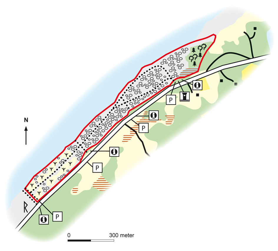
The reserve is located in north-western Öland, adjacent to route 136 and about 2 km north of Byxelkrok.
GPS coordinates to the parking lot WGS 84 decimal (lat, long): 57.34915 , 17.03384
Map: Naturcentrum AB, Stenungsund.
Download: the County administrative boards brochure over (in Swedish only)( 414 kB): Neptuni Åkrar
Download: the entire brochure (in Swedish only) (19 MB): Utflyktsguide Öland
© Lantmäteriverket, Ur Geografiska Sverigedata, översiktskartan Dnr. 106-2004/188”
Source: County Administrative Board, Kalmar
Translation: Visitoland.com