
Solberga Alvar


Traces of Öland’s golden age
Solberga village and its well-preserved farms are located close to the southern end of the Stora Alvar. In June, Solberga Alvar shines with thousands of yellow suns when the hoary rock-rose blooms on the weathered limestone bedrock. Finds of bronze bulls and the many burial sites from the Iron Age provide us with clues about the area’s importance two thousand years ago.
Öland’s golden era
There are three Iron Age burial sites and several stone circles, which consist of round shallow graves lined with stones, on Solberga Alvar. The graves provide a reminder of Öland’s golden era during the Iron Age, when the islanders raised livestock and exported hides, leather and wool to the Roman territories in present-day northern Germany. It was also during this time that several of Öland’s ancient forts and village were built.
Beautiful alvar areas
Solberga Alvar consists mainly of open gravel-dominated limestone where hoary rock-rose and sheep’s fescue are typical species, but there are also small alvar areas with cracks and fissures in the limestone – karst. Ridges in the area are rich in vegetation while the lower parts consist of wet meadows.
The alvar’s colours
In early summer, the colours on Solberga Alvar are dominated by yellow, violet and white. This is when flowers such as hoary rock-rose, breckland thyme, silverstar and sea campion bloom.
Special species
Solberga Alvar is also the home to the special plant thyme broomrape, a parasite that grows near the tussocks of breckland thyme and which via its roots absorbs nutrients from the breckland thyme plants. If you see a spring azure butterfly, take a close look as it may be a large blue, which thrive among flowering breckland thyme and which can sometimes be seen fluttering over the limestone alvar. Other rare species on Solberga Alvar include the steppe puffball, the four-footed earth star and the alvar snail.
Facts:
Size: 314 ha (776 acres)
Year of creation: 2005
Purpose: To maintain the unique grazing-based cultural landscape, as well as vegetation types that are representative of alvar areas, to provide beneficial conditions for both typical and rare plant and animal species, to preserve and make visible the cultural relics in the area and to facilitate the general public’s experience of the area’s nature and cultural assets. The area is part of Natura 2000, the EU’s ecological network of protected areas.
Directions/Location:
The nature reserve is situated to the west of the village of Solberga on southern Öland. Follow route 136 south towards Ottenby, to the road that cuts through the alvar, between Södra Möckleby to the west and the village of Torngård to the east. Beside the road there is a car park and information site with picnic tables, approximately in the middle of the alvar. From here you can follow the boardwalked path to the reserve.
GPS coordinates to the parking lot WGS 84 decimal (lat, long): 56.35259 , 16.46335
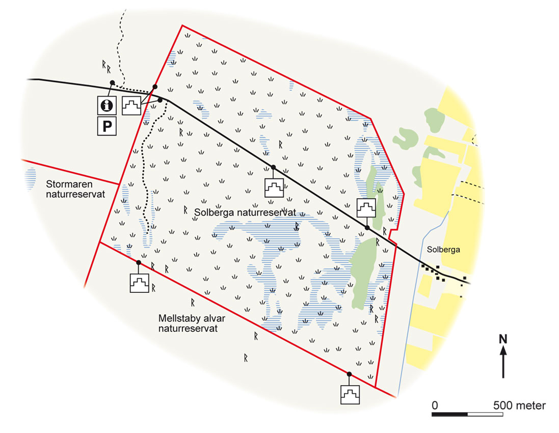
Map: Naturcentrum AB, Stenungsund.
Download: the County administrative boards brochure over (in Swedish only) (715 kB): Solberga Alvar
Download: the entire brochure (in Swedish only)(19 MB): Utflyktsguide Öland
© Lantmäteriverket, Ur Geografiska Sverigedata, översiktskartan Dnr. 106-2004/188”
Source: County Administrative Board, Kalmar
Translation: Visitoland.com