
Vedborm Alpaca
Vedborm Alpaca
![]()
![]()
![]()
![]()
![]()
![]()


Phone: 072-1896891, 070-3250447
E-mail: sara@vedbormalpacka.se
Hemsida: Vedborm Alpaca
Location: Northern Öland
[wpfp-link]
Visa på Google karta
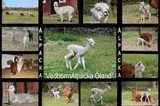
The Farm
Here on the farm, you get to meet alpacas, Bantams and cats.
We talk and inform about animals, you can feed them with something good and maybe pat them.
Alpacas are a flight and flock animals that do a bit as they want. They are very social and like to be with humans. But they are not as cuddly as many want them to be.
But we think that is one of the fascinations with them. But it is always on their terms whenever they want to be patted and be close.
The shop
We also have a shop where we sell soft, beautiful products in alpaca.
All products is Fairtrade. Most products are supplied from other producers, but we also have yarn from the alpacas on the farm.
The shop is unfortunately not handicapped accessible due to the stairs. But the farm works well for those with disabilities.
Opening hours
You find opening hours on the facebook page.
We take an entrance fee for the visit inside the yard.
Welcome!
Greby Go-kart

Greby Go-kart
![]()
![]()
![]()
![]()
![]()
![]()


Phone: 073-948 8252
E-mail: Grebygokart@gmail.com
Hemsida: Greby Go-kart
Location: Central Öland
[wpfp-link]
Visa på Google karta
The Kart Track
Greby Go-kart is Öland’s newest kart circuit, built in 2014 directly on the Öland Alvar.
Family friendly go-cart racing track that offers great caroli kart with timing and also offers junior karts for from about 5 years of age. The karts are new for the season in 2016.
At the track there is a kiosk offering ice cream, candy and cold drinks.
The course is located only 9 km south of Borgholm along the western main road 136.
Opening hours Drop-in 2021
During the low season, we take only cash payment but June 20th to August 18th cash and all major Credit Cards except American Express and Diners
May 15th 11 am – 3 pm
June 12th 11 am – 3 pm
June 16th – July 4th 11 am – 5 pm
July 5th – Aug. 13th 11 am – 7 pm
Aug. 14th – 22nd 11 am – 5 pm
Aug. 28th 11 am – 5 pm
September 4th 11 am – 5 pm
September 11th 11 am – 5 pm
October 2nd 11 am – 5 pm
Prices 2021
Large GO-KART 7 MIN: 160 SEK
10 min: 200 SEK
(minimum length 135 cm.)
JUNIOR GO-KART 7 MIN: 125 SEK
10 min. 150 SEK
(From approx. 5 years old or length 115 cm)
Dubble Kart 7 min 180 SEK
10 min 225 SEK
Welcome!
Ås Church
Ås Church
![]()
![]()
![]()
![]()
![]()
![]()


Location: Southern Öland
[wpfp-link]
Visa på Google karta
Church environment
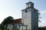
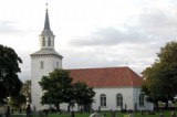
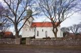
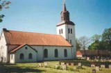
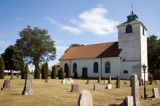
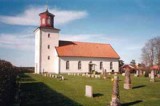
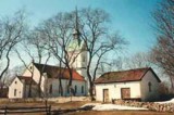
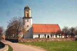
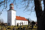
Ås Church is located adjacent to the eastern main road about 5 km from the southern tip of Öland and is the island’s southernmost church.
Both the church and the cemetery is located just inside the wide and high wall, “Karl X’s wall”, which cuts across the island and separates Ottenby “Kungsgård” (Kings demesne) with the rest of the Ås parish.
The environment around the church is made up of meadows and the Alvar heath, and from the tower you can see the sea. A little farther to the west lies Ottenby “Kunsgård” (kings demesne) and the church is located on the so called King farm lands. East of the church on the same side of the road is the local folklore societies cottage in Ås, moved there from Näsby.
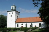
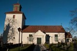
The church
The first church in Ås was built in the mid 12th century. The church was consecrated to the saint St. Catherine and during its first two centuries its name was Ottenby church.
In the 14th century it got its current name. The church consisted of nave and a tower in the east.
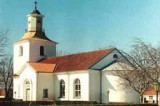
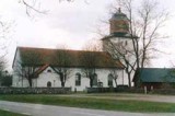
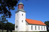
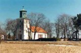
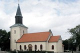
In 1773 the church was ecpanded. Then the nave was extended to the west and a porch were added, builder was Henrik Wermelin. With its wooden barrel vault, Ås church became Ölands first Hall church. It is also Öland’s only preserved east tower church.
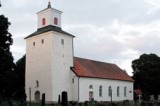
The top floor was rebuilt in 1820 and was then given the lantern for the bells. The reconstruction was led by master mason Johan Petersson from Kalmar. The church’s exterior was plastered for the first time, and the church was fitted internally with a wooden barrel vault.
In 1787 the church was painted inside. The church has two wood sculptures from the 18th century and in the ceiling hangs four brass crowns three of which are from the same century and one is from 1980. The most recent renovation was performed 1992 and it was then an exterior renovation.
Memorial grove
The memory grove is located in the middle of the north long side of the cemetery and opened in 2001.
It consists of a semicircular pavement of limestone with planting. In the plantation is a cast iron cross from 1860 with an angel and to the right of the cross there is a small wooden sign with the text”Minneslund” ( memorial grove). A blue glass ball is placed on the wall behind the memorial grove. Shrubs grow on both sides defining the grove to the east and west.
Buildings
In the cemetery’s northwest corner are two buildings. One is the former materials shed and it was built in 1807. In 1959 it was converted into the morgues. Today it is no longer in use as a morgue, and parts of it have been converted to public toilet.
The house is built of stone and has a plastered, whitewashed façade and tiled roof.
The smallerbuilding to theright of thematerialshed isa storage room,withunknownyear of construction. Ithas awhitewashedfacade andatin shed roof.
Both buildings have red-brown wooden doors.
Other
In the porch is a medieval grave slab, adorned with a cross, inlaid in the floor. The stone is probably from the 13th century.
Source: Kalmar Läns Museum, Kalmar County Museum
Translation: Visitoland.com
Vickleby Church
Vickleby Church
![]()
![]()
![]()
![]()
![]()
![]()


Location: Southern Öland
[wpfp-link]
Visa på Google karta
Church environment
Vickleby church is located up on the edge of the fault line, just west of the western main road. From the cemetery you have a view of the barren “stora Alvar” (the Great Alvar) in the east and the fertile valley with Vickleby village in the west.
East of the cemetery is “Vickleby bygata” (Vickleby village street) with its dense settlements. Here you find among others Bo Pensionat and Capellagården.
In the 1930-40s became Vickleby a popular residence for many prominent artists. Many of them lived in the village, including Arthur Percy.
Right beneath the church to the east is Vickleby vicarage situated which still retains its original function. North of the cemetery is the former Vickleby church school, for long an exhibition hall connected to Capellagården, but is now privately owned.
The church
Vickleby church belongs to the small group of churches on Öland that is wholly or to most parts preserved since the Middle Ages.
Its believed that the current tower was built connected to a wooden nave in the late 12th century. The present nave in stone was built in the 13th century.
Under the leadership of the master mason Anders Törnberg from Kalmar was the medieval chancel and apse demolished in 1778-79, and the nave was extended to the east and a new chancel was added. In 1818 the tower was given a four-sided lantern.
Memorial grove
The Memorial grove is located outside the actual cemetery, in the north-east corner of the park-like area in the west.
It is defined by a semicircular free-standing hedge of spiraea, and a planting with pink flowering shrub roses. It consists of a lawn and in the middle stands a waterfall of metal, and an inscription plate. There is also a tall black-painted light fitting with glass spheres
Buildings
At the cemetery is no additional building but well on the other side of the main road in the east. There stands a building of limestone with roofs covered with older tiles, several tiles has the stamp of Värnanäs brickworks. It was probably erected in 1766 and was then called “redskapshus” (tool shed), the exterior walls were originally plastered, but is now just the masonry. In 1957 the southern part was furnished to a preparation chapel and the north as tool shed.
Other
Older tombstones removed from the cemetery are on display against the northern wall’s western section.
Source: Kalmar Läns Museum, Kalmar County Museum
Translation: Visitoland.com
Ventlinge Church
Ventlinge Church
![]()
![]()
![]()
![]()
![]()
![]()


Location: Southern Öland
[wpfp-link]
Visa på Google karta
Church environment
Ventlinge cemetery encircles the church on the slope of the western fault line just east of the western main road, not far from Grönhögen. From the cemetery, you can see the Kalmar Strait in the west.
The area between the cemetery and the main road consists of a small park which also houses the memorial grove. In the east, just outside the cemetery wall its arable land. South of the cemetery is the old teacher’s apartment.
The church
Ventlinge church was built during the first half of the 12th century. The church was at this time a church without a tower in the Romanesque style and was dedicated to St. Lawrence.
The church had a rectangular nave and a lower and narrower chancel in the east ended with a semicircular apse. The tower was built around 1200th
During the centuries the church underwent many minor changes. In 1812, a comprehensive repair and extension and the church was performed and the church then lost its medieval character.
The chancel and apse were demolished and the nave was extended, and at the eastern gable was a sacristy built. The rebuilding to a modern hall church was led by Johan Petersson from Kalmar.
A lantern designed by JAC Wilenius was built in 1825 by Håkan Göth, from Seby and the church bell was moved up in the tower. A church porch was set up in the medieval defense tower in 1880 after the drawing of Otto August Mankell. The altarpiece is from the 18th century.
Restorations and repairs have been carried out in 1925, -52, -68, -84 and 1999.
Inside the church is a baptismal font foot from early 13th century.
Memorial grove
A memorial grove was built and inaugurated in 1998. It was built just outside and adjacent to the cemetery wall to the west of the so-called Church Park.
In the fund against the wall is planted rhododendrons and around the stone with the word “Minneslund” (Memorial grove) engraved grows blue shrubby juniper. Otherwise it is planted cherry laurel that separates the grove to the north and south and in front of the plantation are added limestone tiles.
Buildings
Outside the cemetery, in the south-east, is a large building that houses storage room and toilets for the public.
Other
On the cemetery wall is a pair of fragments with inscriptions probably from the early 19th century. Except from a “tumba” (a stone sarcophagus) just south of the church, the cemetery lacks today older tombstones.
The “Tumba” is for Jacob Brunnerus and his wife Anna Elisabeth Reuter. Brunnerus was in the 18th century the vicar of Ventlinge and Ås congregations. He died in 1794, a year after his wife.
Not far from the church’s southern entrance is since 1952 the fiddler Gotthard Sjöman buried. He is the author of “Kruspolska, Kvarnpolska” and “Brudmarch till far (Bridal march to father)”
Poet Anna Rydstedt is buried on the south side of the church. On her tomb is a beautiful line engraved ”jag är också född och vuxen till det enda, att vara Anna i världen” (I was born and grown up to the one, to be Anna in the world)
Source: Kalmar Läns Museum, Kalmar County Museum
Translation: Visitoland.com
Södra Möckleby Church
Södra Möckleby Church
![]()
![]()
![]()
![]()
![]()
![]()


Location: Southern Öland
[wpfp-link]
Visa på Google karta
Church environment
The church and the cemetery have a central location in Southern Möckleby village, the main road towards Ottenby in the south and Färjestaden the north passing west of the church and along the road are a few shops including a grocery.
West of the cemetery is the Church park that was laid out in 1957 after plans by Kalmar läns södra Hushållningssällskap (Kalmar County south Housekeeping society). The area was formerly part of the school.
The first school building, built in 1850, is still standing south of the church. The house is considerably rebuilt, partly in connection with the entry into service as town halls when Södra Möckleby became the seat of Ottenby municipality. The building now houses a library and an open preschool, and here was earlier a couple of additional school buildings which was demolished 1965th
North of the cemetery, since 1989, is the parish hall and since 1991 also the parish registrar’s office. Around the cemetery in the east and south is an area with single family houses of different age. The vicarage was earlier located in “Gårdstorp” north of södra Möckleby village but was sold as a new vicarage was built in the village in the 1960s, but is no longer in the parish possession. From 1938, and a number of years forward, were “Södra Möckleby” parish a part of “Kastlösa” parish which also included “Smedby” parish. Nowadays is Södra Möckleby the center of the South Öland parish.
Södra Möckleby has since the 1800s been greatly affected by various industrial activities with alum, lime kiln and cement factory as the most prominent examples. The good harbor location, Degerham, and the access to raw materials made the place ideal.
Öland alum mills or “Södrabruket” gave rise to a whole community with manufacturing plant, workers quarters, mansion and farms. As an example, “Södrabruket” in 1822 had 322 employees, including 116 children. Öland Cement AB was created in 1886 and had in 1920 about 350 employees.
The mills had ups and downs in different periods, and between 1867 and 1926 about 400 parishioners emigrated to America. They were a large percentage of the parish’s population and most of them were young people who had difficulty finding livelihood opportunities at home. The various mills in Degerhamn has greatly influenced the community’s and the parish’s history.
The church
During the medieval times, perhaps as early as the 12th century a church was built in Södra Möckleby. The first known images shows a church with a powerful tower with tent roof, rectangular nave with saddle-back roof and a slightly lower chancel with a semicircular apse.
After lengthy discussions during the 19th century the whole church, except the tower, was demolished, and in 1851 a new church was finished. The drawings were drawn up by Johan Fredrik Åbom and builder was Peter Isberg. The church became a typical neoclassical church with a bright and airy church room.
The church has undergone major interior renovations in 1909 and 1951. In the 1951 renovation, the chancel windows was taken away and clogged, and in 1982 a reconstruction of the altarpiece that existed in the Church in the 18th century was made with the re-use of older parts as well as additions of new ones
The exterior of the church has been restored several times. The biggest change is the clogging of the chancel windows and the cladding of the lantern with sheet metal.
Memorial grove
The memory grove is located in the eastern part of the block 3. The place is small and surrounded by cypress hedge. A limestone rock with the word “Minneslund” (Memorial Grove) marks the grove together with a planting area with shrubs and perennials. There is also a sofa and a stand for flowers.
Buildings
The Morgue with the façade plastered and painted in white. The roof is covered with domed tiles, doors and bargeboards are painted brown. Windows are facing west, three narrow side by side. Airing hatch is facing east and entrance to the south. Above the door is a smooth plastered mark in the facade, as if there previously existed an opening.
Other
The old limestone tombs in the museum is worn and overgrown with bryophyte and lichens, inscriptions are therefore difficult to read, but in the right lightning the text still appears.
Source: Kalmar Läns Museum, Kalmar County Museum
Translation: Visitoland.com
Stenåsa Church
Stenåsa Church
![]()
![]()
![]()
![]()
![]()
![]()


Location: Southern Öland
[wpfp-link]
Visa på Google karta
Church environment
Stenåsa church and the cemetery located along the eastern road between Föra in the north and Ottenby in the south. The parish lies between Sandby and Hulterstad parishes in height with Resmo on the west side. The church is located in the northern part of the village. East and west of the church spreads the agricultural landscape out and beyond the alvaret in the west and the Baltic Sea in the east.
The church
When Stenåsa church was renovated in 1956 they found, under the church floor, remains of a wooden church with mud floors that dated back to the 11th century. This was the first church on the site. In the middle of, or possibly by the end of the 12th century this first wooden church was replaced by a stone church.
During the 13th century the stone church was expanded to be twice as long as the original building. During the 18th and early 19th century the population of the parish increased, making the old medieval church too crowded.
In 1831 a new church was completed which had been built as a shell outside the medieval church. The drawings were made by Samuel Enander and three builders, P.Isberg, P. Ekholm and H. Goethe, was involved in building the church.
The church is characterized interior and exterior of the neo-Classical features.
Memorial grove.
A memorial was built in 2000 in the southwest of the cemetery. The grove is facing and opens to the north, and in the south defined by a hedge of jasmine, along the hedge is a bench.
In the center is a planting lined with red limestone, here are perennials and summer flowers planted. There are also places to set flower vases and candles. In the middle of the planting stands a cast iron cross. The Cross was originally marking the burial place of P. Olsson’s wife, Ch. Jonsdotter who died in 1870. Her data is still on the back of the cross.
Buildings
In the cemetery’s northwest corner stands a tool shed. It has red-tiled roof and standing wood paneling painted in a gray-green tone, window frames and bargeboards in white.
Other
Adjacent to the shed, along the cemetery north wall, are a number of older tombstones that has been removed from the cemetery on display.
In the northern part of block B is a sundial of more modern date.
Source: Kalmar Läns Museum, Kalmar County Museum
Translation: Visitoland.com
Smedby Church
Smedby Church
![]()
![]()
![]()
![]()
![]()
![]()


Location: Southern Öland
[wpfp-link]
Visa på Google karta
Church environment
Smedbychurchis slightlywest of the westerncountry roadandfrom the cemeteryyou have a view of theKalmar straitin the west.Around thechurchin the south andeast isagricultural land.
To the west lies a red wooden building that was built in the 18th century butin a different location. In 1848it was moved toSmedbyand became thevicarage,whichit wasuntil 1929, on the plot isalsostorageand barnbuiltin stonein 1917.North ofthe cemeteryisthe churchpasture.
In the northeast corner of the cemetery wall is an old whitewashed building used as a storage area and where there is a toilet and the former elementary school is located just north of the church.
The church
The earliest church on the site was built in the late 12th century and was a Romanesque apse church with a high west tower which was expanded in the 13th century..
The current neo-classical church was built in 1851-53 north of the site where the medieval predecessor stood.
Smedby church is a hall church with a narrower ending of the chancel, a pentagonal sacristy in the east and the tower to the west. The tower is topped by a lantern. The architect of the church was JA Hawerman and builder P Isberg. The exterior is virtually unchanged since construction.
In 1952 the interior was considerably changed, mainly in the remodeling of the chancel. A barrel vault and two side rooms were built and the chancel came to be separated from the church room in general. These changes were led by Ärland Noren.
Inside the church is a Romanesque baptismal font from Gotland, dated to the 13th century and the pulpit is from 1698. In the tower are two bells. The small bell (“Lillklockan”) cast in 1680, the great bell (“Storklockan”) was purchased from the bell caster JP Forsberg in Kalmar 1878.
Memorial grove
The memorial grove is located in the eastern part of the cemetery, in the open lot southeast of the church building. The location consists of a rectangular lawn area. Shrubs of boxwood define the memorial grove in the north and south and in the east by the 110 cm high and 75 cm wide existing stone wall. An elderly black granite tombstone has been reworked and has the word “Minneslund” (Memorial Grove) written on it.
Buildings
Outside the cemetery, and integrated with the cemetery wall is a whitewashed building of unknown age, which is now used as a tool shed, storage room and visitors toilet.
Source: Kalmar Läns Museum, Kalmar County Museum
Translation: Visitoland.com
Segerstads Church
Segerstads Church
![]()
![]()
![]()
![]()
![]()
![]()


Location: Southern Öland
[wpfp-link]
Visa på Google karta
Church environment
Segerstads church and the cemetery is on the south east coast of Öland at the east main road in the southern part of Segerstad village. Around stretches arable and pasture land and the Alvar out. South of the cemetery is the former vicarage and just north of the cemetery next to the main road is the old school of wood, built 1848.
The church
Segerstads medieval church was the smallest on the island of Öland, only 16 meters long. The ground walls of the small, east tower, church with a strait eastern wall, built in the 12th century is located under the floor of the today church. One of the pillars carved out of limestone from Gotland that was carrying up the vault, is now with its column capital below the baptismal font, while other parts are found in the plinth to the sun-dial in the churchyard.
The current church is a traditional hall church provided with large arched windows and wooden barrel-vault. Tower to the west is surmounted by an octagonal lantern. Sacristy is located in the east.
The church was built in 1839 by Peter Isberg in free interpretations after drawings by RV Brouhn. After the inauguration in October 1843, in addition to an exterior restoration 1949-51, only minor changes have been made.
The 19th Century church was fitted with an altar pulpit. The basket that was sculpted in, in 1765 by Clas Wahlberg, was taken from the old church. When the church was renovated in 1949 the pulpit was moved to the north side of the chancel and behind the altar ring was a new altar placed.
Some of the interior is left since the 12th century and the altarpiece was painted by Einar Forseth, in 1950, and there is also a painting with Öland motifs painted by “solmålaren” (“The Sunpainter”) Per Ekström inside the church.
Buildings
In the northwest corner of the cemetery is an old whitewashed stone building with a tiled roof. Previously it was used as a morgue now only as a storage room.
Outside the cemetery wall to the south is a small wooden building used as a storage room and where there is also a toilet for the public.
Other
At the entrance to the cemetery in the west stands a limestone rock with the inscription: “Wandringsman tänk på ändan 1776.ss Pastor ” (Hiker think of the end) It is a remnant of the former pastor Sven Sahlsten. Sahlsten wanted by the inscription on the hob give the hiker a reminder of his mortality and thus arouse the devotion idea to life.
A sundial stands in the cemetery south of the church. It is partly built of material from the old church. When it was made is unknown.
In the cemetery’s northeastern corner, arranged along the wall, is old gravestones that are taken out of service.
Source: Kalmar Läns Museum, Kalmar County Museum
Translation: Visitoland.com
Sandby Church
Sandby Church
![]()
![]()
![]()
![]()
![]()
![]()


Location: Southern Öland
[wpfp-link]
Visa på Google karta
Church environment
Sandby parish is situated on the eastern side of Öland, almost in level with Färjestaden. The church and the cemetery lies a few kilometers east of the main road that runs along the eastern side of Öland from Föra in the north to Ottenby in the south. Around the church there are several farms still active farm. East of the cemetery is a building that originally was the parish poor house and was built in 1871. The last inherent moved from there in 1929. It was converted in 1953 into a parish hall and functions as such today.
The church
Sandby stone church was built in the 12th century, then with a nave and a tower in the east. During the 13th century the western tower was added, which made Sandby church to one of Öland’s pack-saddle churches. In 1782, a major renovation of the medieval church was performed which among other things resulted in that the east tower was demolished.
In the early 19th century a proposal was brought forward to build a joint church to Gårdby and Sandby parishes. The proposal won no support and the two parishes instead started to rebuild their own medieval churches separately.
In Sandby the work began in 1860. The drawings for the new church were made by JF Åbom and master builder was Peter Isberg and his son Isaac from Algutsrum. The new church was built south of the medieval church. For the new church, among other things, the Baptismal font from the 12th – 13th century was transferred. The new church can be characterized, interior and exterior, of the neo-Classical features.
The last major renovation was carried out, 1992.
Memorial grove
The memorial grove was built in 1999 west of Block B. The place is surrounded to the south and to the north by hedges of white cedar. In the northern part is a simple wooden cross.
In front there are plantings and a surface coated with limestone where you can place candles as well as a holder for flower vases. In the south there is a bench.
Other
East of the Church’s chancel is the Patriarchal Cross that was found in 1957. The cross marked with canted limestone’s that are slightly raised above the grass. No one today knows the history of the Cross.
In the southeast corner of the cemetery is a small hill. Here, the temporary blacksmith’s workshop is believed to have been located in the connection to the building of the church in 1860. Here among others was the black smith August Klint working then. He and several other family members are buried here in the so called “Klint hill”.
Source: Kalmar Läns Museum, Kalmar County Museum
Translation: Visitoland.com
Resmo Church
Resmo Church
![]()
![]()
![]()
![]()
![]()
![]()


Location: Southern Öland
[wpfp-link]
Visa på Google karta
Church environment
Resmo church and cemetery is located on the west side of Öland on the fault line overseeing the fertile Mörbylånga valley. West of the church is the former elementary school, built in 1868. South of the cemetery and the road towards Kleva is the old junior school from the 1920s. School and education was moved to Mörbylånga in 1955. To the east is the old blacksmith cottage and with the gable as part of the church surrounding wall is the morgue. Previously there was a poor house east of the church. Outside the cemetery in the north the agricultural landscape spreads out with a spectacular view over the Kalmar strait.
The church
Given the findings of the rune stones and parts of a “Eskilstunakista” found in Resmo, the first church in Resmo should have been a wooden church. A stone church, it is believed, was built in 1070, this of a great man named Sweinu and whose name are on a rune stone found in the cemetery. Resmo church is one of the oldest and best preserved on Öland, since it has retained its fundamental layout from the Middle Ages.
Prior to 1750 the sacristy was added and in 1826 the eastern towers top was demolished while the west tower was erected. Today, the restored Church consists of a chancel with apse and an unusually narrow and high nave with windows in both north and south.
In the 1920s, the church was renovated both internally and externally, and in 1931 the church was renovated once again inside and frescos from the 12th, 13th, and the 16th century were restored. Renovations have since been performed on several occasions, for example, 1966, 1987, and in the 1990s. The medieval altar from the 12th century was reinstated in the church to the 900 years anniversary in 2000.
Minneslund
Församlingen har fått tillstånd och har under 2006 påbörjat arbetet med att anlägga en minneslund i kvarter 04 norr om kyrkan.
Memorial grove
At Resmo church there is a memorial grove, description will be added later.
Buildings
The former mortuary located as part of the surroundings in the east and has an entrance from the cemetery.
It is a building of whitewashed limestone. Previously, the building had shingle roofs as in the 1980s still, and probably even now, remains below the roof tiles.
The morgue has wooden doors and above the entrance is in plaster shaped cross. The house is currently used as storage facility. The floor is laid out of limestone and it houses among other things an older altar circle, a rune stone fragments and a tomb which before 1965 was located out at the south portal.
Other
Daniel Sabelström was a farmer in the area and he also owned The Inn in Resmo between the years 1842-1870.
A gravestone from the 18th century to the east of the apse intends the priest Elias Salomon and his wife Maria Cecilia Berghman. During the tapered towering limestone west of it rests dean Israel Ahlqvist, uncle of Abraham Ahlqvist, known for his book on Öland’s history.
Grave location with cast iron fence in the Southeast is for Reverend C Ekvall year 1876th
The cast iron fence around the sea captain Johan Söderlund’s gravesite in the southwestern part of the cemetery is made by Kockums.
Source: Kalmar Läns Museum, Kalmar County Museum
Translation: Visitoland.com
Norra Möckleby Church
Norra Möckleby Church
![]()
![]()
![]()
![]()
![]()
![]()


Location: Central Öland
[wpfp-link]
Visa på Google karta
Church environment
N Möckleby church is located on the eastern side of Öland along the road that goes from Föra in the north to Ottenby in the south. The church is located in the northern part of the village where today there are both older buildings and new residential areas. South of the church is the former school house that was built in 1896. The angle of this building is a cantor home that was built in 1927-28. East of the church is the former vicarage today a private resident.
The church
A church was built in N Möckleby in the later part of the 12th century. It consisted of a nave and a tower to the west. Around the year 1200, was another tower erected to the east and the church was turned into a pack-saddle church. The sacristy in the north was added around the year 1300.
Several conversions and extensions were made until the present church was built in 1824. The eastern tower and the nave was demolished and a new nave, designed by the architect JW Gerss was built, to the west Tower was a lantern added and a portal from the medieval nave was transferred to the tower.
This now serves as the church’s west entrance. Apart from the tower, which has an archaic character, the church interior and exterior is built in a neoclassical style with large arched windows, ceilings with wooden barrel-vault and style typical decorative elements in the interior. During the 1900s, the church has undergone four major renovations 1922-23, 1954-55, 1969, 1988.
Memorial grove
The memorialgrove is locatedin thecemetery’ssoutheast corner, it is enclosed by ahedgeofwhite cedarwhichis open towardsthe west.The locationis marked byalimestonecross with the text “Minneslund” (memorial grove), which stands in a planting with shrubby cinquefoil, shrubby juniper and summer flowers. Here is also a standforvasesand a cabinetfor candles and a bench.
Buildings
In the cemetery’s northeast corner is a stone building with plastered facade in white and a roof with red tiles. In the south there are two small openings and two wooden doors. The latter are painted black like other woodwork. Inside the building, the floor is paved with old gravestones. The building is currently used as storage room and tool shed.
In the southern part of Block A is a bell tower and in it is a bell that’s been taken out of service. The bell cast in 1643 by Gert Meyer is cracked but the congregation felt it had a beautiful decor and therefore wanted to preserve it. Architect Nils Carlgren designed the bell tower built in the early 1960s. It consists of two pillars of masonry limestone and covered by a tent roof in wood.
Övrigt
Äldre gravvårdar som tagits bort från kyrkogården är dels uppställda öster om kyrkan, dels sydost om kyrkogården.
Man kan i kyrkogårdsmuren hitta rester av äldre tegelpannor märkta WNS. Dessa kommer från Wärnanäs tegelbruk som var i drift vid slutet av 1700-talet fram till sekelskiftet 1900. En stor del av deras produktion skeppades till Öland. Än idag kan man se rester av tegelbruket norr om den Oxenstiernska byggnaden på Värnanäs.
Other
Older tombstones that’s been removed from the cemetery is displayed in the east of the church, and southeast of the cemetery.
Source: Kalmar Läns Museum, Kalmar County Museum
Translation: Visitoland.com
Mörbylånga Church
Mörbylånga Church
![]()
![]()
![]()
![]()
![]()
![]()


Location: Southern Öland
[wpfp-link]
Visa på Google karta
Church environment
Church and Cemetery in Mörbylånga parish is located on the low fertile coastal plain and not, as most of Öland’s churches, on or near the fault line.
Mörbylånga village already existed in the Middle Ages. On the oldest map from 1641, it has been interpreted as the vicarage plot was located a little south of the cemetery, and here should also the medieval vicarage been located.
The estate closest to the church in the South was in the year 1700 appointed to vicarage, and in the mid 18th century a assistant vicar residence was built to the assistant vicar Anders Hultenius. The house was moved a bit to the south in 1935, to be used as the parish hall.
At the same time a vicarage was built on the land west of the assistant vicar residence. Next to the assistant vicar residence a low, red wooden building was built in 1988 to be used as the parish office and archives.
The two buildings were connected with an angular building facing down to the vicarage. The vicarage is since 2005 no longer in the parish possession.
The former school building is located south of the cemetery. It’s a yellow-painted wooden building, built in 1915, and characteristic of the period. The former school is now privately owned. Junior school was in the little house opposite the school. The plastered house which is situated east of the church building was for a long period the village common bathhouse.
Mörbylånga urban district was founded in 1820 and came during the 19th century to grow, while the main village at large retained its old scope. Mörbylånga was for long an annex parish to Resmo. This relationship changed in 1935 when Mörbylånga became its own parish.
The church
Mörbylånga church consists of a medieval tower and a nave and chancel which in 1811 replaced the medieval building elements.
The new nave and chancel was designed by architect Axel Almfelt at the Superintendent’s Office. During the period 1760 to 1860, 23 new churches was built on Öland, of which 16 retained its medieval towers, The exterior of the church represents a typical example of churches rebuilt on Öland in this period.
The church has an overall neoclassical expression with its shallow pitched roof, the large arched windows, the smooth undecorated facades and the highlighted south entrance.
The broad and high tower is perceived as large in comparison with the nave and preserves some of its medieval character with the heavy walls and the ancient portal in the west.
This impression is reinforced by the relatively small windows and the neo-gothic inspired spire – an addition from the 1870s. Sacristy built in 1931. The interior has had major renovations carried out in 1931 (J Fred Olson), 1966 (David Dahl and others) and 2000 (Jerk Alton and others.).
Memorial grove
The memory grove is located in the new cemetery’s northern part. The area consists of a circle in limestone with a lawn in the middle. The area is surrounded by trees and bushes.
In the northern part stands a tall wooden cross with the Lamb of God in metal, and an altar table in gray limestone. The limestone table was added in the 1990s in memory of Maria Svensson Ceorecius which was Mörbylånga parish missionary in South Africa 1960-97. Here is also a light carriers designed by Elwin Brask.
Buildings
The Morgue in northeast.
The morgue has a frame made of bricks and plastered facades colored in light yellow color with gray painted base. Entrance is in both the east and west through the double doors painted in pink-red color with black wrought iron fittings. The windows are made of cast iron and thin lattice. The pitched roof building is coated with roof tiles and the construction Year 1915 written in forging numbers over the entrance to the east. In front of the building, to the east and the west, the ground is paved with limestone. The building is divided into two rooms. The West served as mortuary while the east, now used for storage, held the hearse. The morgue was designed and built by master builder CA Svantesson
Outbuilding in the northwest
Tool shed with plastered facades colored in white and saddle-back roof covered with roof tiles. Doors to the east and the bargeboards are painted blue. The year 1948 is on the facade facing east. The building is not in use nowadays.
Outbuilding in the southwest
Tool shed, etc. built with plastered facades in white color with a saddle-back roof covered with roof tiles, extended later on with a red painted wooden building component.
Other
In the cemetery’s northern part, between the oldest and second oldest cemetery is a well with vats of pink limestone. The well was dug in 1921.
Source: Kalmar Läns Museum, Kalmar County Museum
Translation: Visitoland.com
Kastlösa Church
Kastlösa Church
![]()
![]()
![]()
![]()
![]()
![]()


Location: Southern Öland
[wpfp-link]
Visa på Google karta
Church environment
Kastlösa church is located on the eastern fault line near the western country road in the northern part of Kastlösa village. Immediately west of the cemetery is Kastlösa “stiftsgård” (diocesan study center).
When the new church was built in the 1850s, then a new vicarage was also built and the old one was moved to the other side of the road and became the first school in Kastlösa.
In conjunction with the building of a new church in the 1850s, a new vicarage was built and the old one was moved to the other side of the road and became the first school in Kastlösa.
The church
Around the 1850’s the old pack-saddle church from the 12th century had became too small for the parish. The old church had consisted of a nave, chancel and an eastern tower, and a western tower had been added during the 13th century
The new church in Kastlösa was built after drawings by Adolf Johan Hawerman in 1855 and master builder was Peter Isberg from Glömminge. In the minutes from the parish meeting it is written that the church was built “comparatively cheap because most of the work and the execution were carried out by the parishioners themselves“. It came to be built north of the old church.
The new church is made up of rectangular structure, divided into three naves, with chancel in the east, the sacristy in the north and a tower in the west.
The whitewashed walls are covered by a pitched roof and the tower is crowned by a lantern with a short spire. Almost one hundred years after the consecration of the church was major interior renovations performed for the Jubilee.
The nave was transformed in a uniform manner, and got among other things, a flat inner ceiling. Bench interior, the gallery and the pulpit are from the same date.
Memorial grove
The memorial grove was opened in 2000 and is built on the north side of the church. It is defined by a circular hedge of white cedar with an opening in the west.
From the beginning it had an opening on each side in the north and the south, but has later been changed to get a more confined area.
In the eastern part of the grove there is a planting and an older limestone cross. In front of the planting is a stand for vases and to the left a bench where you can sit down.
Buildings
In the northeast corner as part of the cemetery wall is an older materials storehouse, built around 1805, with whitewashed facades and tiled roofs. The house has over a period been used as a morgue but now it’s only storage.
Other
Outside the materials storehouse west wall has a place for older gravestones been arranged, and the oldest one is from the 17th century.
Smidesgrindarna från 1856 skall vara av den öländske konstsmeden Jonas Peter Dahlgren som under 1800-talet svarat för många vackra kyrkogårdsgrindar på Öland. En ättling – Lars Peter Dalgren – smed från Bredinge malm sover lugnt på kyrkogården.
The Forging Gates from 1856 is believed be of the blacksmith Jonas Peter Dahlgren from Öland, who in the 19th century produced many beautiful cemetery gates on Öland. A descendant – Lars Peter Dalgren – blacksmith from “Bredinge” rests peacefully in the cemetery.
In Block A south of the church is a well made of limestone’s.
Source: Kalmar Läns Museum, Kalmar County Museum
Translation: Visitoland.com
Eketorps Borg
Eketorps Borg
![]()
![]()
![]()
![]()
![]()
![]()


Location: Southern Öland
[wpfp-link]
Visa på Google karta
Borgen
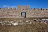
Eketorps borg, landets enda totalundersökta och rekonstruerade fornborg, har ett mycket högt vetenskapligt och pedagogiskt värde och är ett av öns mest uppskattade besöksmål.
Läget
Eketorp är den sydligast belägna av de öländska fornborgarna. Den är strategiskt placerad 1,7 kilometer från Östersjön, mitt ute på Stora Alvaret. Inom borgen finns en källa som förmodligen har varit avgörande i valet av plats för borgbygget.
Olika funktioner och perioder
Borgen undersöktes arkeologiskt under åren 1964-1976. Syftet var dels att klarlägga bakgrunden till de medeltida fynd som tidigare hade gjorts innanför borgmuren, dels att söka en förklaring till de öländska fornborgarnas funktion och datering. Utgrävningarna visade att Eketorp varit ianspråktagen i tre olika perioder från år 300 till 1 300 e Kr. Cirka 25 000 föremål påträffades, såväl enkla vardagsföremål som konstnärligt arbetade smycken och vapen.
Eketorp I
Under det första byggnadsskedet, Eketorp I (300-400 e Kr), fungerade borgen som tillflyktsort för bygdens befolkning. Ursprungligen hade borgen en diameter av 57 meter med 20 radiellt placerade hus med öppna gavlar mot ett centralt torg. Den senare bebyggelsen vid platsen medförde att de tidiga stadierna av Eketorp I skadades i tämligen hög utsträckning.
Eketorp II
I samband med borgens nästa period, Eketorp II (400-700 e Kr), etablerades en fast bosättning i borgen. Dess funktion ändrades till en befäst bondby med både bostadshus, fähus och förråd. Borgens dimensioner utökades till en diameter av 80 meter och försågs med portar i nord, syd och öst. Den bestod av omkring 15 gårdar. Fullt utbyggd innehöll borgen 53 hus, fördelade på tre kvarter längs murens insida. Befolkningen tycks ha varit relativt välbärgad. Arkeologerna fann bland annat ett förhållandevis stort antal smycken och vapen från denna tid.
Eketorp III
Eketorp II övergavs på 700-talet. 300 år senare byggdes på ruinerna av Eketorp II en verklig borganläggning, Eketorp III (1000-1300 e Kr). Den tidigare borgmuren förstärktes och man uppförde även en yttre ringmur. Borgens storlek uppgick till 115-120 meter i diameter (yttre ringmuren). Samhället var av en annan karaktär än de tidigare agrara, befolkningen försörjde sig huvudsakligen på handel och hantverk. Även planlösningen förändrades, rader av syllstenar visade var timmerlängor och bodar uppförda i skiftesverk hade stått. Mellan byggnaderna fanns stenlagda gator och gränder som strålade samman till ett centralt torg. En avloppsränna ledde från brunnen till den angränsande våtmarken i öster. Till området mellan den inre och yttre muren lokaliserades den eldfarliga verksamheten, bland annat smedjor.
Fynd från utgrävningar
Huvuddelen av de fynd som gjordes vid undersökningarna härrör från Eketorp III. Fynden utgjordes bland annat av silvermynt, vapen, hantverksredskap och hästutrustning. Sannolikt finns ett funktionellt samband mellan Eketorp III och de rika sillfiskena vid Kyrkhamn på Ölands södra udde.
Borgen idag
Idag reser sig åter den imponerande ringmuren på Stora Alvaret. Innanför muren finns rekonstruerade hus från järnålder och medeltid. Man kan besöka bostadshus, fähus och förrådshus, som byggts upp med gamla hantverksmetoder och material. Guidade turer ges under sommarhalvåret. Ett urval av fynden finns utställda i ett museum. Genom osteologiska analyser av benmaterialet har man kunnat konstatera vilka djur man höll sig med vid borgen. Som ett led i att återskapa den forntida miljön finns även tamdjur: grisar, får och gäss.
Om Eketorps Borg som Museum, Öppetider, Aktiviteter, se: GÖRA/Museum/Eketorps Borg  Karta Eketorps Borg Källa: Länsstyrelsen i Kalmar län
Gettlinge Gravfält
Gettlinge Gravfält
![]()
![]()
![]()
![]()
![]()
![]()


Location: Southern Öland
[wpfp-link]
Visa på Google karta
Gravfältet
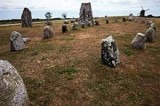
Gettlinge gravfält är en fornlämning i Södra Möckleby socken på södra Öland. Gravfältet är ett av de största på Öland, med en längd av nästan två kilometer. Det är beläget längs öns västra väg mellan byarna Gårdstorp, Gettlinge och Klinta.
Gravfältet beskrevs av historikern Johannes Haquini Rhezelius i hans “Monumenta runica”, från 1634. Han ritade av skeppssättningen i sin resedagbok. Carl von Linné undersökte en grav 1741. Landskapsskildraren Abraham Ahlqvist skrev om platsen 1825. Han intresserade sig särskilt för de båda drygt tre meter höga stenarna i Klinta.
Raden med förhistoriska kulturlämningar börjar norr om Gettinge by. Många har blivit förstörda genom stenbrott eller av skattsökare. På gravfältet fanns omkring 250 gravar. Idag återstår mer än 200. De flesta är stensättningar från yngre bronsålder och järnålder. I kvadratiska eller runda stensättningar har man funnit stenkistor med obrända skelett. Fältets norra del är mest varierande. De stora kalkstenshällarna där har rests för att märka ut platsens betydelse. På en imponerande, 30 meter lång skeppssättning, som består av 23 resta granitblock intill varann, finns ett tjugotal skålgropar. Skålgropar är ett ständigt återkommande motiv på stenar från bronsåldern.
Omkring år 1900 undersöktes 15 gravar i Gettlinge. Det var enbart mansgravar, några innehöll vapen men de flesta var plundrade. Den bäst bevarade graven bestod av tio kalkstenshällar och ett dubbelt lager täckstenar. Den döde hade lagts i graven tillsammans med sin hund, två spjut, en sköld och sporrar. Denna gravform är från första århundradet efter Kristus. Gravfältet utnyttjade under 2000 år från 1000 före Kristus till 1050 efter Kristus.
På öns västsida finns flera gravfält. Det största, med omkring 300 gravar, ligger i Ås vid Ottenby. Ett annat stort fält finns vid Mysinge.
Källa: Wikipedia
Hulterstad Church
Hulterstad Church
![]()
![]()
![]()
![]()
![]()
![]()


Location: Southern Öland
[wpfp-link]
Visa på Google karta
Church environment
Hulterstad church and cemetery is located on the south eastern side of Öland, at the height of Kastlösa on the west side. The road from Föra in the north to Ottenby in the south which connects villages and communities on the eastern side of Öland goes through the village.
The church is located in the northern part of the village Hulterstad, which holds several active farms. West of the church is it not far to the “Alvar” (the typical moor of Öland) and to the east stretches the arable land out.
South ofthe church is thevicarage, today a private resident.
Between the church and the cemetery is a building that has probably been the vicarage wash/brew-house. Today the building is owned by the church. The house has been recently renovated and there are now toilets for the cemetery’s visitors as well as storage.
The Church
The first stone church in Hulterstad was built in the first half of the 12th century. It is believed that the stone church was preceded by a wooden church, but remains after one has not been found.
The stone church was built with three naves with a broad west tower surmounted by two smaller towers, a so-called Twin Tower.
During the 13th century the church was re-built, like so many other churches on Öland, to also act as a defense facility. One of the changes was that the tower was rebuilt.
During the 18th century the parish’s population increased, which made the medieval church crowded, and a decision was taken to demolish the medieval nave.
The new nave, chancel and sacristy were finished in 1803, and the tower had got a new lantern. The building was designed by architect G af Sillén and the builder was J Söderström and H Wermelin.
During the 19th and 20th century, the church has been renovated several times, among others 1950-51 and most recently in 1983, and in the church are several fragments of rune stones kept.
The church nave is characterized interior and exterior of classical stylistic features while the tower despite the lantern from 1803 has an older character.
Memorial grove
The memorial grove is situated in the northeastern part of block D. The grove is marked by an archaic limestone cross.
The cross was earlier heading the tomb of the village blacksmith Lindström who died in 1870. His personal data remains on the back of the cross while a new text “Minneslund” (memorial grove) is carved into the front of the cross.
Around the Cross is a flower bed, a stand for flower vases and limestone tiles to place candles on. The grove is surrounded in the north by a low hedge.
Buildings
In the northern part of the cemetery is a building formerly used as charnel house and then as wood and tool shed. In 1957 the building was re-built to the morgue, the plans for the reconstruction was done by the builder Henning Johansson.
The facade is plastered in white except for a portion of the gable in the north that has standing panel in black. The roof is tiled. All windows and doors have black carpentry.
The northern part of the building is used as storage while the south is a devotion room. The ceiling in the devotion room is covered with tiles, walls are plastered and painted in white and the floor covered with slabs of limestone.
The north wall has a painting by artist Rune Söderberg, and here is a catafalque and a small stone altar.
Other
In block E is a monument to those who died aboard the man-of-war and flagship “Kronan” that was sunk during the “Skånska” War in 1676. The monument consists of a large black painted anchor, four square blocks of stone with iron rings at each corner and a small memorial plaque in stone with the text ”Tappra svenska män ombord Stora Kronan i slaget vid Öland 1676”, (Valiant Swedish men onboard “Stora Kronan” in the battle of Öland 1676)
Source: Kalmar Läns Museum, Kalmar County Museum
Translation: Visitoland.com
Gårdby Church
Gårdby Church
![]()
![]()
![]()
![]()
![]()
![]()


Location: Southern Öland
[wpfp-link]
Visa på Google karta
Church environment
Gårdby church and cemetery is located where the road which runs along the eastern side of Öland from Föra in the north to Ottenby in the south, meets one of the roads to Törnbotten and Färjestaden.
Here has a small community of detached houses emerged. In the community were earlier service functions as the country shop, railway station, telegraph station and smaller workshops. Today, most of it is gone, but still left is the school.
In Gårdby is also Eksgården with restaurant and conference facilities, and east of the church is the parish hall.
The Church
It is not known when the first stone church in Gårdby was built, but in the 13th century there was a church building in the Romanesque style. The church had a nave, chancel and apse. The tower must have been one of the most powerful on Öland with base dimensions of 9×10 meters.
In the early 19th century a proposal to build a common church for Gårdby and Sandby parishes was raised. The proposal was not accepted and instead a new church for each of the parishes was built.
In Gårdby, was the walls of the medieval church partially used in the new church building and the work were finished in 1841. The Architects were T Edberg and N I Löfgren and builder Peter Icebergs from Algutsrum.
The Church Interior and exterior is characterized of classicist stylistic features. The Church has been renovated several times, last time in 1989.
Memorial grove
The memorial grove is located in the southern part of the area A. It is open to the north and shielded in the south by a thuja hedge.
The memorial grove is marked by a wooden cross, and around it is a flower bed bordered with limestone. There is also a rack for vases. In both ends of the thuja hedge stands bird bath made of stone.
Buildings
To the east of the cemetery stands a building that houses storage room and workshop. It has white painted concrete walls and gable truss in red painted standing panel, tiled roofing and carpentry in white.
Other
Tombstones that have been removed from the cemetery are placed along the cemetery wall in the south. A small collection also stands along the wall south of the entrance to the east.
Source: Kalmar Läns Museum, Kalmar County Museum
Translation: Visitoland.com
Gräsgård Church
Gräsgård Church
![]()
![]()
![]()
![]()
![]()
![]()


Location: Southern Öland
[wpfp-link]
Visa på Google karta
Church environment
Gräsgård church in the south-east of Öland is like many of the churches in the east of Öland, located on the east fault line, consisting of beach ridges formed during the various stages of development that the Baltic gone through.
On the eastern fault line is the main road and along this the church site in Gräsgård, just about in the middle of the parish. The Church has been located here since the early Middle Ages.
In the parish are prehistoric relics from the Stone, Bronze and Iron Ages. Most prominent is the traces from the Iron Age with the Eketorp fortress
Immediately south of the church and the cemetery is the former vicarage, which since 1991 is no longer owned by the congregation.
Just south of the Church was a school building which burnt down to the ground in 2006, what now remains is the former junior school building from 1926. The church and cemetery is surrounded by several farms with active farming.
The Church
The church has a medieval origin, which today is partly preserved in the tower and the east wall of the chancel, and in the porch and the first floor of the tower are several medieval arches visible.
In the church exterior much of the expression it received in connection with the renovation in 1884 has been preserved. The tower spire design has been simplified yet retaining its neo-gothic character.
The Interior has during the renovations in the 20th century slowly been peeled off from the big style renovation in 1884. The change of benches 1952-53 and the gradual removal of wall painting are the biggest changes.
Today the experience of the church room is most affected by the new color scheme the church got in the renovation 1980-81.
Memorial grove
The memorial grove is located in the extended portion of the west and laid out in the early 1990s. Previously the area had been used as a ceremonial site.
The area is bounded by a tall Thuja hedge and adorned by a high, almost monumental cross in limestone from the early 1960s.
Buildings
In the northeast corner of the cemetery is a building that was moved there in 1814. It was built of materials from an old parish hall or materials shed and was made so high that it could accommodate the parish magazine on the upper floor.
The house is plastered and painted white with a tailed pitched roof.
Other
Along the northern churchyard wall, there are many tombstones removed from their original locations on display.
Primarily it is limestone tombs from the late 19th century and smaller tombs in black granite from the early 20th century. These tombs are not that common anymore in the churchyard, and it’s therefore a great historical value in that the tombs are on display for visitors to the cemetery.
Close to the church, on the south side, there are two limestone tombs from the late 1870’s on display.
Source: Kalmar Läns Museum, Kalmar County Museum
Translation: Visitoland.com
Algutsrum Church
Algutsrum Church
![]()
![]()
![]()
![]()
![]()
![]()


Location: Central Öland
[wpfp-link]
Visa på Google karta
Church environment
The church and the cemetery is situated high on the fault line in the western part of the parish. Route 136, which extends from the northern to the southern end of the island goes past Algutsrum just below the fault line.
The church and the cemetery form the center of the village of Algutsrum, and have been located here since the Middle Ages.
North of the church is a memorial grove, laid out in 2006 on land that formerly belonged to the property adjacent to the cemetery, whose houses still remains.
West of the church is an old gravel pit called “Kyrktäkten”, today used as a recreational area.
The large open area to the east of the cemetery is the marketplace dating back to the 1780s. The location with market stalls is still in function at two annual markets. Around the marketplace is a mixed development of residential houses.
Several of the buildings were originally built for different crafts and business activities. Adjacent to the marketplace is a white plastered house that was built in the 17th century and has been used as, among others, the parish magazine and poorhouse. The building now houses the local folklore society museum.
East of the marketplace is since the late 1980s the parish hall, and since 1991 also the registrar’s office.
The houses are new built houses but there is also an older croft called “Rydbergstorpet” (The Rydberg croft), which have given the parish hall its name “Rydberggården”.
Just northeast of the parish hall is the school which is still in use.
The vicarage which belonged to the church is located a bit south of the church, still owned by the Swedish Church, but at present leased out as a private residence.
Algutsrums congregation is included in Glömminge parish and Southern Öland church community.
The Church
The church hasamedieval origin, which today is onlypreservedin parts ofthe masonryand ina fewconstructiondetails andfurniture.
By and large, the church exterior has a neoclassical expression, a result of the new building of the nave and the sacristy in 1822 and the tower in 1864. The church exterior is well preserved from this period.
Inside, the church has undergone several major renovations. The last two in the 1950s and 1980s, have transformed the church character of the room slightly since amendments under the gallery has been done, and the colouring has become stronger.
The nave still conveys much of its neo-classical origin. The Church lantern and tower is striking in its exterior and also unusual in its interior, with its three floors where one holds a viewing deck.
The highlights of the movables are the medieval altarpiece, the triumph crucifix, the baptismal font and the medieval gravestones. Others are the pulpit by Jonas Berggren and the second altarpiece of the Öland artist NJ Jonsson.
Memorial grove
The memorial grove, designed in 2006 by the caretaker Inge Slottner and located northwest of the cemetery, consists of a rippling brook lined with plants, a stone cross in granite, benches and a light carrier.
Buildings
In the cemetery’s northeast corner is a stone shed with white plastered facades under a pitched roof covered with old tiles. It was built between 1874 and 1884.
Other
In the corner between the nave and the sacristy is a sundial of limestone.
Source: Kalmar Läns Museum, Kalmar County Museum
Translation: Visitoland.com
Räpplinge Church
Räpplinge Church
![]()
![]()
![]()
![]()
![]()
![]()


Location: Central Öland
[wpfp-link]
Visa på Google karta
Church environment
Räpplinge church is located next to the road between Borgholm and Gärdslösa. A few hundred meters east of the church is a hillock called “Tingsbacken”. East of the cemetery is the church cottage.
In the open space south of the church are the old elementary school built around 1850 and the new elementary school built in the 1920s, known as the Red school. On and adjacent to the school grounds, grave findings have been found which have been dated back to the Viking Age.
Räpplinge Parish was originally smaller. The area closest to Borgholm Castle was during the Middle Ages its own parish called Borg, which in the early 17th century was incorporated with Räpplinge.
Borg’s parish is first mentioned in a document from about 1320. In the border region between Borg and Räpplinge parishes were in the Middle Ages the now vanished village Getstad, whose land already in the 16th century was given to Borgholms Kungsladugård (crown demesne).
The Church
The first stone church in Räpplinge was built in the 12th century and consisted of a nave and a chancel with apse. In the second half of the 12th century was a tower to the west added, and by the end of the century the church was rebuilt to a pack-saddle church
Around 1240 a chapel was erected on the church’s northern long side, it may have been a cemetery chapel. Remaining of the chapel today is the west gable with a narrow round arch window.
The chapelis said to beyoungerthan themedievalnavesprofanefloor.Probablywasthe ArchbishopJönsBengtssonOxenstierna’scoffin standingin the chapel, he died atBorgholm Castlein 1468, and his coffinwas transferred to theCathedral of Uppsala in1472.
A church porch was added in the mid 13th century and the sacristy was built around the year 1300.
The proximity to Borgholm Castle led to great pressure on the church and its furnishings during the war times of the 16th and 17th century. At the bishop’s visitation in 1732 it was decided to repair the church. In 1788 the church was however so dilapidated that the congregation decided to build a new church.
The reconstruction of the church began in 1802 and master mason was Henry Wermelin. The new church was both longer and wider than the old one. From the old church used in the new one was the south portal, a storage room and the church porch.
The new church room was a good representative of the times church ideals, a so called a hall church where chancel and the nave constitute a single room.
The church has been repaired and altered on several occasions, in 1820 the tower was rebuilt, about 1897 the church porch was demolished. During the 20th century renovations took place in 1929, 1958, 1966, and the most recent renovation in 1983-84.
Inside the church are several older gravestones, among other, there are at least 10 gravestone slabs which originates from the Middle Ages. From the Middle Ages is also the cross marked altar surface in the chapel.
About fifty gravestones from the 17th and 18th century are preserved in the curch. The baptismal font is of Öland limestone from 1642. Inside the sacristy hangs a part of a profane tablecloth, embroidery, with red silk on natural colored linen, probably Danish work from the 17th century. Two more parts of the cloth is kept in Kalmar County Museum.
That the royal summer villa Solliden is located within the parish can also be seen in the church. It has, among other things an Antependium embroidered by King Gustaf V and Princess Sibylla has donated armchairs and a couple of crucifix.
Memorial grove
The memorial grove is laid out in the northwestern part of the cemetery and was designed by Peter Berglund, Gröna rum.
It has a maze-like structure with the high thuja hedges which form boundaries outwards, with numerous limestone-paved walkways that runs east-west and north-south direction.
In the grove there is a birdbath in limestone, donated by Harry Engelholm. Around the bird bath is flower bed with plants.
Right next to the bird bath is a rectangular ground filled with red limestone’s to set flower vases. In the grove are also benches, lighting and a water pump. The memorial grove was opened in 1992.
Buildings
Outside the cemetery in northeast lies the church cottage built in 1989. The architect was Leonard Eriksson from Borgholm. It is a white painted wooden building with a tiled roof. It is used as a parish hall but also as staff rooms for the janitor.
Next is also a plastered building with tiled roof built in the 1960s and used as a tool shed.
Other
A sundial stands in the cemetery just south of the church. Its age is unknown.
North of the memorial garden next to the cemetery wall is the number of older limestone slabs. The slabs are in various stages of decay and many of them are so cracked that you can’t read the text any more.
At Gunnar Håkansson tour on Öland during the 1930s and 1940s were the slabs, however, in such a condition that they could be read. The slabs are from the 17th and 18th century. One of the slabs had previously marked the burial place of the bailiff on northern Öland, Erich Hanson Törnecrantz and his wife Christina v Campenhausen. The slab was dated 1673.
Source: Kalmar Läns Museum (Kalmar County Museum)
Translation: Visitoland.com
Runstens Church
Runstens Church
![]()
![]()
![]()
![]()
![]()
![]()


Location: Central Öland
[wpfp-link]
Visa på Google karta
Church environment
Runstens church is located on the eastern fault line in the south of Runstens village. Past the cemetery to the west is the southern village street, and from the west the road from Glömminge connects.
Outside the cemetery wall to the west is the church grounds and across the road the parish hall and library in the old elementary school, built in 1865.
A little further west is today’s school that was built in 1949-50. North of the church is the vicarage which was built in 1828. The vicarage is still owned by the diocese, but now rented out as a private residence.
The Barn wing which to some extent represents the cemetery’s northern boundary line was built in 1702. North, south and west of the church stretches the village out. To the east lies the former leasehold from 1917.
The Church
Runstens first stone church was built in the 12th century, which on Öland was an intense period of church building.
The building originally consisted of chancel and apse in stone and a wooden nave. But relatively soon the nave was also built in stone and a tower in the west was added.
Over time, probably during the first half of the 13th century a tower in the east was also built, so that the building became a pack-saddle church. This was repaired and rebuilt in the following centuries.
In 1832 were the first drawings for a new church developed by Nils Lofgren Isaac. These were later revised by Johan Carlberg at Överintendentsämbetet (today The National Property Board of Sweden).
Demolishing of the old church began 1836, and in parallel the new church was built north of the old one. The nave was completed the same year, and the tower two years later. The work was led by master builder Peter Isberg, Algutsrum.
The new church exterior and interior are dominated by the neo-classical stylistic features such as the arched window openings and the light and airy church room. Of earlier churches movables and fixtures is one of the most prominent a baptismal font made of sandstone dating to the period around the year 1225. In the sacristy wall is a rune stone, and inside the church porch are older gravestones hung on the walls. Another old gravestone slab is located in front of the entrance to the porch.
Memorial grove
A memorial grove was inaugurated in 1994 in the northwest corner of the cemetery. Around an elderly tombstone, from the 18th century in which “memorial grove” is inscribed, is a flower bed and a place to set flower vases. In the area is a number of maples and the entire area are sown with grass.
Buildings
The morgue is located in a part of the vicarage old barn wing from 1702. This was done in 1961 and the proposal was developed by the builder Lage Olsen. The morgue is plastered in white, has doors of brown painted wood and a tiled roof.
Outside the cemetery wall to the east is a red wooden house with a tiled roof, facilitating staffrooms, storages and public toilets. The house was built 2003.
North of the staff building there is a small red painted wooden shed with pent roof. The building was moved there in 1962 from the vicarage, and it houses the parish hearse.
Other
A poor-box, from 1732, is right outside the main gate on the church grounds in the west. It was renovated in 2002 by Jan Erik Johansson, Norra Bäck.
A large number of gravestones which are no longer in use are placed along the cemetery’s eastern wall. The majority is from the 19th and early 20th century, but there is also one gravestone in limestone from 1772.
Several tombstones are made of cast iron but a large number are also of limestone. Several of the limestone’s are heavily overgrown with lichen and cannot be read. Parts of tombs and fences made of cast iron are displayed on the outside of the wall.
Along the southern side is small limestone’s standing with the graveyard row number on.
Source: Kalmar Läns Museum (Kalmar County Museum)
Translation: Visitoland.com
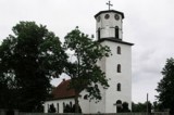
Persnäs Church
Persnäs Church
![]()
![]()
![]()
![]()
![]()
![]()


Location: Northern Öland
[wpfp-link]
Visa på Google karta
Church environment
Persnäs parish is situated on the northern Öland between the parishes Föra and Källa. The Church Village is located a few kilometers east of the road 136th
The church is surrounded by farmland but the parish’s most important industry has long been quarrying. West and south of the church are the remains of old quarries.
The Stonemason traditions are also evident by the many barns of limestone and remains of “skurkvarnar” (a wind-driven scouring machine). Today is quarrying performed in the parish western parts.
The Church
A nave and a narrow chancel in stone were probably built in the first half of the 12th century. The west and east towers were probably built shortly after each other during the late 12th or early 13th century.
The church transept was built in the mid 13th century, the church porch in the south and storage facilities in the north probably shortly thereafter.
During the late Middle Age there were several changes in the church interior. The sacristy was added in 1650-62 in the angle between the east tower and the transept to the north.
Throughout the 17th and the 18th century the parish had very high costs of maintenance of the church. They also made some costly changes to the interior, an organ was installed and a gallery was built in1756-59.
In the mid 19th century the church was considered to old so a collection of money started for building of a new church. The old church had also become crowded when the population of the parish grew during the 19th century.
Drawings were made and sent to the “överintendentsämbetet” (today The National Property Board of Sweden). The parish request for a new church was handled by architect CG Blom Carlsson, who instead advocated for a reconstruction of the old church and drew up a new proposal.
According to the new proposal the transepts should be expanded instead. The work on the new transepts began in 1856. The following year, when the demolishing of the old transepts had begun, the eastern tower collapsed. To re-erect the tower would be too costly so instead the parish got permission to build a new chancel to the east.
Originally, the sacristy was located in the eastern transept behind the altar, but in 1959 it was moved to the north transept.
Memorial grove
At Persnäs cemetery there is no memorial grove.
Buildings
In flight with the churchyard wall in the west lies the morgue. When the building was originally built is not known. Until 1966 when the building was renovated it was used as a storeroom and a provisional morgue.
At the renovation a room for mortuary removal was prepared and better storage facilities. Even today, it is used as storage but also as a morgue. The facade is smooth plastered in white, the roof is tiled and joinery painted black.
Outside the cemetery’s northwest corner is a newly built janitorial house with garages. The building has standing gray-painted wood paneling, white joinery and black metal roofs.
Other
Up until 1848 there were several old grave slabs in the cemetery. Many of them were used to the new church floor 1857.
One of the most renowned is Sigmund from Horns grave slab from 1341. Another renowned grave slab is “Digerflisan” (the Black Death slab) now located as stair stone at the church’s southern entrance. According to the legend, there were not more survivors after the Black Death in the 14th century in Persnäs parish than that could stand together on “Digerflisan”.
South of the morgue are several older tombstones arranged along the entire southern part of the cemetery wall. There are among other several old limestone crosses and some cast iron crosses
Source: Kalmar Läns Museum (Kalmar County Museum)
Translation: Visitoland.com
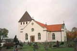
Löt Church
Löt Church
![]()
![]()
![]()
![]()
![]()
![]()


Location: Northern Öland
[wpfp-link]
Visa på Google karta
Church environment
Lots church and cemetery is located at the intersection of the road 137 on the eastern side of Öland and the road to Alböke. Adjacent to the church a small center evolved where there were a shop, school, etc.
East of the church is the vicarage. The manor house that exists today was built in 1868, but the vicarage history goes further back in time. During the 18th century a large orchard was established at the vicarage. The vicarage is today a private residence, but one of the church stables, earlier belonging to the vicarage, is now owned by the local historical society.
West of the church is a piece of land called Kyrkhorvan. This land was donated by the vicar Wallander to the parish, and a school building was built here in 1852 and is still there today.
To the east of school a residence for the teacher was built, called “Klockargården”, which today is a home for the elderly.
The Church
The first stone church in Löt was built in the first half of the 12th century. The church consisted at that time of a nave and a narrower chancel with an apse.
During the second half of the 12th century, when the threat from pagan pirates from the Baltic area increased, was the church in Löt as so many of Öland churches rebuilt to a defense church. First a shooting floor was built above the nave, and a tower in the west was added around the year 1200.
During the 13th century’s first decades and extra floor was added to the tower, to a total of four. A Church porch to the south was also added during this century, while the sacristy was built in the north in the 14th century.
In the records from parish assembly meetings in the 17th and 18th century there are notes about changes and renovations during this period. The biggest change was implemented in the late 18th century when the tower was equipped with a lantern were the church bells was hanged. They had previously hung in a belfry.
In the 19th century, the population increased and the church got crowded and soon to small for the parish. Decision to build a new church was taken and drawings were made in 1838 by Nils Löfgren Isaac. In 1840 the builder Peter Iceberg began the work on the new church.
To keep the costs down, the tower and part of the nave west wall was used for the new church. The rest of the medieval church was demolished.
The new nave was built outside the medieval church grounds and the building was extended to the east and the sacristy was built to far east.
The new church is dominated both the interior and exterior of neoclassic stylistic features such as the round-headed windows and the bright, airy nave. Even the medieval tower now has a Classicist expression with the lantern, the round-headed windows and the entrance to the west.
Memorial grove
At Löt’s cemetery there is no memorial grove.
Buildings
To the west of the cemetery are two buildings located. One of these has plastered white walls and a tiled roof, accommodating the toilets for the church visitors.
The second building has standing white painted wood paneling and a tiled saddle roof. This building houses staff facilities and workshop.
Other
At the cemetery’s northwest corner is a canopy of limestone chips. Here stands a cast-iron fence that previously surrounded one of the tombs in the cemetery.
Source: Kalmar Läns Museum (Kalmar County Museum)
Translation: Visitoland.com
Långlöts Curch
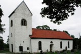
Långlöts Curch
![]()
![]()
![]()
![]()
![]()
![]()


Location: Central Öland
[wpfp-link]
Visa på Google karta
Church environment
The church is located on the northern part of the burial ground used from 200-300 BC and up to the 11th century.
The church is not directly connected to any village, its located on the eastern fault line between the villages Långlöts and Folkeslunda.
South of the church lies the former vicarage, the manor house was built in 1839 and outbuilding 1844. In the courtyard is a memorial stone to the artist Ivan Hoflund from 1962. The vicarage is today a private residence.
Next to the church grounds was in the 19th century also school and poor house. Around the church is farmland.
During the Middle Ages until the mid 16th century was Långlöt a parish. But king Gustav Vasa incorporated Långlöt parish with Runesten in 1545, to where it belonged until 1585. After that Långlöt became an independent parish again and remained so until 1917, when it once again was incorporated with Runesten.
The Church
The first church in Långlöt has probably been a wooden church, a secondary used timber roof truss has been dated to about the year 1080. At the restorations of the present church was also a coin that dated to 1084-1088 found.
The first stone church was built in the early 12th century, and during the 12th and 13th century it was rebuilt and expanded until it became a so called pack-saddle church
In the late 18th century large parts of the medieval church was demolished and today’s church was built. It consists of a spacious nave, with the Romanesque tower preserved in the west. North of the chancel is the sacristy that was built in 1855.
The church walls are cavity walls built of limestone. The church is plastered in white and around the church runs a socle.
Inside the church is a baptismal font in gray limestone from Gotland, which is dated to between late 12th to early 13th century.
Memorial grove
The memorial grove is laid out in the southwestern part of the cemetery. It has a rectangular shape with rounded corners.
In the west it is bounded by the cemetery wall and the east, west and south by a low hedge of cotoneaster.
In the south is a natural stone surrounded by laid limestone slabs. On the stone is engraved memorial grove and around it is a flower bed where flowers are planted. There are also racks for flower vases. Adjacent to the plantation stands a bench to sit down on.
Buildings
As a part of the wall to the north lies a small building which houses both staff rooms and toilets for the cemetery visitors. The house is plastered in white with a tiled roof.
Outside the wall in the northeastern corner is a white painted wooden storage building with a roof of sheet metal.
Other
About 700 m ENE of the church is a triangular field, belonging to the vicarage. It has, according to tradition, been used as cholera or plague cemetery far back in time when the eastern road followed the fault line closer to the Baltic Sea than the present road.
South of the church is a sundial of red, polished limestone, consisting of a baluster shaped shaft with a square foot, the year MDCCCLIV, 1854 are engraved on the dial. An older sundial has been standing in the churchyard before. In 1732 is a payment registered for “timstensstocken” (means like “Time stone log”), the oldest known sun-dial and is today incorporated in the walled late Romanesque south portal.
East of the church is a well in dry stoned limestone covered by a large limestone rock with a square hole in the middle, in which a pump is inserted.
In the 18th century, the well was used as spring water well of the local population. It has also been used as a sacrificial spring
Outside the western cemetery gate stands a poor-box of oak, probably identical with the poor-box that was purchased in 1764. It was restored in the 1970s.
Both the inside and outside of the northern churchyard wall stands tombstones, and along the southern cemetery wall, are more tombstones. All are taken out of service and some completely overgrown by the ivy growing on the cemetery wall.
Source: Kalmar Läns Museum (Kalmar County Museum)
Translation: Visitoland.com
Köpings Church
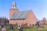
Köpings Church
![]()
![]()
![]()
![]()
![]()
![]()


Location: Central Öland
[wpfp-link]
Visa på Google karta
Church environment
Köpings church and cemetery is located along road 136 in the midst of Köping. The area has a very long history and was during the Iron Age, a trading center on the island of Öland. The parish is therefore rich in ancient remains.
Northeast of the church is one of the more remarkable; “Tingsflisan” (flisa equal to Stone) believed to be from the 11th century. This is an almost 10 feet tall stone standing on a hill and with a text in ornamental runic characters saying “Torer and Torsten and Torfast, these brothers raised this stone after their father Gunnfus. God help his soul”.
East of the church is a two-storey building that was constructed in the 1840s, then housing the parish’s first school and parish hall. Today the building is owned by the local historical society, and is among others things used for the societies meetings.
Adjacent to this building is a yellow painted wooden villa. It was built in 1880 as a residence for the teacher but has also been used as a cantor residence. The house is now the parish registrar’s office
North of the cemetery is a row of church stables. When they were built is not known. They represent the remains of all the church stables that once surrounded the church, when the other stables where demolished is not known today.
The Church
In the area around Köping church are several ancient remains, of which a large number are Christian funerary monuments from the 11th century. This makes researchers to believe that there existed a wooden church on the site at this time. According to tradition, the wooden church has been located about 5 meters west of today’s cemetery, but traces of this church have not yet been found.
The first stone church was built in the mid 12th century. At first a chancel and an apse of stone was erected, while the nave appears to have been of wood. But not long after a new nave and a west tower was also built in stone.
During the late 12th and early 13th century the church was rebuilt. A tower was erected in the east so that the church became a pack-saddle church. A Church porch to the south was built in the mid 13th century and a sacristy in the north around the year 1300.
In the early 19th century, after lengthy discussion in the parish, it was decided to demolish the medieval church and build a new one. The drawings were made by Jacob Wulff at the “Överintendentsämbetet” (today The National Property Board of Sweden).
Parts of the medieval church’s north wall were inserted into the new church but the rest was demolished. The new church had a tower in the west and chancel and sacristy in the east.
After a few years it turned out that the new church grounds was very poor. The building suffered subsidence so strong that stones in the wall were cracked. In the early 20th century the building was also hit by two powerful lightning strikes.
In the 1940s the church was so dilapidated that the parish did not dare to use it. The services were moved to the parish house and planning to build a new church was begun.
A new church was built in the year 1954-55, designed by Arland Noreen. When the church from 1805 had been torn down a study was made of the medieval Church’s foundation residues.
The new church was erected with a full wide chancel in the east and a tower in the west, and in 2007 an extension to the church porch facing north was made.
Memorial grove
The Memorial grove is situated east of the church. The area is surrounded by a thuja hedge. In the south there are flower beds with roses and summer flowers, a Hill Cherry tree and small paths paved with limestone.
Also in the north are flower beds and a wooden cross and a cabinet for candles. Here is the ground sown with grass. The Memorial grove was completed, 1992.
Buildings
East of the cemetery is a building that houses the janitors and garage. The building has lying yellow panel, white carpentry and a tiled saddle roof. In front of the building’s doors lies an old gravestone in limestone as part of the stairs.
Outside the cemetery’s northeast corner is a row of preserved church stables. The building has standing red painted paneling, black doors, white carpentry and pent roof covered with black plate. In a part of the building is a collection of architectural fragments from the medieval church kept.
Other
Along the churchyard wall in the northeast corner of the cemetery are a number of tombstones that have been removed from the cemetery located. A number of tombstones or parts of tombstones are also placed at both the eastern and western entrance to the cemetery.
At Köpings cemetery are several grave-slabs and standing tombstones of old age that makes them historically valuable, there are also tombstones that are made of special materials, has a special design or otherwise has an interesting history.
Source: Kalmar Läns Museum (Kalmar County Museum)
Translation: Visitoland.com
Källa gamla Kyrka (The old Church in Källa)
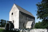
Källa gamla Kyrka (The old Church in Källa)
![]()
![]()
![]()
![]()
![]()
![]()


Location: Northern Öland
[wpfp-link]
Visa på Google karta
Church environment
The old Church in Källa is located along the road to Källa Harbour. Källa Harbour was for a long time one of the north-eastern Öland’s most important harbours. Around the church lies Vi Alvar (The typical moor of Öland) with plenty of ancient remains from the Iron Age.
The church and its surroundings is thus an old central location in Källa parish. East of the church is today a community with mixed family houses with both permanent residents as well as summer residents.
The Church
During excavations of the church in 1971-72 a thick layer of soot and fire residues was found under the current stone church. This was interpreted as the stone church had had a predecessor in the form of a wooden church. This wooden church should then have existed as early as the 11th century. It was also found interments under the soot layer and within the earlier wooden church walls. The building of the stone church began around 1170. It was then the church tower was built either adjacent to the wooden church or as a standalone defense tower.
In the early 13th century the wooden church disappeared and the construction of the nave in stone began. During the 13th century the nave was built out step by step until it got a fully wide chancel and two floors above the nave. The west tower was lowered and a flèche (ridge turret) of wood was built in the middle of the nave roof. In the mid 13th century the church porch to the south was added. In the following centuries were only minor changes made to the building.
In the 17th century the roof was coated with shingles, and the windows were also changed. In the 1760s, the sacristy was built and changes to the tower were done, and several repairs and minor alterations were performed.
A major renovation and remodeling was done from 1802 to 1807. Inside were the medieval vaults removed and replaced with a wooden barrel vault. The interior walls were plastered, the windows were made bigger and the flèche (ridge turret) was removed.
During the 19th century maintenance work were carried out continuously and in1850 an inspection of the church showed that more extensive measures were necessary. It was then the thought about building a new church began and discussions about where the new church would be built started, however, the discussions was protracted and first in 1882 was the land where Källa new church is located purchased.
The old church was abandoned but The Royal Swedish Academy of Letters, History and Antiquities banned the parish from demolishing it. The Furnishings from redevelopment in the early 1800s was however removed. Some were reused and another was sold.
The church now fell into disrepair. But the interest in the building would wake up again. In 1911, the Government granted funds to repair the church and in 1928 the church meeting decided that the church would be submitted to The Royal Swedish Academy of Letters, History and Antiquities. During the 1900s, several repairs have been carried out, and two major ones in 1960-61 and 1978.
Today the church is owned by The Swedish National Heritage Board and is managed as a museum and is used except as a museum for weddings and concerts.
Buildings
At the car park to the south is a building that houses the toilets for visitors. The building has a saddle roof covered with cardboard and standing brown wood paneling.
Other
At the cemetery entrance in the south is an information board from the National Heritage Board which tells of the history of the area.
Source: Kalmar Läns Museum (Kalmar County Museum)
Translation: Visitoland.com
Källa Church
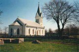
Källa Church
![]()
![]()
![]()
![]()
![]()
![]()


Location: Northern Öland
[wpfp-link]
Visa på Google karta
Church environment
Källa church and cemetery located in the village “Vi” along road 136 in northern Öland. Previously, the main road passed near the church in the east but today it passes outside the village.
At the church is the small village with houses, and there is still a local shop. North of the church, in the village Källaberg, is the new vicarage located, it was built in 1955. The old vicarage, built in 1879, is located in the village Högnäs.
A few kilometers east of Källa Church are Källa old Church and cemetery located which was abandoned when the new church was completed in 1888. Källa old Church is currently used in the summers for concerts and weddings.
The Church
There has probably been a wooden Church in Källa, believed to have been built as early as in the second half of the 11th century. Traces from this early church haven’t been found yet though, but it’s believed that the location is just under the old church.
During the 12th and 13th century were, step by step, building segments in stone erected and added to the church, and the church in Källa became, like so many other churches on Öland at this time a defense church. In the middle of the 13th century the church had got the form it still has today.
In the period 1500-1880’s, when the new (old) church was completed, there were several renovations and alterations. Many of the repairs were extensive and in 1855 it was found that the church was in a bad condition and for the first time it was proposed that a new church would be built. Negotiations for the new church location started, and in 1880 it was decided to purchase land in the village Vi. The parish center, due to this decision, then came to move a few kilometers east to a more geographically central location in the parish.
The land, on 1½ acres, was purchased by Nils Persson at a cost of 600 SEK (about 60 Euro). Drawings were drafted by the engineering firm Hultqvist and Ackzell, Mönsterås, and further revised and processed by Louis Peterson. The work began in 1886 and two years later it was completed.
The building is characterized interior and exterior of the Neo-Gothic style and features. The chancel is located in the west and the tower in the east, this because the road earlier passed close to the church.
Memorial grove
The Memorial grove was laid out in 1998 in the northeastern corner of Block C. The area is surrounded by an arborvitae hedge. In the center is a large stone surrounded by two Dasiphora fruticosa (shrubby cinquefoil). In front of the stone is a flower bed for summer flowers and lighting in the style of earlier time’s gaslights. The memorial grove has also a bench for visitors.
Buildings
West of the cemetery is a building that houses staff rooms, garages etc. The building has standing red painted wood paneling, black tin roof and white joinery.
Other
At the cemetery’s northwest corner, there is a parking for tombstones that have been removed from the cemetery. The tombstones are mainly from the period around the year 1900 and there are stones of both limestone and granite. On the outside of the churchyard wall in the east there are specific limestones fastened into the wall, the purpose for this was to tie the horses to them, when visiting the church.
Source: Kalmar Läns Museum (Kalmar County Museum)
Translation: Visitoland.com
Högsrums Church
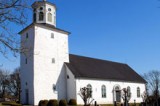
Högsrums Church
![]()
![]()
![]()
![]()
![]()
![]()


Location: Central Öland
[wpfp-link]
Visa på Google karta
Church environment
The church is located next to the road between Rälla and Gärdslösa. Around the church is pastures and Alvar (the typical Moorland of Öland). East of the church grounds is the parish house decorated in a whitewashed two-story house with a tiled roof from the 1820s. The house was formerly community hall, poorhouse and school. Downstairs there was teacher’s residence until around 1920. Since 1926, the Church has used the premises for church activities.
Just north of the parish house is the local folklore society house located, and the parish’s oldest schoolhouse is located close to the church. South of the church along the village road is Högsrum village.
The Church
In the 11th century there was probably a wooden church in Högsrum, but where this church stood is not known. During the first half of the 12th century a church of stone with a nave, chancel and apse was built on the site where the church stands today.
A tower in the west was added in the second half of the 12th century. This tower is to the greatest extent the one that exist today, as also the western gable of the nave is. In the south, there was a church porch but when it was built is not known.
During the 18th century the population increased in the parish. The church was equipped with a gallery and more benches were installed, but it did not help in the long run.
In 1821 a proposal for a new church was sent to “Överintendentsämbetet”( today: The National property Board of Sweden). This was processed by the architect Carl Gustaf Blom-Carlsson, who also designed the church in Persnäs.
To the medieval tower there was built a new nave with a chancel and sacristy in the east, and limestone from the old church was used for the construction. The work was led by master builder Leonard Lidman from Wij in Källa parish.
Since the church was built, several changes and restorations have been made. Among others a roof lantern was added to the tower in 1840.
The exterior of the church today is characterized mainly by neo-Classical features with arched window openings and portals. Also the medieval tower has a neoclassical touch now with the roof lantern made of wood. Even in the interior is the neoclassical features most prominent but there are also neo-Gothic elements in the pulpit and organ façade design.
Memorial grove
There is no memorial grove at the cemetery in Högsrum. Instead, there is a memorial grove in Rälla Tall belonging to the congregation, so the members of the parich who wish to be buried in a memorial grove are referred there. The Memorial grove was prepared in the 1990s.
Buildings
Inside the cemetery west of the tower there is a boiler room that was built in 1965. It is painted white with a tiled roof and a gray painted wooden door.
Other
Along the southern cemetery wall is part of the church’s former pillars of limestone.
Older decommissioned tombstones are placed along the northern churchyard wall. Some of them were previously buried north of the cemetery wall, but were found during excavation work. They were then taken care of and were put up at the wall.
In 1990 a place for meditation and prayer was prepared north of the church. Around and as demarcation are hedges of privet and crab apples planted. In the middle of the field, there is a fountain of limestone and around it are plants planted. Outgoing from the circle, in all cardinal points goes gravel walks. The design was made by landscape architect Peter Bergholm.
Several of the tombstones that are made of limestone in the cemetery are probably carved by local stonemasons.
Source: Kalmar Läns Museum (Kalmar County Museum)
Translation: Visitoland.com
Högby Church
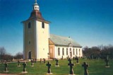
Högby Church
![]()
![]()
![]()
![]()
![]()
![]()


Location: Northern Öland
[wpfp-link]
Visa på Google karta
Church environment
Högby church and cemetery is located east of the community Löttorp, along road 136. When the railway was built in 1906 was Löttorp one of the important stations along the railroad. During the 20th century has northern Öland’s service and trade been concentrated to Löttorp. Here are today among other things, school, health center, shopping and businesses.
Southwest of the church is a building that was formerly the school. The building was completed in 1851 and was used as a school until 1967, and a few years later rebuilt to the parish house.
North of the church are some of the former church stables preserved, the first church stables were built in the mid 19th century. Today the remaining stables are managed by the local historical society.
Northeast of the church is the vicarage from 1846. The vicarage is still today the official residence of the vicar and additionally the parish registrar’s office.
East of the church is the vicarage barn, built in stone. In the barn there are today some 50 tombstones, including a number that are made in wood, which have been removed from the cemetery.
North of the cemetery is an agricultural landscape spreading out and south of the cemetery is a deciduous forest area Högbyeke which is a nature reserve.
The Church
Högby church was built in the mid 12th century, at first with nave, a small chancel and an apse. The tower in the west was added during the second half of the 12th century. Around the year 1200 the nave was vaulted so that the nave became divided in two with six groined vaults.
During the first half of the 13th century the chancel was expanded. It became rectangular in shape and had two floors. At the same time another floor was added to the tower, a so-called clock floor. With the lower nave, chancel with two floors and the tower with three floors the church got the shape of a pack-saddle church.
In the early 13th century the church porch was built at the south entrance. A further extension was made in the south east of the church porch, this in the second half of the 13th century. It was a chapel building dedicated to Saint Otto. The Chapel came in the late middle age to be used as crypt too the family Bielke.
In the late 13th century the sacristy was built in the north. In the centuries thereafter minor changes was performed. Towards the end of the 18th century there were several major changes due to cracking. The arches in the church porch and the nave was removed and replaced by Wooden Barrel vault.
In 1797 St. Otto’s Chapel was demolished. The year 1825-26 the clock floor of the tower was rebuilt into its present appearance surmounted by a bell-shaped hood.
As the population grew during the 19th century the church became crowded. This led to that the whole of the medieval church, except the tower was demolished and replaced by the present nave. The drawings were made by FR Ekberg and the work was led by master builder P. Petersson, Madesjö.
During the 20th century, two major renovations were carried out. The first was made in 1939 and was led by architect Paul Boberg and artist Torsten Hjelm while the second was conducted in 1975-76 and led by architect Ture Jangvik.
Memorial grove
The Memorial grove was built in 2004 and designed by Outside landscape architects & engineers AB. The place is circular and surrounded by a newly planted hornbeam hedge. The burial ground is marked by a stone paved circle in the grass. At the site’s eastern side is a wooden cross, rose planting and a place for flower vases and candles.
Buildings
West of the cemetery is the morgue, which was built in 1961 and designed by “Nerles Arkitektkontor”. The building has a masonry facade of limestone and roof covered with slate. The entrance to the north has dark wooden doors.
South of the morgue is a yellow, plastered building with a roof covered with concrete tiles. The house was built in the 1970s and contained the toilets for the church visitors. In 1985 it was rebuilt and furnished with the staff room for the janitors.
Other
The churchyard has no specific parking for older tombstones that have been removed from the cemetery. Instead, several older tombstones are left in the cemetery. But some of the old tombstones that have been removed are now kept in the parsonage barn east of the church.
Source: Kalmar Läns Museum (Kalmar County Museum)
Translation: Visitoland.com
Gärdlösa Church
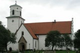
Gärdlösa Church
![]()
![]()
![]()
![]()
![]()
![]()


Location: Central Öland
[wpfp-link]
Visa på Google karta
The Church environment
Gärdslösa church and cemetery is located adjacent to and west of the road between Bredsätra and Långlöt, north of the villages of North and South Gärdslösa. The church is located above the fault line and just north of the church environment is Störlinge southern “Kvarnbacke” that is a burial ground with single standing stones and stone settings.
South of the cemetery is the church grounds where a memorial stone to the poet EJ Stagnelius is erected. Stagnelius father was dean of the congregation and Stagnelius spent his childhood in the rectory close by. The Portrait Medallion on the stone is the work of sculptor Arvid Källström. The memorial stone was unveiled on midsummer 1924
To the west is the former morgue built together with the parish hall. In the northwest is the foundation of an old guild house. Around the church environment are farmlands extending both east and west and to the east you can see the sea.
The Church
A wooden church have probably been here already in the 11th century, of which the found rune stones testify. A stone church replaced the wooden church, sometime in the second half of the 12th century.
The church has been rebuilt several times over the years and the church today consists of a nave, a chancel of about the same height and width as the nave and between them the so-called nave extension. To the west rises a slender tower and at the naves western half are transepts to the north and south.
The church is the one that has the best preserved medieval character of the island’s churches and the chancels Gothic crow-stepped gable is unique to the island of Öland.
All the walls of the church consist of cavity walls of limestone and no baseboards have been observed. The walls are since 1958 silted and whitewashed, with the exception of the north transept showing the beautiful masonry.
The tower was rebuilt in 1845 and one of its openings for the church bells are a tomb to the dean Johan Greselius and his wife dead 1710.
In the church porch are two pieces of a rune stone of gray limestone with dragon band and inscription kept. Youngest stone hob in the church dates from 1780. Most of the tombs kept inside the church were moved out of the cemetery sometime in the 19th century. A few are still left in the aisle.
About 15 years ago an attempt was made, according to Ragnild Boström, to move the oldest stone hob, from 1311 over Gärdslösas first known priest Olaus, into the church porch. The stone was then broken into several pieces which are now kept in the Church. In the chancel are church frescos, both medieval and younger.
Memorial grove
The memorial grove which opened in 2000 is located west of the cemetery adjacent to the parish hall which also forms the border in the south. In the west there is a fence, outside the fence runs “silverbäcken” (the Silver brook).
Towards the north it is planted bushes in a semi-circle and in the east it is planted shrubs, and in the area there are five tall pine trees. The rest is lawn with a planting area which is surrounded by a limestone wall, with an older limestone tomb behind.
The parish plans, following a decision by the church council, in the near future to place a memorial stone in the memorial grove. The memorial stone shall be of limestone and polished on both sides. On the stone, brass plates with the names of the buried can be applied, for the families who so wish.
Buildings
The Morgue, which was inaugurated in 1968, is just outside the cemetery to the west. It was designed by Gösta Gerdesiö, Kalmar. It is built of limestone with a saddle roof covered with tiles. The former entrance to the east has double doors of oak. Inside the chapel is the medieval portal embracing the altar niche. The morgue is now remodeled and connecting with the parish house that was built in 1987.
In the northwest corner is a white painted wooden building that houses staff areas, tools and machine storage and public toilet.
Other
Tombstones set aside are placed along the west wall of the cemetery.
A sundial assembled from many different parts stands next to the limestone walk path in the south. Under the clock-face is the year 1733 imprinted, parts of it can however come from a baptismal font dated to 1750.
Source: Kalmar Läns Museum (Kalmar County Museum)
Translation: Visitoland.com
Föra Church
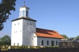
Föra Church
![]()
![]()
![]()
![]()
![]()
![]()


Location: Northern Öland
[wpfp-link]
Visa på Google karta
Church environment
Föra church and cemetery is located at the intersection where the roads along Öland’s eastern and western side meet. East of the church site is the village Föra, one of the row villages on Öland. West of the church, is the school, which was built in 1927. The school ceased in 1995 and the building was taken over a year later by the parish. Today the house is used as a parish hall. South of the church is the vicarage. The main building was erected in 1917. The vicarage is today owned by the parish and inhabited by the parish priest.
The Church
The church was built during the 11th century, a stave church of wood, and as a shell on the outside of this building was a new stone church erected around 1160.
During the 12th century the church was converted into a fortified church with a tower to the west, shooting floor above the nave, and a bit later also a tower in the east. The building had thus assumed the shape of a pack-saddle church.
The medieval church stood until 1828 when the eastern tower and the nave were demolished. The drawings for the new church were made by architect C. Blom-Carlsson and builder was Petter Ekholm. The new nave is interior and exterior performed in the classical style.
The West Tower from the 12th century has been investigated thoroughly, which showed that it probably has been used as shelter both in troubled times as in times of peace. In the towers floors has been discovered among other things, leftovers, costume details and game pieces. On the second floor there is even a so-called privet, a privy or medieval toilet, preserved. It could be Sweden’s oldest of its kind. In the nave floor is still several tombstones mainly from the 17th and 18th century.
Memorial grove
A memorial grove is laid out north of the church, west of Block III. The area is bounded on the east and west by an arborvitae hedge and in the north of the cemetery wall.
Next to the cemetery wall is a wooden cross and a flowerbed for roses and summer flowers. Into the area leads a pathway paved with limestone, and on each side of the pathway is two Japanese flowering crabapple planted with groups of Orpine. To the west stands a bench.
Buildings
At the entrance to the south is a building that was originally used as a morgue. It is bricked of limestone. The gable of the south is smooth plastered white with doors covered with copper plates. The gable to the north is also smooth plastered white with a small glass brick window and a vent. The house has limestone slate roofing.
Outside the cemetery to the north lies the Porter’s office. In 1995 it got its present form when an older storage building was rebuilt. When the older building was built is not known. The Porter’s Office has standing red painted wood paneling, white woodwork and doors, and a roof with red tiles. In the building are staff rooms, toilets for the church visitors as well as garage and storage room.
Other
East of the memorial grove stands a number of tombstones that has been taken away from the cemetery; several of them are of limestone.
Source: Kalmar Läns Museum (Kalmar County Museum)
Translation: Visitoland.com
Egby Church
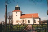
Egby Church
![]()
![]()
![]()
![]()
![]()
![]()


Location: Central Öland
[wpfp-link]
Visa på Google karta
Church environment
Egby church and cemetery is located midway between the two villages Egby and Sandby along the road that runs from Föra in the north to Ottenby in the south along the eastern side of Öland.
The parish is located due east of Köpingsvik on the island’s northern half. The two villages are typical “row village” of Öland where the farms are aligned along the highway. East of the church was formerly the parish poorhouse. Today it is farmland and next to the church are several farms located with active farming.
The Church
The first stone church in Egby was probably built in mid 12th century. Prior to this building a wooden church has probably existed but where this building stood is not known. The stone church consisted of a nave, a chancel with apse and vestry on the north side. Of this building remains today the chancels outer walls and the apse and nave wall in the south and the lower parts of the nave wall in the north and west.
In the late 12th century and early 13th century the church was rebuilt to a defense church, including a profane upper floor and in mid 13th century the church porch at the nave’s south side was probably added.
During the 18th century several repairs of the church was done, but in 1815 the building was in a deplorable state. In addition, the church became too small for the growing population of the parish. In 1817 the work with the extensive renovation of the medieval church began. Parts of the walls were rebuilt and in the west a tower was built. The work was led by the master masons Pettersson and Berg, Kalmar. The work with the church’s interior furnishing, fixtures and paintings took until the 1830s. The church has since this renovation undergone several repairs, the latest more extensive was done in 1959, and in conjunction too this, an investigation of the masonry was performed.
Memorial grove
The memorial grove is located north of the vestry along the cemetery wall. The area is surrounded by a common privet hedge. Into the memorial grove leads a pathway paved with limestone. In the northern part of the area stands a wooden cross with a flowerbed for roses and summer flowers in front it.
Buildings
In the cemetery’s northwest corner stands a building that today houses storage room and workshop. The building has a smooth plastered facade. The saddle roof is coated with tiles and the woodwork is painted black. The building is probably the shed built by Olof Olofsson 1774 that was used as a morgue. In 1800 it was decided to expand the building but it is not known whether the decision was effected.
Source: Kalmar Läns Museum (Kalmar County Museum)
Translation: Visitoland.com
Böda Church
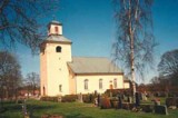
Böda Church
![]()
![]()
![]()
![]()
![]()
![]()


Location: Northern Öland
[wpfp-link]
Visa på Google karta
Church environment
Böda parish is the most northerly parish on Öland. The church and the cemetery are located along road 136 on the road’s west side, in the southern part of Böda.
North of the church is the rectory that was built in 1839, today a private residence, and further north of the church is the school house from 1849.
The Church
The church that was built in Böda during the second half of the 12th century had a small nave, narrower chancel and a semicircular apse to the east.
During the, for Öland, troubled times in the late 12th century and 13th century the church was rebuilt to a defense church. The apse was demolished and the chancel was made as wide as the nave.
Several changes were made in the following centuries, and in the mid 18th century the population of the parish had increased so much that the church became too crowded.
Drawings for a new church were developed but had to be revised, and the construction work was finally carried out 1801-03. To reduce cost the medieval church’s western and southern wall was saved and included in the new church. The new church was built with a tower in the west, a nearly square nave and a vestry in the east.
The church has since it was built undergone several restorations. In 1942 the facing plaster was taken away which made it possible to investigate the ancient walls and thereby get interesting information about the medieval church.
The Church interior and exterior is today characterized of classical stylistic features such as the round-headed windows, the bright church room and the furnishings design.
Memorial grove
The memorial grove was laid out in 1990 in connection with the enlargement of the cemetery. It is located at the middle of the wall which forms the border to the old cemetery and facing south. The memorial grove is a circular area and surrounded by a yew hedge. A pathway paved with limestone leads into the area, and follows the hedge around the whole area.
In the middle is the earth area for the ashes that is sown in with grass, at the south verge is a flower bed for perennials and in the northern part is five black painted wrought iron crosses of various sizes and a place to put flower vases.
Buildings
West of the block B are three buildings. The most conspicuous of these is the morgue, which was built in the late 1940s. The building has walls of limestone and a slated roof. The entrance is in the east with double, dark wooden doors. The gable has a slated deep roof projection and is decorated with a wooden cross.
North of the morgue are two buildings located. The western accommodates garage and storage and the eastern staff rooms and toilets for visitors. Both buildings have plastered facades of pale yellow color and the ceilings are covered with black painted plate.
Other
In the northwest corner of the cemetery is an area for meditation which was established in 1990. Outside of this, along the cemetery wall is a gravel coated area where the tombstones that have been removed from the cemetery are placed.
Outside the cemetery at the lichgate in the north stands a mite box of wood. The first mite box in Böda should have been set up at the initiative of dean Fagerroth in the late 18th century.
Source: Kalmar Läns Museum (Kalmar County Museum)
Translation: Visitoland.com
Bredsätra Church
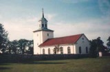
Bredsätra Church
![]()
![]()
![]()
![]()
![]()
![]()


Location: Central Öland
[wpfp-link]
Visa på Google karta
Church environment
Bredsätra church and cemetery is located on the eastern side of Öland at the height of Borgholm. Around the church is a small community with mixed buildings including several houses built in the 1950s. Opposite the church is the road to Sikavarps harbour with the ruin of Sikavarps Chapel and the lighthouse.
The Church
Various fragments of rune stones and other objects shows that the parish was Christian during the 11th century. Maybe there has been a wooden church here by that time, but no trace of such has been found. The first stone church was built in the mid 12th century. This building consisted of a nave and a narrower apse chancel. From this the oldest church remains today the foundation walls and the west gable of the nave.
In the late 12th century and early 13th century Öland and coastal areas were threatened by pagan pirates from the Baltic area. This led to that a number of churches were reconstructed to defense churches. So were also done in Bredsätra. First there was a tower built in the west and soon a tower to the east so that the church became a pack-saddle church. The work was probably completed in the mid 13th century.
The next extension was made sometime in the period from the late 13th century to the 16th century. Then a vestry was built to the north of the chancel.
During the 18th century there were several repairs to the church. Meanwhile, the population grew in the parish and the old medieval church became more and more crowded. In 1841 the parish meeting took the decision on a major rebuilding of the church. The drawings were made by the architect Th Edberg and the work was led by master builder Peter iceberg.
The medieval west tower was retained but the east tower was demolished and a new nave and a fully wide chancel and vestry in the north were built. Both the exterior and interior of the Church are characterized of neoclassic stylistic features, even though the interior to some extent also is interspersed with older styles as older movables and fixtures was transferred from the old church.
Buildings
Outside the cemetery’s entrance in the west there is a building that houses janitorial and toilets for the church visitors. The building has white plastered facades, black metal roofing and carpentry in brown.
Other
In connection to the janitors and the composts are a number of older tombstones and plinths removed from the cemetery.
Source: Kalmar Läns Museum (Kalmar County Museum)
Translation: Visitoland.com
Borgholms Church
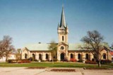
Borgholms Church
![]()
![]()
![]()
![]()
![]()
![]()


Location: Central Öland
[wpfp-link]
Visa på Google karta
Church environment
Borgholms cemetery is located in the northwestern part of the city. The place is surrounded in the north by a strip of beach towards the Kalmar strait, in the east of “Kapelludden” camping, in the south by Sandgatan and Bäckmans Park and in the west by the port area.
What once were the city’s outskirts has now become part of the urban environment. The church is located a bit away from the cemetery at the square. This type of solution with church and cemetery away from each other became common in the cities during the 19th century.
The Church
The construction of the church in Borgholm began in 1872, previously, the school building had been used as a church hall. When the church was erected it was built together with a new school building. The architect was Ernst Abraham Jacobson from Stockholm, and the builder was Chronwall from Kalmar.
The part that held the school was completed in 1873 while construction of the church dragged on because of shortage of money, but in 1879 the church was finally consecrated by Bishop Pehr Sjöbring from Kalmar.
The style is neo-Romanesque with buttresses, lombard bands, blind windows and the towers Tourelle. The tower is located in the middle of the building structure and the chancel is facing east. The exterior has not undergone any major changes.
The interior of the church was originally decorated in a time typical neoclassical style. The church was renovated in 1935 but got its current appearance at the rebuilding 1960-61.
The new interior was designed by architect Carl Hampus Bergman. In connection with the renovation the former school building was transformed to be the new parish house. This part of the building had during the 1900s been used for several different activities.
Memorial grove
The memorial grove was founded in 1985 and is located at the cemetery’s northern wall separating the area from the 1920s and St. Elavi chapel. The area has the shape of a triangle and is surrounded to the east, west and north by a low limestone wall. Inside the wall is ornamental shrubs planted in the west. At the entrance grows two pollarded elms. In to the memorial garden leads a pathway paved with limestone.
In the northern part is a pond and around this is space to place flower vases. North of the pond grows two blue spruce, ornamental shrubs and summer flowers. Between the blue spruces is a wooden cross standing. West of the pond is a cabinet in black painted plate where you can light and place memorial candles. In the eastern part stands a stone with inscription in gold. The area has several pine trees.
Buildings
At the cemetery’s northeastern corner is St Elavi chapel. The building, inaugurated in 1971, is built of yellow bricks with flat roofs covered with green plate. Also the interior walls are lined with yellow bricks. The chapel altarpiece consists of large windows with a beautiful view out over the Kalmar strait. In the building is also the morgue, serving the entire northern Öland.
Porter’s Office
South of the part of the cemetery that was added in the 1950s is the porter’s office. Here are two buildings. Both are clad with vertical green painted wood paneling and ceilings covered with red painted sheet metal. They accommodate staff rooms, storage room and garage. Here is also a porch, composting and storage areas.
The old Porter’s Office
In the angle between the old cemetery and the part that was added in the 1950s is the old Porter’s Office that is currently used as storage. The building has a flat roof and brown painted standing wood paneling.
Other
East of the part of the cemetery that was built in the 1990s is a cemetery park with plantings of shrubs, trees and lawns.
In the northern part of this area is a ceremonial area marked by a wooden sculpture. Next to the ceremonial area is an area coated with limestone, a pond and benches.
A specific area for tombstones that have been removed from the cemetery is missing. These are instead collected in connection to the Porter’s Office.
In the southeast corner of the old part of the cemetery are still traces of St. Elavi chapel that originally stood on the site, it consists of a slightly elevated rectangular area, and building remains was found here in connection to work with rearranging graves.
Source: Kalmar Läns Museum, (Kalmar County Museum)
Translation: Visitoland.com
Alböke Church

Alböke Church
![]()
![]()
![]()
![]()
![]()
![]()


Location: Northern Öland
[wpfp-link]
Visa på Google karta
Church environment
Alböke church and cemetery is located about 15 km north of Borgholm. The village and the church are located along the country road’s old route just east of what is now the path of road 136. The church is surrounded by farmland and in the village are several farms.
The Church
In Alböke, sometime in the middle of the 12th century, a stone church was built which consisted of an apse, nave and west tower. When the threat from the Baltic Vikings grew stronger an eastern tower was also built and the church was reinforced. It got in that way the shape of a pack-saddle church.
The pack-saddle church was built in the east-west direction with the chancel in the east. The population growth made the medieval church to small, and in 1859 it was decided to build a new church.
The drawings were made by Albert Törnquist and the work was led by master builder Peter Isberg from Algutsrum. The pack-saddle church stood intact while construction of the new church was going on and the new church was built perpendicular in the north-south direction. It made that the chancel and vestry came to be located in the north.
When the nave and the chancel was built, the medieval church was demolished and where its nave previously been, a new tower was erected of the stones from the medieval church. The church was consecrated in 1862.
The new church is dominated interior and exterior of neoclassic stylistic features like the round-headed windows, the bright church room and the ceilings wooden barrel vault.
In the interior there are also older stylistic features represented as movables and fixtures was transferred from the old church. Most prominent is the pulpit and altar both of which both are from the late 18th century and performed in the Rococo style.
Memorial grove
The Memorial grove is located northwest of the church. The grove is surrounded by a thuja hedge but is open to the east. A footpath paved with slabs of stone lead into the memorial grove.
To the west stands a wooden cross. There is also a flower bed with roses and summer flowers. In the flower bed is a large stone with a special appearance, the stone was found by a man named Söderberg in a moss in the village Askelunda.
Buildings
To the west of the church is a small building constructed of stone that is currently used as storage and the porters office. The main façade is clad with standing gray-painted wood paneling. The woodwork is painted white and the roof covered with black plate. The facades of stone can be of older date but the building is today heavily modernized.
Outside the cemeteries northwest corner, in connection with the cemetery wall, is a plastered building with standing wood paneling in the gable top. The plaster is coloured in white and the wooden paneling is painted blue, the joinery and doors are painted black.
Other
In the niche between the tower and the nave east of the church is a rune stone located. The upper part of the text is worn away. What remains is a small part of the text at the stones base.
In the niche between the tower and the nave west of the church is a part of the demolished medieval church, a middle column, placed.
In the northern part of the block A is a sundial. The disc is carried by a portion of the demolished medieval Church middle column.
Source: Kalmar Läns Museum (Kalmar County Museum)
Translation: Visitoland.com
Vickleby Alvar
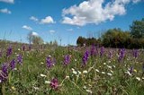
Vickleby Alvar
![]()
![]()
![]()
![]()
![]()
![]()


Location: Southern Öland
[wpfp-link]
Visa på Google karta
Classic orchid area
You can really experience the splendour of Öland’s orchids on Vickleby Alvar in May. And the strange Resmo Zone is located a few kilometres out on Vickleby Alvar; this is a water-bearing fracture zone which runs into Resmo spring and which provides a source of water for the whole of Mörbylånga.
The Stora Alvar’s plant world
Vickleby Alvar features plants that are typical of and special to the Stora Alvar. The central and eastern parts are dominated by expansive gravel alvar areas. In the west and around the alvar lakes and adjacent to the Resmo Zone there are well established flowering dry meadows. Most of the plant species of geographical interest exist in this area, such as Illyrian buttercup, hoary rock-rose, globe daisy, silverstar and alpine catchfly. Examples of rare species in the area are garden leek, lesser marshwort, wormwood, tansy ragwort and shrubby violet.
Birds and insects
The wildlife found here is also representative of the Stora Alvar. Characteristic birds in the area include the Eurasian skylark, the European golden plover and the northern wheatear. Montagu’s harriers also forage in the area. Insects found here include the pink-winged grasshopper and the distinctive wetted doll robber beetle, as well as the butterflies Nothris lemniscella, Setina roscida and viper’s bugloss.
Resmo Zone
The Resmo Zone on Vickleby Alvar was formed by rupturing and collapsing of the bedrock and it contains underground streams and karst features where water has eroded the limestone to form pits and ridges. This provides a habitat for species such as the distinctive Scellus dolichocerus long legged fly and the Chondrina clienta snail.
Historical landscape
Vickleby Alvar has traces of old roads, shepherds’ huts, tumuli, foundations and tombs, such as the altar stone with its associated stone ship. In the small cottages on the edge of the alvar life was previously characterised by poverty. The small buildings at Vickleby alvargata are constructed of limestone walls or oak planks. The cottages are typical of malm limestone buildings erected outside the villages.
Facts:
Size: Stora Vickleby 660 ha (1631 acres), Lilla Vickleby 613 ha (1515 acres)
Years of creation: 1997 and 1999
Purpose: To preserve the unique grazing-based alvar landscape with its special flora and fauna, to make cultural relics visible and to give the public the opportunity to experience the area’s assets. The area is part of Natura 2000, the EU’s ecological network of protected areas.
Directions/Location:
Take route 136 southwards on Öland towards Ottenby. Information and a car park is located at Vickleby kyrka (Vickleby church).
GPS coordinates to the parking lot WGS 84 decimal (lat, long): 56.57693 , 16.46122
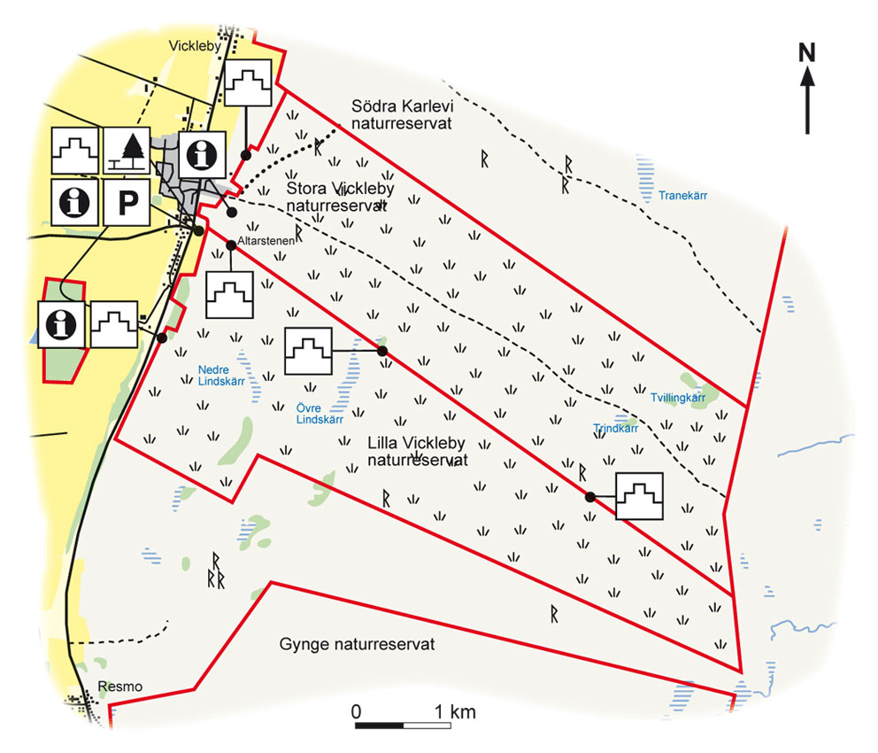
Map: Naturcentrum AB, Stenungsund.
Download: the County administrative boards brochure over (in Swedish only) (710 kB): Vickleby Alvar
Download: the entire brochure (in Swedish only) (19 MB): Utflyktsguide Öland
© Lantmäteriverket, Ur Geografiska Sverigedata, översiktskartan Dnr. 106-2004/188”
Source: County Administrative Board, Kalmar
Translation: Visitoland.com
Trollskogen (The enchanted forest)
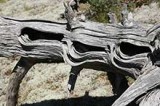
Trollskogen (The enchanted forest)
![]()
![]()
![]()
![]()
![]()
![]()


Location: Northern Öland
[wpfp-link]
Visa på Google karta
Magical forest on Öland’s north-eastern cape
Trollskogen (The enchanted forest) is situated at the tip of Öland’s north-eastern cape (nordöstra udde). It is an old grazed coniferous forest that truly deserves its name. It is the home of gnarled windswept pines and old oaks with wide crowns. The magical feeling is enhanced by ivy running along the ground and up tree trunks. Trollskogen is one of Öland’s most popular and most frequently visited locations.
Pearls of the forest
Cattle grazing has given Trollskogen an open character with gaps in the trees here and there, and the rare Chimaphila umbellata grows here, as does the little almond scented twinflower. The presence of old hollow trees and dead wood allows many insects, tree fungi and lichens to thrive in Trollskogen, such as the rare bark lichen. The breeding birds in the area include black woodpeckers and red crossbills. This is also the best location on Öland to see the willow tit, one of the island’s rarest breeding birds.
Shingle and fishing grounds
Mighty beach ridges of shingle have formed on Öland’s north-eastern cape over the millennia, shaped by wind, waves and ice. Atlantic herring and European flounder can be found in the surrounding coastal waters. Grankullaviken bay is a very important “nursery” for many fish species.
Ancient sites
The north-eastern cape has had great significance for humans since prehistoric times, due to the rich supply of fish and the harbour at Grankullaviken. Prehistoric burial sites are situated like a string of pearls on older beach ridges along both sides of the headland. The cape’s strategic location is also highlighted by fortifications from the 1400s, when the Danes tried to occupy the former naval base of Örbovik. At the headland’s narrowest point there is a hunting wall that was probably built by Johan III in the 1500s.
Facts:
Size: 266 ha (657 acres) of which 115 ha (284 acres) is land
Year of creation: 1998
Purpose: To preserve an area of natural coniferous forest, ancient oak trees, grazed coastal meadows and coastal and shallow areas with their typical flora and fauna.
Directions/Location:
Öland’s nordöstra udde (north-eastern cape), is about 65 km from Borgholm. Follow route 136 north and turn towards Grankulla just before Byxelkrok. Signs show the way from Grankulla.
GPS coordinates to the parking lot WGS 84 decimal (lat, long): 57.34280 , 17.11920
Karta: Naturcentrum AB, Stenungsund.
Download: the County administrative boards brochure over (in Swedish only) (795 kB): Trollskogen
Download: the entire brochure (in Swedish only) (19 MB): Utflyktsguide Öland
© Lantmäteriverket, Ur Geografiska Sverigedata, översiktskartan Dnr. 106-2004/188”
Source: County Administrative Board, Kalmar
Translation: Visitoland.com
Södviks sjömarker (shoreline wetlands)
Södviks sjömarker (shoreline wetlands)
![]()
![]()
![]()
![]()
![]()
![]()


Location: Northern Öland
[wpfp-link]
Visa på Google karta
Unique coastal meadows
Some of the county’s most beautiful and most valuable coastal meadows, created by millennia of grazing, are located along the shores of Södvik bay in north eastern Öland. The area is a bird habitat of international class.
The area’s character
The coastline between Södvik and Östra Vässby differs markedly from the rest of the island’s shores. The coast here is shallow and has more little inlets than usual. Out in the bay there are many small islands and shallows. What is today dry land was, for a long time, below sea-level. The extremely flat shores mean that the coastal meadows are unusually wide and varied. The wetlands have been shaped by humans who have let their cows and sheep graze here. The area currently consists of four nature reserves: Södvik, Hjälmstad, Marsjö and Östra Vässby.
Valuable bird habitats
Södvik is a classic place for birds and annually attracts large crowds of birdwatchers. Many migratory birds rest here, especially during the autumn. These include red knot, little stint, grey plover and Brent goose. Examples of wading birds that breed in the area are dunlin, northern lapwing, common ringed plover and common redshank. The coastal wetlands also provide habitats for pied avocets and black-tailed godwits. When the avocet returned to Öland in the 1940s, it was at Södvik that it began to breed, although the number of breeding pairs has declined in recent years.
Grazing plants
The foreshore area is the home of plants such as strawberry clover, silverweed, seaside centaury and sea-milkwort. The slightly elevated grazing areas are preferred by bird’s-eye primrose, blue moor grass, breckland thyme and mountain clover. The endemic species Baltic sea wormwood grows in the parts of the shoreline meadows that sometimes dry out. Slender hare’s-ear, common glasswort and annual sea-blite are other plants that feature in the area.
Traces of human settlement from bygone times
Ancient sites such as old enclosures and burial sites are found mainly in the western parts of the area, which were the first to rise out of the sea. The coastal wetlands were particularly rich in terms of providing wood and good grazing as well as fish and wild animals.
Facts:
Size: Östra Vässby 222 ha (549 acres), Marsjö 140 ha (346 acres), Hjälmstad 35 ha (86 acres), Södvik 79 ha (195 acres).
Years of creation: 2000 and 2001
Purpose: To preserve the grazing tradition and the habitats suitable for the flora and fauna of the coastal wetlands. The area is part of Natura 2000, the EU’s ecological network of protected areas.
Directions/Location:
Turn off route 136 on northern Öland at Södvik. Take a small road in a south easterly direction for about 2 km until you reach the car park and information at Södvik bay.
GPS coordinates to the parking lot WGS 84 decimal (lat, long): 57.04359 , 16.90890
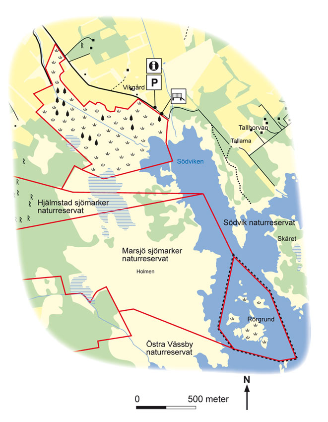
Map: Naturcentrum AB, Stenungsund
Download: the County administrative boards brochure over (in Swedish only) (670 kB): Södviks Sjömarker
Download: the entire brochure (in Swedish only) ( (19 MB): Utflyktsguide Öland
© Lantmäteriverket, Ur Geografiska Sverigedata, översiktskartan Dnr. 106-2004/188”
Source: County Administrative Board, Kalmar
Translation: Visitoland.com
Södra Greda (Southern Greda)
Södra Greda (Southern Greda)
![]()
![]()
![]()
![]()
![]()
![]()


Location: Northern Öland
[wpfp-link]
Visa på Google karta
Lovely wooded meadow
A glimpse of paradise! The Södra Greda wooded meadow on an early summer day provides the very best a wooded meadow on Öland can offer!
Early summer excursion
Swallows and swifts dart around in the air and in the lush greenery of the trees the collared flycatcher sings its somewhat strident song along with willow warblers and tree pipits. If you follow the marked path out through the meadow you will be met by an almost overwhelming profusion of flowers. Ragged robin, heath spotted orchid and lesser butterfly-orchid fight for attention with oxeye daisies and common milkwort. It’s like heaven!
Orchids
In the western part of the meadow, orchids such as the western marsh-orchid and green-winged orchid thrive, as do cowslip, sheep’s fescue, common rock rose, breckland thyme, lady’s bedstraw and spiked speedwell. There are moister soils east of the embankment, which are home to bird’s-eye primrose, common selfheal, Irish fleabane, purple moor-grass and many other plants.
Rare fungi
Rare fungi such as the polypores Pachykytospora tuberculosa, ox tongue and Hapalopilus croceus grown on several of the oaks in the area. Other rare fungi in the meadow include eccentric pinkgill, Inocybe adaequata and Xerula pudens.
Cultural assets
In the northern part of the wooded meadow there is a small building called the sheep shed. The building was already in existence in the early 1800s and was used primarily as a storage space for tools and harnesses. It was probably also used as protection from the weather for workers in the fields and meadows. In Södra Greda’s shoreline wetlands there are the remains of an extensive Iron Age settlement. The wetlands have provided good grazing areas while fishing and hunting was also an important part of the food supply.
Facts:
Size: 3 ha (7,5 acres)
Year of creation: 1962
Purpose: To preserve a typical wooded meadow and its flora, as well as the ridge formations in the meadow. The area is part of Natura 2000, the EU’s ecological network of protected areas.
Directions/Location:
The Södra Greda wooded meadow is located on the east of Öland, about 20 km NE of Borgholm. From Södra Greda village, there are signs leading east to the nature reserve, where there is a car park and information.
GPS coordinates to the parking lot WGS 84 decimal (lat, long): 56.99429 , 16.87462
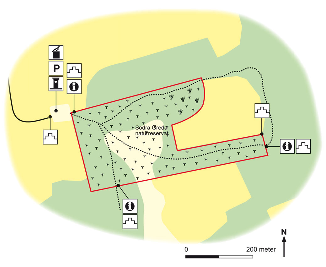
Map: Naturcentrum AB, Stenungsund.
Download: the County administrative boards brochure over (in Swedish only) (814 kB): Södra Greda
Download: the entire brochure (in Swedish only) (19 MB): Utflyktsguide Öland
© Lantmäteriverket, Ur Geografiska Sverigedata, översiktskartan Dnr. 106-2004/188”
Source: County Administrative Board, Kalmar
Translation: Visitoland.com
Stormaren
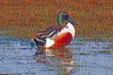
Stormaren
![]()
![]()
![]()
![]()
![]()
![]()


Location: Southern Öland
[wpfp-link]
Visa på Google karta
The deepest lake on the Alvar
Stormaren is situated in a distinct dip in the bedrock and is the deepest of the alvar lakes. Stormaren is a bird sanctuary to which access is prohibited during the breeding season. Several seabird species breed here.
Grebes, geese, birds of prey
Little grebes and horned grebes breed in Stormaren, and if you are lucky it is possible to see them in the spring around the sedge and reed beds. Rare ducks such as the northern shoveller and garganey can also be seen. In recent years, water rail and common snipe have increased in numbers in the area. Flocks of greylag geese often stay at the lake during the summer. Geese families stay together during their migration to and from wintering sites to help the young birds learn to find their way. The wintering sites for greylag geese are now mostly in the Netherlands. At Stormaren you can also see birds of prey such as western marsh harriers and Montagu’s harriers, which hunt in the area now and again. Blue harriers and rough-legged buzzards can sometimes be seen in the autumn. Even eagles come here, such as the mighty white-tailed eagle and also, later in the autumn, golden eagles.
A variety of environments
There are a number of different environments in Stormaren Nature Reserve. Closest to the lake there are wetlands with various types of reeds and sedges, common club-rush and water clover, and wet meadows with devil’s-bit scabious and Irish fleabane. To the east and the south of the lake there are wet areas that dry out during the summer. The areas of alvar in the reserve are dominated by moorland with the hoary rock-rose and sheep’s fescue as typical species and flat rock areas with karst fissures in the limestone. In the western and central parts of the area, there are deeper layers of soil with dry meadows full of vegetation and wet meadows. The dry meadows are well grazed and feature plants such as dropwort, common rock rose, spring cinquefoil, hairy rock cress, fairy flax, meadow oat grass, large self-heal and quaking grass.
Facts:
Size: 213 ha (526 acres)
Year of creation: 2002
Purpose: To preserve and care for the bird life, the particularly valuable wetlands and the surrounding wet meadows and alvar areas with their rich flora. The area is part of Natura 2000, the EU’s ecological network of protected areas.
Directions/Location:
Follow route 136 on Öland for about 37 km southwards. Turn off at Södra Möckleby towards Tornegård above the alvar. Around the middle of the alvar there is parking, information and a picnic area available at Gräsgård quarry. From here it is about 1 km on foot to the nature reserve.
GPS coordinates to the parking lot WGS 84 decimal (lat, long): 56.35259 , 16.46335
Important note:
The area may not be entered between 1 April and 31 July.

Map: Naturcentrum AB, Stenungsund.
Download: the County administrative boards brochure over (in Swedish only) (620 kB): Stormaren
Download: the entire brochure (in Swedish only) (19 MB): Utflyktsguide Öland
© Lantmäteriverket, Ur Geografiska Sverigedata, översiktskartan Dnr. 106-2004/188”
Source: County Administrative Board, Kalmar
Translation: Visitoland.com
Solberga Alvar
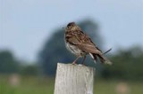
Solberga Alvar
![]()
![]()
![]()
![]()
![]()
![]()


Location: Southern Öland
[wpfp-link]
Visa på Google karta
Traces of Öland’s golden age
Solberga village and its well-preserved farms are located close to the southern end of the Stora Alvar. In June, Solberga Alvar shines with thousands of yellow suns when the hoary rock-rose blooms on the weathered limestone bedrock. Finds of bronze bulls and the many burial sites from the Iron Age provide us with clues about the area’s importance two thousand years ago.
Öland’s golden era
There are three Iron Age burial sites and several stone circles, which consist of round shallow graves lined with stones, on Solberga Alvar. The graves provide a reminder of Öland’s golden era during the Iron Age, when the islanders raised livestock and exported hides, leather and wool to the Roman territories in present-day northern Germany. It was also during this time that several of Öland’s ancient forts and village were built.
Beautiful alvar areas
Solberga Alvar consists mainly of open gravel-dominated limestone where hoary rock-rose and sheep’s fescue are typical species, but there are also small alvar areas with cracks and fissures in the limestone – karst. Ridges in the area are rich in vegetation while the lower parts consist of wet meadows.
The alvar’s colours
In early summer, the colours on Solberga Alvar are dominated by yellow, violet and white. This is when flowers such as hoary rock-rose, breckland thyme, silverstar and sea campion bloom.
Special species
Solberga Alvar is also the home to the special plant thyme broomrape, a parasite that grows near the tussocks of breckland thyme and which via its roots absorbs nutrients from the breckland thyme plants. If you see a spring azure butterfly, take a close look as it may be a large blue, which thrive among flowering breckland thyme and which can sometimes be seen fluttering over the limestone alvar. Other rare species on Solberga Alvar include the steppe puffball, the four-footed earth star and the alvar snail.
Facts:
Size: 314 ha (776 acres)
Year of creation: 2005
Purpose: To maintain the unique grazing-based cultural landscape, as well as vegetation types that are representative of alvar areas, to provide beneficial conditions for both typical and rare plant and animal species, to preserve and make visible the cultural relics in the area and to facilitate the general public’s experience of the area’s nature and cultural assets. The area is part of Natura 2000, the EU’s ecological network of protected areas.
Directions/Location:
The nature reserve is situated to the west of the village of Solberga on southern Öland. Follow route 136 south towards Ottenby, to the road that cuts through the alvar, between Södra Möckleby to the west and the village of Torngård to the east. Beside the road there is a car park and information site with picnic tables, approximately in the middle of the alvar. From here you can follow the boardwalked path to the reserve.
GPS coordinates to the parking lot WGS 84 decimal (lat, long): 56.35259 , 16.46335
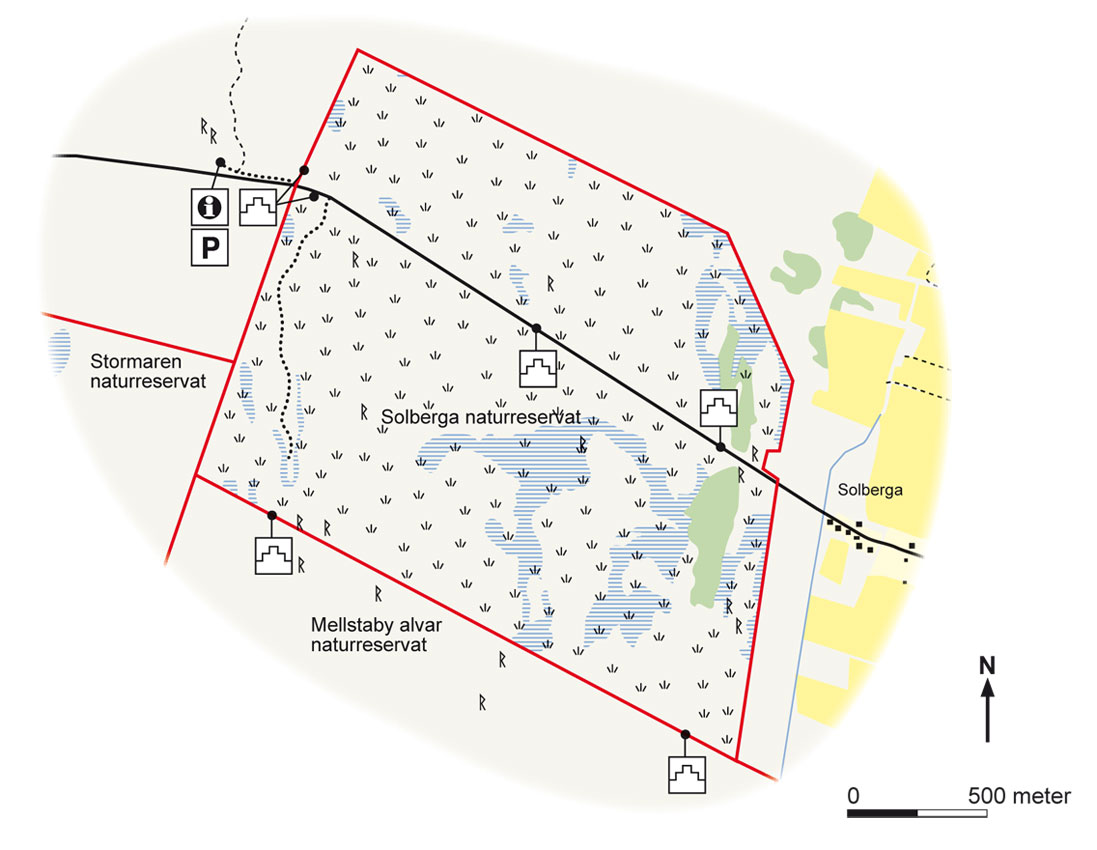
Map: Naturcentrum AB, Stenungsund.
Download: the County administrative boards brochure over (in Swedish only) (715 kB): Solberga Alvar
Download: the entire brochure (in Swedish only)(19 MB): Utflyktsguide Öland
© Lantmäteriverket, Ur Geografiska Sverigedata, översiktskartan Dnr. 106-2004/188”
Source: County Administrative Board, Kalmar
Translation: Visitoland.com
Rönnerum-Abbantorp
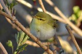
Rönnerum-Abbantorp
![]()
![]()
![]()
![]()
![]()
![]()


Location: Central Öland
[wpfp-link]
Visa på Google karta
The heart of the Mittland forest
Rönnerum-Abbantorp is located in the heart of Mittland (Midland) forest and consists of various deciduous forests, grazed dry meadows, calcareous wet meadows and wetlands. The Rönnerum fornby (ancient village), one of Öland’s most fascinating Iron Age environments, is situated in the middle of the area.
Lovely early summer hiking
The open pastures at Rönnerum fornby are like a bright open room surrounded by lush deciduous forests. Walking across the dry meadows filled with juniper and other vegetation on an early summer day, when the newly blossomed greenery shifts between different shades of light green, the ash trees are beginning to unfurl their leaves and the hawthorn blossoms in white, is a lovely experience.
Voices in a choir of birds
The choirs of birds that sing in the large hardwood forests in Rönnerum-Abbantorp are very enjoyable. Wood warblers, icterine warblers, Eurasian blackcaps, European pied flycatchers, hawfinches, willow warblers, common chaffinches and European robins assail you with their songs. The nature reserve has one of the largest hornbeam forests in Sweden. There are some areas of pure hornbeam, but they often also include elements of field elm, ash, oak and birch as well.
Rare species
The reserve provides a habitat for rare species of birds such as the European honey buzzard and the hawfinch. The Eurasian golden oriole is also an occasional guest. Capricorn beetles thrive in the flowering hawthorn and musk orchids like the limestone wet meadows.
Iron Age village
Rönnerum’s ancient village (fornby) is one of Öland’s best-preserved Iron Age villages. Spread over an area of approximately 1.2 hectares, there are ten foundations surrounded and connected by the remains of stone walls. The village well has also been preserved. To the west lies a multitude of rock mounds with small strips of farmland in between. To the southwest is a burial site with about 100 graves. This was probably the ancient Rönnerum cemetery.
Ancient sites linked
There are several interesting archaeological sites located here in the heart of Mittland forest. The ancient village of Rönnerum is not far from Ismanstorp’s ancient fort to the east, Odin’s stones to the north and the Noah’s Ark on Karum Alvar to the northeast.
Facts:
Size: 524 ha (1295 acres)
Year of creation: 2004
Purpose: To protect and care for the assets associated with the ancient village and the borgvägen (track to the old fort), as well as the hardwood forests and hornbeam forests, broadleaved pastures, dry meadows and calcareous wet meadows with their characteristic flora and fauna. The area is part of Natura 2000, the EU’s ecological network of protected areas.
Directions/Location:
About 2 km SE of Högsrum church. The area can be reached from the road at Högsrum-Ismantorp, parking is available at Odin’s stones, and via a minor road from the village of Rönnerum, where there is also a car park.
GPS coordinates to the parking lot WGS 84 decimal (lat, long): 56.76669 , 16.61910

Map: Naturcentrum AB, Stenungsund.
Download: the County administrative boards brochure over (in Swedish only) (920 kB): Rönnerum – Abbantorp
Download: the entire brochure (in Swedish only) (19 MB): Utflyktsguide Öland
© Lantmäteriverket, Ur Geografiska Sverigedata, översiktskartan Dnr. 106-2004/188”
Source: County Administrative Board, Kalmar
Translation: Visitoland.com
Petgärde and Djurstad
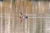
Petgärde and Djurstad
![]()
![]()
![]()
![]()
![]()
![]()


Location: Northern Öland
[wpfp-link]
Visa på Google karta
Wetlands with rich birdlife
The Petgärde and Djurstad marshes are a preserved part of Öland’s formerly extensive wetlands. Birds such as Montagu’s harrier, western marsh harrier, red-necked grebe, water rail, spotted crake and common snipe breed here.
Areas of wetland harvesting
The Petgärde and Djurstad marshes were used in former times as harvesting meadows but both areas were drained in the early 1900s in order to create more farmland. In recent years, nature conservancy measures have been implemented that aim to restore the natural water level fluctuations. This, along with harvesting and grazing, is important to re-create the areas’ rich birdlife and flora.
Wetland character
Djurstad marsh consists of a sedge mire, a former lake that has been drained together with areas that dry out during the summer. Petgärde marsh consists mainly of great fen-sedge and common reeds, open water, wet pastures and fens with orchids. Species that thrive there include the fragrant orchid and the marsh helleborine. Grass-of-parnassus and bird’s-eye primrose, among others, grow in the wet meadows.
Paradise for birds
Mornings in May are often accompanied by the singing of nightingales and marsh warblers in the willow thickets. Reed warblers and common reed buntings thrive in the reeds and one can also catch sight of Montagu’s harriers and western marsh harriers. The handsome red-necked grebe, with its pig-like screams, is one of the species that is characteristic of the area. Evening excursions can be a great experience as one listens to the voices of common grasshopper warblers, water rails and spotted crakes. At dusk, you can also hear the characteristic vibrating sound made by common snipes.
Facts:
Size: Petgärde 111 ha (274 acres), Djurstad 87 ha (215 acres)
Year of creation: Petgärde 1978, Djurstad 1980
Purpose: To preserve the areas’ flora and fauna, particularly the wetland areas valuable for bird life. The areas are part of Natura 2000, the EU’s ecological network of protected areas.
Directions/Location:
Petgärde and Djurstad marshes are located on the eastern side of Öland, approximately 17 km NE of Borgholm and about 5 km south of Föra. The nature reserve has a car park and several bird observation towers.
GPS coordinates to the parking lot WGS 84 decimal (lat, long): 56.96851 , 16.84872
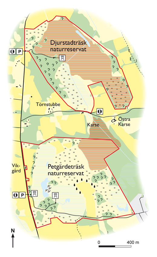
Map: Naturcentrum AB, Stenungsund.
Download: the County administrative boards brochure over (in Swedish only) (1 MB): Petgärde och Djurstad
Download: the entire brochure (in Swedish only) (19 MB): Utflyktsguide Öland
© Lantmäteriverket, Ur Geografiska Sverigedata, översiktskartan Dnr. 106-2004/188”
Source: County Administrative Board, Kalmar
Ottenby
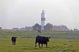
Ottenby
![]()
![]()
![]()
![]()
![]()
![]()


Location: Southern Öland
[wpfp-link]
Visa på Google karta
Internationally well-known location for migratory birds
Ottenby and the southern cape of Öland are one of Sweden’s most visited areas of nature and is the country’s most internationally renowned location for migratory birds. A large number of waders, ducks, geese and small birds rest and breed here every year and a ringing and bird migration research programme has been carried out here since 1946.
Fantastic birdlife
Birds thrive at Ottenby and Öland’s southern cape because the cape has a south-eastern facing location by the sea, as well as a mild climate and varied nature that provides many different environments for foraging, sheltering, resting and breeding. Important bird species that can be seen at Ottenby include gadwall, black-tailed godwit, ruff , pied avocet, the southern type of dunlin, corncrake and the Eurasian golden oriole. Most of Sweden’s 470 bird species have been seen at Ottenby.
Metropolis for migratory birds
The southern cape acts like a magnet for migratory birds. After a long flight across the Baltic Sea, land is finally sighted at southern Öland. Here, the small birds can rest and find food in the lighthouse garden during spring migration, before they move on to Ottenbylund and then north across Öland and Sweden. During autumn, thousands of arctic waders and geese migrate south from the Russian tundra and taiga. They rest at Ottenby for a while before embarking on the long journey across the Baltic to central Europe or Africa.
Nature and culture
People have lived around Ottenby since the Stone Age. Öland’s finest fishing and trading market was located here in the Middle Ages. The area includes burial sites, one of northern Europe’s largest hay meadows, extensive pastures, a valuable hardwood grove and interesting geological formations. On the northern part of Schäferi meadows (Schäferiängar), hay harvesting has been resumed on an area of 40 ha. Species that depend on hay harvesting flower here, such as the eyebright and the grass-of-parnassus. Conservation is carried out on the large pastures by allowing sheep and cattle from Ottenby demesne to graze there.
Nature experiences suitable for people of all ages
In the exciting Naturum visitor centre, you can learn more about migratory birds, plants and the southern cape’s nature and culture. Or why not visit the lighthouse village (fyrbyn) and climb the 197 steps of the winding staircase in Sweden’s highest lighthouse, Långe Jan, which is 42 metres above sea level? Ottenby offers nature and cultural experiences for both young and old!
Facts:
Size: 995 ha, (2459 acres), of which 900 ha, (2224 acres) is land
Year of creation: 1970
Purpose: To protect and nurture the area due to its “importance with regard to knowledge of Öland’s nature and wildlife, its beauty and its otherwise remarkable condition.” The area is part of Natura 2000, the EU’s ecological network of protected areas.
Directions/Location:
Drive south on route 136 on Öland. Just east of Ottenby demesne (kungsgård), turn right towards Öland’s southern cape (södra udde) and drive 4 km. Parking and information is located next to the lighthouse and the visitor centre. There is a restaurant, guided tours, a bird watching tower, the Långe Jan lighthouse and pathways suitable for disabled people.
GPS coordinates to the parking lot WGS 84 decimal (lat, long): 56.19765 , 16.39946
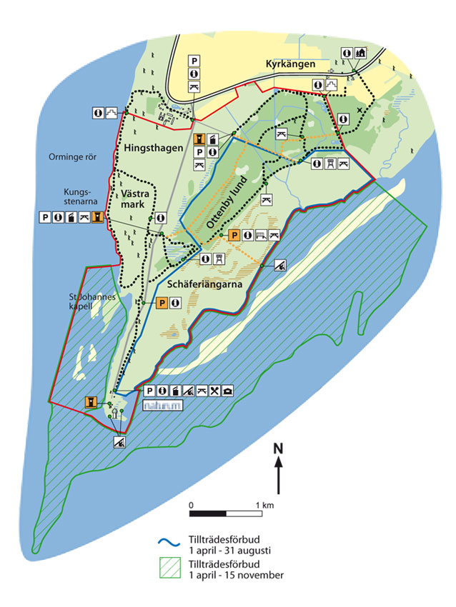
Map: Naturcentrum AB, Stenungsund.
Download: the County administrative boards brochure over (in Swedish only) (913 kB): Ottenby
Download: the entire brochure (in Swedish only) (19 MB): Utflyktsguide Öland
© Lantmäteriverket, Ur Geografiska Sverigedata, översiktskartan Dnr. 106-2004/188”
Source: County Administrative Board, Kalmar
Translation: Visitoland.com
Neptuni åkrar (Fields of Neptune)
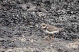
Neptuni åkrar (Fields of Neptune)
![]()
![]()
![]()
![]()
![]()
![]()


Location: Northern Öland
[wpfp-link]
Visa på Google karta
Where sea and sky meet
It was Linnaeus who, in 1741, gave the expanse of shingle beach and undulating embankments here the name Neptuni åkrar, and the landscape certainly looks like it has been shaped by the sea god himself. Tourists and locals alike flock here when viper’s-bugloss is flowering against the grey-white limestone.
Wave-like embankments
The material for the beach embankments at Neptuni åkrar was once deposited by glacial action. Baltic Sea waves have then milled and ground the material to create smooth stones and washed up the stones onto the shore. This process has been going on for thousands of years while the land has being rising from the sea.
Sparse flora
Neptuni åkrar is perhaps best known for its colourful blooming of viper’s bugloss. The shingle embankments otherwise have a relatively sparse flora, which includes plants such as mouse-ear-hawkweed, swallow-wort, carline thistle, sheep’s fescue, silky spike melic and breckland thyme. Saltmarsh rush, sea aster and sea plantain thrive along the beach..
Bird life
The area’s special bird is the common ringed plover, which runs, foraging along the shoreline. Other waders include the Eurasian oystercatcher and the common redshank, which emits its intense warning sound if you get too close. Out on the water, common eider and common shelduck are often seen.
Öland’s northernmost burial site
On the beach to the south of Neptuni åkrar there is a Viking burial ground called Forgallaskeppet. According to legend, a major sea battle took place off the coast here. The enemy ship, Forgalla, foundered in the shallows that came to be called Forgalla. After the battle, the dead were placed in coffins that were covered with stone. Archaeologists have found, however, that the site contains men, women and children with grave goods from the Viking Age. There is a raised stone located to the south of the burial site, which is called Höga flisa (High sliver). According to tradition, this was a Christian prayer site for the fisherpeople in Byxelkrok.
Facts:
Size: 20 ha, (49 acres)
Year of creation: 1975
Purpose: To protect the scenic, undulating beach and the shingle embankments, which have exceptionally high geoscientific value and which are of fundamental importance for outdoor recreation purposes.
Directions/Location:
The reserve is located in north-western Öland, adjacent to route 136 and about 2 km north of Byxelkrok.
GPS coordinates to the parking lot WGS 84 decimal (lat, long): 57.34915 , 17.03384
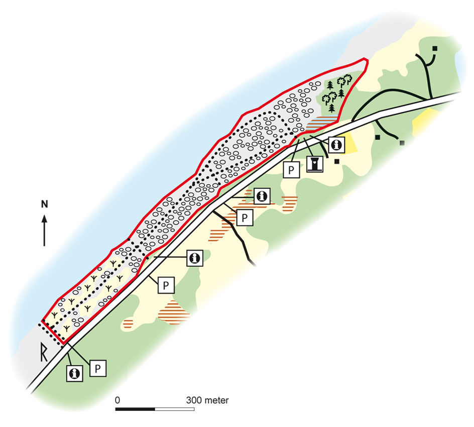
Map: Naturcentrum AB, Stenungsund.
Download: the County administrative boards brochure over (in Swedish only)( 414 kB): Neptuni Åkrar
Download: the entire brochure (in Swedish only) (19 MB): Utflyktsguide Öland
© Lantmäteriverket, Ur Geografiska Sverigedata, översiktskartan Dnr. 106-2004/188”
Source: County Administrative Board, Kalmar
Translation: Visitoland.com
Lindreservatet (Linden Nature Reserve)
Lindreservatet (Linden Nature Reserve)
![]()
![]()
![]()
![]()
![]()
![]()


Location: Northern Öland
[wpfp-link]
Visa på Google karta
Meadows and blossoming linden
Lindreservatet is one of Öland’s finest nature reserves. It features hardwood forests, pine forests, open pastures, limestone alvar, marshes and vegetation-rich hay meadows. There are large areas of linden in the reserve, which is a rare sight today.
Valuable raiding of hardwoods
Linden (lime) is a tree species that had a higher prevalence in Sweden during warmer periods, particularly during the Bronze Age. Many linden, ash and oak trees in the area are very old, and the ash and linden have traces of previous pruning to obtain leaves for fodder. The oaks have large crowns, which indicate that they once grew in an open landscape.
Lovely floral displays
The Lindreservatet contains hay fields with broadleaf trees and a rich flora. The meadows have the typical Öland appearance, with a mixture of completely open areas bordered by narrow swathes of trees and shrubs. During late spring and summer there are lovely floral displays of cowslip, early-purple orchid, military orchid, quaking grass, greater yellow-rattle, crested cow-wheat, fragrant orchid and lesser butterfly-orchid.
Rare species
The Lindreservatet is home to the rare fungus Biscogniauxia cinereolilacina, and is the only place that this is found in Kalmar County. Lung lichen grows on older deciduous trees.
Tree residents
Many birds and bats dependent on old coarse hardwoods with holes in which to nest enjoy the wooded meadows. The unusual collared flycatcher and the rare natterer’s bat and nathusius’ pipistrelle can be found here.
Iron Age villages
There are traces of two adjacent Iron Age villages in the area around Torp village – Ebberskog to the north and Åker to the south. With their extensive system of foundations, enclosures and burial sites, these are among Öland’s best-preserved remains from the farming community of the early Iron Age.
Facts:
Size: 76 ha, (188 acres)
Year of creation: 2000
Purpose: To preserve the naturally developed hardwood forests, forest-like coniferous and mixed forests, meadows, dry meadows, alvar areas and wetlands, and the flora and fauna associated with these habitats. The area is part of Natura 2000, the EU’s ecological network of protected areas.
Directions/Location:
Lindreservatet is located 2 km east of Byxelkrok, at Torp. Follow directions to the Lindreservatet Nature Reserve.
GPS coordinates to the parking lot WGS 84 decimal (lat, long): 57.31967 , 17.02925

Map: Naturcentrum AB, Stenungsund.
Download: the County administrative boards brochure over (in Swedish only) (695 kB): Lindreservatet
Download: the entire brochure (in Swedish only)(19 MB): Utflyktsguide Öland
© Lantmäteriverket, Ur Geografiska Sverigedata, översiktskartan Dnr. 106-2004/188”
Source: County Administrative Board, Kalmar
Translation: Visitoland.com
Lilla horns löväng (Little horn’s wooded meadow)
Lilla horns löväng (Little horn’s wooded meadow)
![]()
![]()
![]()
![]()
![]()
![]()

Location: Northern Öland
[wpfp-link]
Visa på Google karta
Agricultural landscape
Lilla Horns löväng is a wooded hay meadow and is one of Öland’s few remaining real meadows. Anyone who has ever visited a flowering hayfield never forgets it!
The meadow is the mother of agriculture
Meadows were the most important type of land in Sweden for two millennia. This is where farmers harvested winter fodder in the form of hay and leaves for cows, sheep and horses. The term “The meadow is the mother of agriculture” is recorded in the medieval provincial laws. Hay harvests in the meadows determined how many cattle a farmer could maintain and the number of cattle determined how much manure could be spread on the fields. Meadows also provided berries, nuts, medicinal plants, wood for fence posts, bast for rope, roof coverings, insect richness (pollinators) and honey. As a result of scything and grazing, meadows became the most species-rich habitats in the country. Today only remnants of these ancient hay meadows remain.
Tending the meadow
In April, when the wood anemone blossoms, cleaning was done and the meadows were tidied by raking up the leaves and twigs. In July, the meadows were scythed. The cut grass and weeds were left to dry before the hay was taken to the barns. When the hay crop had been harvested, cattle were released into the meadow to graze. The trees in the wooded meadow were pruned in August to remove their leaf mass. Leaves and twigs were dried and became food for the cattle.
Richness of species in the meadows
Hay meadows provide one of our most diverse habitats. By cutting and subsequently grazing, nutrients are removed from the meadow, which enables many grasses and weeds that are good retainers to gain a competitive advantage. This produces a wide variety of species. On a single square metre of meadow, there may be 40 to 50 different species of plant.
Greenery and stone piles (odlingsrösen)
Lilla Horns löväng provides a home for meadow plants such as cowslip, eyebright, heath spotted orchid, grass-of-parnassus, quaking grass and viper’s-grass. The old, hollow trees contain plenty of insects and the collared flycatcher thrives here. The meadow also has traces of old stone walls and piles of stones created when clearing the area for cultivation.
Facts:
Size: 8 ha, (20 acres)
Year of creation: 1981
Purpose: To maintain the richness of species, as well as the nature and cultural features, found in Öland’s wooded meadows by means of hay making, grazing and pollarding. The area is part of Natura 2000, the EU’s ecological network of protected areas.
Directions/Location:
Lilla Horns löväng is located at Lilla Horn, along the old highway, just north of Persnäs on northern Öland. The nature reserve is signposted from route 136.
GPS coordinates to the parking lot WGS 84 decimal (lat, long): 57.08562 , 16.91471
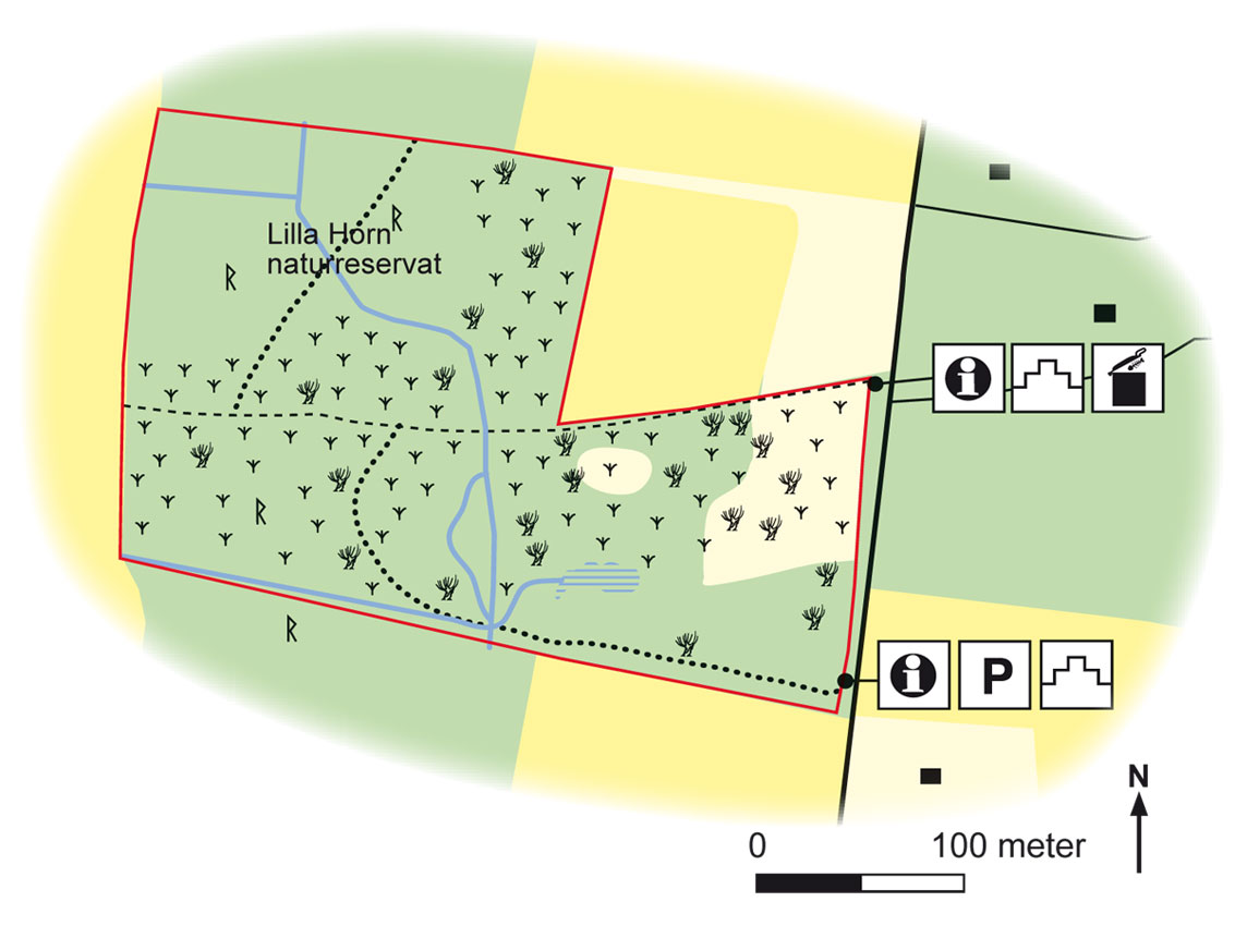
Map: Naturcentrum AB, Stenungsund.
Download: the County administrative boards brochure over (in Swedish only) (1,2 MB): Lilla Horns Löväng
Download: the entire brochure (in Swedish only) (19 MB): Utflyktsguide Öland
© Lantmäteriverket, Ur Geografiska Sverigedata, översiktskartan Dnr. 106-2004/188”
Source: County Administrative Board, Kalmar
Translation: Visitoland.com
Knisa mosse (Knisa Alvar lake)
Knisa mosse (Knisa Alvar lake)
![]()
![]()
![]()
![]()
![]()
![]()


Location: Northern Öland
[wpfp-link]
Visa på Google karta
One of Öland’s few undrained wetlands
Knisa mosse is one of Öland’s few un-drained wetlands. This valuable “Alvar” lake (shallow calcareous lake) survived a wave of drainage measures implemented in the late 1800s, when new farmland was created to feed a growing population.
Resource since ancient times
Öland’s wetlands have been used by humans since prehistoric times for fishing, hunting, scything and grazing. Several burial sites, as well as building foundations and traces of enclosures, can be seen at Knisa mosse.
The Alvar lake’s nature rescued
In the 1930s, Knisa mosse was acquired by the state and was rescued from drainage. However, after it was placed under a protection order, the Alvar lake started to become overgrown with great fen-sedge and shrubs. This resulted in the areas of open water decreasing and breeding birds such as the horned grebe, the black tern and the garganey disappearing. Many bird and plant species are dependent on well-tended areas and restoration measures were implemented in the 2000s in order to create more open water areas in the Alvar lake by means of scything and to improve the management of the moist soils by means of grazing. The hope is to regain the black tern as a breeding species.
Hiking around the Knisa Alvar lake
There is a 5 km hiking trail around the Alvar lake that offers great nature experiences. Plants such as the musk orchid, the early marsh orchid and the marsh helleborine grow in the shore meadows and the swampy areas. Dragon’s teeth thrives in the shore meadows and burnt orchid is typical of the dry meadows. And if you are lucky you may see a Montagu’s harrier hunting over the fields.
Facts:
Size: 150 ha, (371 acres)
Year of creation: 1993, extended in 2005.
Purpose: To recreate and develop a diverse, undrained marsh area and to promote its rich flora and fauna. The area is part of Natura 2000, the EU’s ecological network of protected areas.
Directions/Location:
400 m west of Knisa village, approximately 30 km SSW of Löttorp. A car park is located just to the east of the area. The nearest bus stop is on route 136.
GPS coordinates to the parking lot WGS 84 decimal (lat, long): 57.05070 , 16.84975

Map: Naturcentrum AB, Stenungsund.
Download: the County administrative boards brochure over (in Swedish only) (864 kB): Knisa Mosse
Download: the entire brochure (in Swedish only) (19 MB): Utflyktsguide Öland
© Lantmäteriverket, Ur Geografiska Sverigedata, översiktskartan Dnr. 106-2004/188”
Source: County Administrative Board, Kalmar
Translation: Visitoland.com
Karum
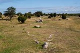
Karum
![]()
![]()
![]()
![]()
![]()
![]()


Location: Central Öland
[wpfp-link]
Visa på Google karta
Unique farming landscape
Karum in central Öland is a unique agricultural landscape with traces from many different periods going back to the Iron Age. The famous and popular Noah’s ark stone ship is located on Karum’s Alvar, one of only a few such alvar areas in central Öland.
Fascinating burial sites
The sheep-grazed burial sites on Karum’s Alvar are fascinating in all seasons. In spring the slopes of the old burial pits are coloured in yellow, purple and white flowering cowslips, early purple orchids and meadow saxifrage. In summer, the silky spike melic’s ornate silver panicles sway over the countryside and spring azure butterflies flutter gracefully over thyme tussocks. On dry late summer days almost the only thing that is green is the poisonous swallow-wort that is left in clumps by the grazing sheep. And in the autumn the raised stones stand silently and secretively in the morning mists and one almost feels like one has been transported back in time to ancient Öland.
Old agricultural landscape
The land on the Karum has been inhabited for over 2,000 years. Building foundations, remains of enclosures and graves from the early Iron Age show continuity in land use going back a long time. Today’s agricultural landscape is archaic and small-scale, and contains a mixture of small fields, limestone alvar areas and deciduous forests on former hay meadows. Developments in Karum can be traced using well-preserved map material extending back to the 1600s.
Old arable weeds
One of the aims of the nature reserve in Karum is to recreate an older type of farmland. Thirty hectares of arable land is cultivated using a crop rotation system, which means that rye is grown in one year, six-rowed barley the next year and then the fields lie fallow in year three. Thanks to the older agricultural style and the management of the seeds, rare arable weeds such as corncockle and rye brome are preserved. Older crops such as Gotland rye, Öland oats and Östergötland six-rowed barley are grown in the fields.
High ecological value
Karum provides a home for a number of interesting plants and animals. For example, proliferous pink, jagged chickweed and breckland speedwell grow at the burial site around Noah’s Ark. And many rare insects have been found on the actual alvar, such as spider wasps and narrow-bordered five-spot burnet. Efforts to restore hay meadows on Karum are ongoing. These provide a habitat for military orchids, burnt orchids, saw-worts and leafless hawk’s-beard.
Facts:
Size: 315.7 ha, (316 acres)
Year of creation: 2006
Purpose: To recreate the nature and culture typical of areas of older agriculture and to preserve central Öland’s typical as well as endangered plant and animal species. The area is part of Natura 2000, the EU’s ecological network of protected areas.
Directions/Location:
From route 136 in Rälla, drive towards Högsrum. Then turn towards Gärdslösa where the road forks. After about 1 km you will see the burial ground on Karum’s Alvar. There is car parking here which provides the opportunity to visit the burial ground and the alvar areas. After another 1 km turn left towards the village – signposted to Karum. Parking is on the left-hand side before the village.
GPS coordinates to the parking lot WGS 84 decimal (lat, long): 56.78651 , 16.64528
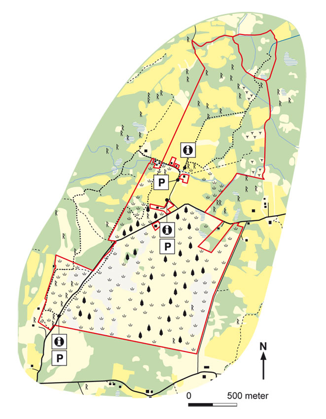
Map: Naturcentrum AB, Stenungsund.
Download: the County administrative boards brochure over (in Swedish only) (370 kB): Karum
Download: the entire brochure (in Swedish only) (19 MB): Utflyktsguide Öland
© Lantmäteriverket, Ur Geografiska Sverigedata, översiktskartan Dnr. 106-2004/188”
Source: County Administrative Board, Kalmar
Translation: Visitoland.com
Jordtorpsåsen
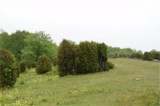
Jordtorpsåsen
![]()
![]()
![]()
![]()
![]()
![]()

Location: Central Öland
[wpfp-link]
Visa på Google karta
Roam along a magnificent ridge
Few places on Öland can compete with Jordtorpsåsen (The Jordtorp ridge) in terms of varied scenery offering recreational opportunities and great excursions. The mighty ridge was formed by rising ancient sea levels, which deposited water-sorted material in a beach embankment.
Burial sites and hollow ways
Jordtorpsåsen was very important for humans as early as prehistoric times; as a burial site, as a communications route and probably also as pastures or hay-making areas. The whole ridge is today a coherent archaeological area, with burial sites in rows and several hollow ways formed by the feet of humans and animals that have passed this way over the course of millennia. The oldest routes on land were usually located on ridges and heights, where the ground was dry and easily drained.
Varied landscape
The landscape around Jordtorpsåsen is very varied. The dry meadows up on the ridge feature plants such as dropwort, small pasque flowers, breckland thyme and common rock rose. Below the ridge there are wetlands with tufted sedge, slender sedge and purple loosestrife. This is where dragonflies thrive, as do rare agile frogs. North of the ridge, in a calcareous fen, there are orchids such as the early marsh orchid, the cream-flowered early marsh orchid, and the fly orchid. The hazel groves provide a home to many rare fungi such as Cortinarius terpsichores.
Wild bees and beetles
Several species of wild bee nest in the sand on the ridge’s dry meadows, including the tawny mining bee and the girdled mining bee. Rare short-necked oil beetles live as larva off the bees’ nectar and develop into adult beetles inside the bees’ nests by the following spring. The rich insect life on the ridge is helped by flowering shrubs and trees such as blackthorn, hawthorn, glaucous dog-rose and Swedish whitebeam.
Popular area for excursions
Jordtorpsåsen is a very popular area for walking and for excursions. It is also very suitable for nature and cultural studies. From the Jordtorpsåsen Nature Reserve, there is a four kilometre long walking trail that goes east to Gråborg.
Facts:
Size: 12 ha, (30 acres)
Year of creation: 1968
Purpose: To protect an untouched beautiful section of ridge that forms a conspicuous feature in the landscape of Öland and which provides an excellent recreational area for the general public. The area is part of Natura 2000, the EU’s ecological network of protected areas.
Directions/Location:
Drive to Algutsrum on Öland. Follow signs from the market place in Algutsrum towards Jordtorpsås Nature Reserve. Prams and pushchairs can also be taken on the paths.
GPS coordinates to the parking lot WGS 84 decimal (lat, long): 56.67873 , 16.5580

Map: Naturcentrum AB, Stenungsund.
Download: the County administrative boards brochure over (in Swedish only) (106 kB): Jordtorpsåsen
Download: the entire brochure (in Swedish only) (19 MB): Utflyktsguide Öland
© Lantmäteriverket, Ur Geografiska Sverigedata, översiktskartan Dnr. 106-2004/188”
Source: County Administrative Board, Kalmar
Translation: Visitoland.com
Högenäs orde
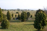
Högenäs orde
![]()
![]()
![]()
![]()
![]()
![]()


Location: Northern Öland
[wpfp-link]
Visa på Google karta
A magnificent view
Few places are as lovely as Högenäs orde. From the beacon on the ridge there is a magnificent view of the glittering Baltic Sea and a mild vanilla-like scent of blooming kidney vetch and breckland thyme wafts up from the open pastures in the early summer. It’s a place that is made for an excursion!
Beacons and signalling fires
Orde is the Öland term for a promontory. In the heart of the area, there is a ten-metre high beach embankment with one of Öland’s few remaining beacons. Beacons and signalling fires have sometimes been lit along the Swedish coast to signal danger and beacons have their roots in the time around 500-600 AD. Such beacons are built of both limestone and granite.
Varied pastureland
The land has been used for grazing for many years. The higher areas feature dry open grasslands where western-marsh orchids and early-purple orchids bloom profusely in the spring. The lower areas have predominantly moist soils and tufted meadows, where bird’s-eye primrose thrives, as do a wide variety of orchids, such as military orchids, fragrant orchids, early marsh orchids and fly orchids.
Rich bird life
The grazing pastures around Högenäs orde have a rich bird life, particularly in terms of waders, ducks and gulls. The most common wading birds that breed here include northern lapwings, common redshanks and Eurasian oystercatchers. Somewhat scarcer birds include the Eurasian curlew and the common ringed plover, and even pied avocets appear in some years. Breeding ducks and gulls include common eiders, northern shovellers, tufted ducks, Eurasian coots, Arctic terns and common gulls.
More to discover
There are approximately 15 km of stone walls in the pastures, which were erected after the agricultural reform of 1811 and which are still maintained today. The Källa medieval church is located just north of the reserve and is well worth a visit.
Facts:
Size: 122 ha, (301 acres)
Year of creation: 1972
Purpose: To preserve one of the types of habitat characteristic of Öland’s east coast, with beach embankments projecting out into the sea and grazed pastures in the surrounding area. The area is part of Natura 2000, the EU’s ecological network of protected areas.
Directions/Location:
About 3 km SE of Källa, just over 30 km N Borgholm. Follow route 136 to Källa. Turn off at the sign for “Källa ödekyrka”. From the next crossroads, small blue signs point the way to the Högenäs orde Nature Reserve.
GPS coordinates to the parking lot WGS 84 decimal (lat, long): 57.09004 , 16.97730

Map: Naturcentrum AB, Stenungsund.
Download: the County administrative boards brochure over (in Swedish only) (91 kB): Högenäs Orde
Download: the entire brochure (in Swedish only) (19 MB): Utflyktsguide Öland
© Lantmäteriverket, Ur Geografiska Sverigedata, översiktskartan Dnr. 106-2004/188”
Source: County Administrative Board, Kalmar
Translation: Visitoland.com
Hulterstad Alvar
Hulterstad Alvar
![]()
![]()
![]()
![]()
![]()
![]()


Location: Southern Öland
[wpfp-link]
Visa på Google karta
St. Bernard’s lilies and black-tailed godwits
Hulterstad Alvar is an open and beautiful area of limestone where first hoary rock-roses bloom in June and biting stonecrop lights up the expansive gravel alvar areas later in the summer. In the western parts, there are flat rocky areas of limestone and karst fissures where the St. Bernard’s lily has one of its more abundant occurrences on Öland.
Hike to the Tingstad stones
Far out on the Stora Alvar, on a beach embankment formed by ancient seas, stand the legendary Tingstad stones, Öland’s most famous thingstead. Alvar paths, now long forgotten, once led from numerous villages to this place, where important decisions were made, justice was done and people’s fates were decided. From Hulterstad, you can hike along a 7 km path to the Tingstad stones. The path initially follows the old district road towards Kastlösa and passes wetlands where you can see northern lapwings, black-tailed godwits and Eurasian curlews. Further out on the alvar, the St. Bernard’s lily blooms together with the hoary rock-rose, breckland thyme and swallow-wort. At the mid-wall, which was built when the outlying fields were divided between villages and parishes in the 1800s, turn north for about two kilometres, before you turn west and reach the beach embankment where the stones are located.
Characteristic alvar limestone flora
Hoary rock-rose is characteristic of the Hulterstad Alvar. In the western part of flat rocky areas of limestone and karst, there are fairy flax, swallow-wort and breckland thyme. In deeper soil there is tufted milkwort and limestone wormwood. The St. Bernard’s lily is rare on the island of Öland but is most prominent on the Hulterstad Alvar. There is also plenty of shrubby cinquefoil, bird’s-eye primrose and devil’s-bit scabious at Penåsabäcken and in the wetlands.
Rich bird life
Facts:
Size: 859 ha, (2123 acres)
Year of creation: 1998
Purpose: To maintain the unique grazing-based cultural landscape and the vegetation types that are representative for areas of alvar, to provide good conditions for both typical and rare plants and animal species, to preserve and improve the visibility of cultural relics, and to facilitate the public’s experience of the natural and cultural assets in the area. The area is part of Natura 2000, the EU’s ecological network of protected areas.
Directions/Location:
The reserve is located just to the west of Hulterstad village in south-eastern Öland. In the centre of the village there is a road leading to the car park at the start of the alvar.
GPS coordinates to the parking lot WGS 84 decimal (lat, long): 56.44617 , 16.56575
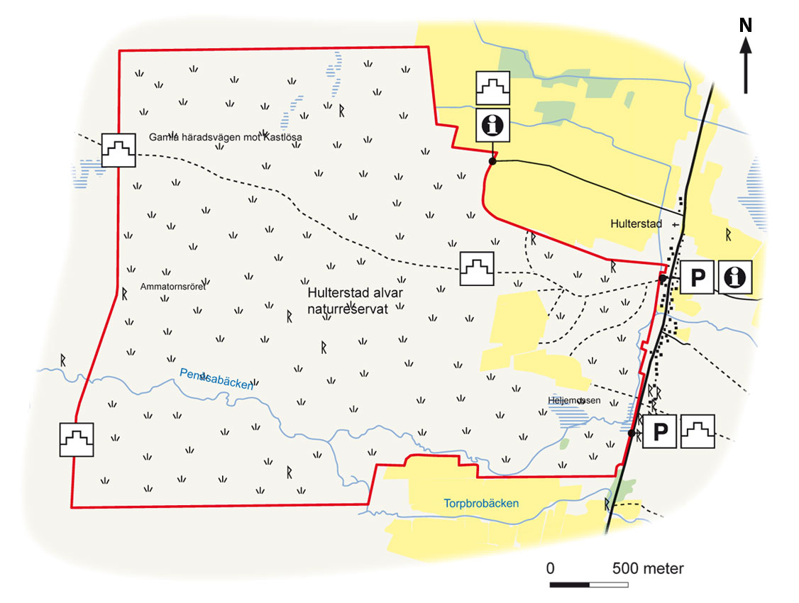
Map: Naturcentrum AB, Stenungsund.
Download: the County administrative boards brochure over (in Swedish only) (678 kB): Hulterstad Alvar
Download: the entire brochure (in Swedish only) (19 MB): Utflyktsguide Öland
© Lantmäteriverket, Ur Geografiska Sverigedata, översiktskartan Dnr. 106-2004/188”
Source: County Administrative Board, Kalmar
Translation: Visitoland.com
Horns kungsgård (Horn’s crown demesne)
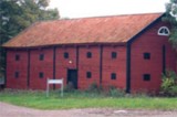
Horns kungsgård (Horn’s crown demesne)
![]()
![]()
![]()
![]()
![]()
![]()

Location: Northern Öland
[wpfp-link]
Visa på Google karta
Öland’s nature in a nutshell
Horns kungsgård, which is located at the northern end of Öland, can be said to sum up much of Öland’s natural beauty and uniqueness. Most of Öland’s various habitats are represented here.
Ancient monuments tell a story
At Horns kungsgård, you can experience ancient history in the heart of the landscape. Foundations show us where Iron Age farmers lived and there are remnants of stone walls where they had their enclosed fields and meadows. The area’s alvar are home to a number of burial sites and there are traces of a fortified medieval manor at Hornsjön (Horn Lake).
Kungsgården created
In the 1550s, Gustav Vasa merged the farms in the original village of Degerhorn and formed the Horns kungsgård (Horn’s demesne). The farmers were forced to move. Kungsgården was designed to produce meat, cheese, skins and wool for the royal stores, while also serving as a model farm for the local farmers.
Varied landscape
Today, conservation-compatible farming is carried out at Horns kungsgård, with includes the rearing of cattle. The landscape is very varied and has an impressive variety. There are cliffs, alvar limestone areas, wetlands, hardwood forests, oak pastures and hayfields. Many orchids thrive in the beautiful Skogsgärdesängen area, including the imagination-stimulating pyramidal orchid, the fragrant orchid and the heath spotted orchid. Collared flycatchers sing in the groves. At Hornsjön, which is Öland’s largest lake, one can see both the osprey and the Caspian tern. Great crested grebes breed there annually. On late spring evenings, one can listen to the great bitterns and see bats hunting over the water.
Bats and insects
The area is one of Sweden’s best bat locations and features 12 of the country’s 18 species. Rare species that can be seen here include the barbastelle and the nathusius’ pipistrelle. Beetles such as the stag beetle and the Capricorn beetle thrive in the large, old oaks.
Facts
Size: 829 ha, (2049 acres), of which 284 ha, (702 acres) is water-covered.
Year of creation: 1979, expanded in 2001
Purpose: To preserve the area’s rich flora and fauna as well as the valuable cultural landscape with its mosaic of arable land, meadows, pastures and woodland. The area is part of Natura 2000, the EU’s ecological network of protected areas.
Directions/Location:
About 3 km SW of Byrums Sandvik, about 5 km NW of Löttorp. From road 136: turn off towards Löttorp and drive west. After 4 km, when you see the road-sign “Horn 2”, follow the road northwards.
GPS coordinates to the parking lot WGS 84 decimal (lat, long): 57.18521 , 16.93898
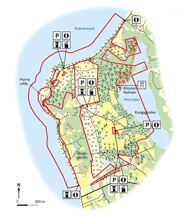
Map: Naturcentrum AB, Stenungsund.
Download: the County administrative boards brochure over (in Swedish only) (1,9 MB): Horns Kungsgård
Download: the entire brochure (in Swedish only) (19 MB): Utflyktsguide Öland
© Lantmäteriverket, Ur Geografiska Sverigedata, översiktskartan Dnr. 106-2004/188”
Source: County Administrative Board, Kalmar
Translation: Visitoland.com
Halltorp
Halltorp
![]()
![]()
![]()
![]()
![]()
![]()


Location: Central Öland
[wpfp-link]
Visa på Google karta
Huge trees and rare beetles
Halltorp Nature Reserve hosts one of northern Europe’s most valuable hardwood forests and the area has one of the country’s richest selections of species. The large old oak trees in the reserve provide habitats for our three largest beetles – the great Capricorn beetle, the stag beetle and the hermit beetle.
Old forest meadows
The Halltorp pasture (Halltorps hage) represents the southern part of a more or less coherent deciduous forest belt stretching to Borgholm. Like many other groves on Öland, Halltorp has been a wooded meadow. Winter fodder was harvested for cattle here – with both grass and leaves being collected. Meadow management ceased at the beginning of the 1900s and the land became more wild. Today, much of the reserve has been cleared and is grazed again.
Huge oaks
There were a large number of oaks around Halltorp until the early 1900s. However, copious logging took place in 1918 and around a thousand old oak trees were cut down. Today, large stumps remind us of this event. Around thirty large oak trees were left in place and it is these that today constitute the Halltorp pasture, which is the only place in the Nordic countries in which the great Capricorn beetle can definitely be found.
Rare beetle
The great Capricorn beetle’s larvae develop over six years only in sunlit old and very large oaks. In the wood of the oak trees one can see oval exit holes which the larvae have gnawed. One of today’s major nature conservation challenges is to try to provide replacement trees for the old dying oak giants and the biggest threat is the gap in age between the old and young oaks. The question is whether we will manage to develop sufficiently large replacement oaks in order to ensure that the great Capricorn beetle survives in the area.
Facts:
Size: 198 ha, (489 acres), of which 56 ha, (138 acres) is water-covered
Year of creation: 1979
Purpose: To preserve a particularly valuable section of the deciduous forest’s mosaic, flora and fauna along the coast of Öland. To facilitate the public’s experience of the area. The area is part of Natura 2000, the EU’s ecological network of protected areas.
Directions/Location:
Around eight kilometres north of Glömminge, turn off at the sign for Halltorps hage and continue for just over a kilometre. Parking is available at Ekerumsbadet and on route 136. The reserve has several different walking trails, one of which is also suitable for disabled people.
GPS coordinates to the parking lot WGS 84 decimal (lat, long): 56.79447 , 16.56657
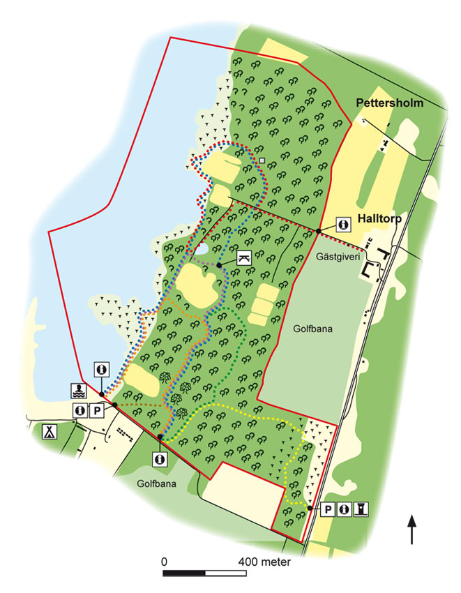
Map: Naturcentrum AB, Stenungsund.
Download: the County administrative boards brochure over (in Swedish only) (1,5 MB): Halltorp
Download: the entire brochure (in Swedish only) (19 MB): Utflyktsguide Öland
© Lantmäteriverket, Ur Geografiska Sverigedata, översiktskartan Dnr. 106-2004/188”
Source: County Administrative Board, Kalmar
Translation: Visitoland.com
Gynge & Möckelmossen
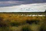
Gynge & Möckelmossen
![]()
![]()
![]()
![]()
![]()
![]()

Location: Southern Öland
[wpfp-link]
Visa på Google karta
Alvar flora and migrating cranes
Anyone who travels along the classic route between Resmo and Stenåsa will encounter a magnificent limestone alvar landscape. Maybe the Gynge Alvar and the Mysinge Alvar will be the first contact with the Stora Alvar’s barren and unique beauty.
Gynge Alvar
The Gynge Alvar has traditionally been grazed by cattle, sheep and horses. The area has periodically been ungrazed, but grazing has now resumed and shrubs have been removed. It has an abundance of globe daisies, Branched St. Bernard’s lily, alpine catchfly, Illyrian buttercup and silverstars. Gynge Alvar is one of the richest areas of individual orchids on the Stora Alvar. Early-purple orchids and western marsh orchids are the most common but the rare dark-red helleborine can also be found.
Mysinge Alvar
The Mysinge Alvar is well-tended by sheep grazing. Large parts of the Stora Alvar were as treeless as this up until the 1960s. The vegetation is dominated by thin soils consisting of weathered gravel, which is known as sheep’s-fescue alvar, but there are also rocky areas and wet meadows. Sheep’s-fescue and red fescue, the latter which is unique to Öland, are abundant, as are spiked speedwell, yellow oxytropis, dropwort and mountain everlasting. The wet meadows provide a home for shrubby cinquefoil and there are junipers in the dry meadows.
Möckelmossen
Möckelmossen, which is the alvar’s largest lake, is unique because it has never been subjected to draining. It holds water throughout the year but its size varies considerably between autumn rainfall, snowmelt and summer drought. In the autumn, it provides a resting and sleeping place for thousands of common cranes. It also provides a breeding place for species such as black-headed gulls, common ringed plovers, redshanks and Eurasian curlews. In winter, after a few cold nights, the Möckelmossen provides an excellent skating rink. Many visitors marvel at the fact that they can see northern pike swimming under the ice.
Facts:
Size: 922 ha, (2278 acres)
Year of creation: 1968
Purpose: To maintain the unique grazing-based cultural landscape and the vegetation types that are representative for areas of alvar (limestone pavements), to provide good conditions for both typical and rare plants and animal species, to preserve and improve the visibility of cultural relics, and to facilitate the public’s experience of the natural and cultural assets in the area. The area is part of Natura 2000, the EU’s ecological network of protected areas.
Directions/Location:
The area can easily be accessed from the Resmo-Stenåsa road. There is parking, an information point and toilets at Möckelmossen.
GPS coordinates to the parking lot WGS 84 decimal (lat, long): 56.52804 , 16.51992
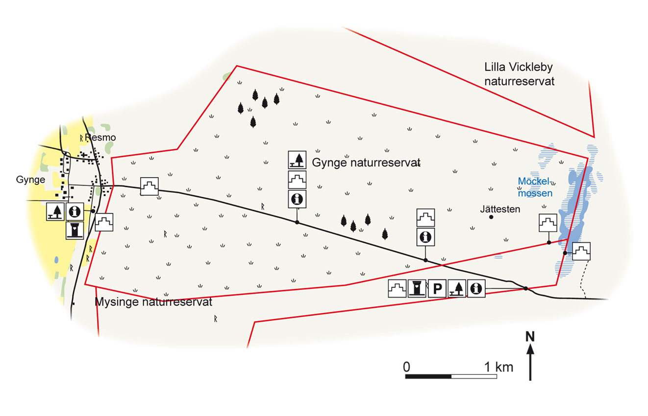
Map: Naturcentrum AB, Stenungsund.
Download: the County administrative boards brochure over (in Swedish only) (519 kB): Gynge & Möckelmossen
Download: the entire brochure (in Swedish only) (19 MB): Utflyktsguide Öland
© Lantmäteriverket, Ur Geografiska Sverigedata, översiktskartan Dnr. 106-2004/188”
Source: County Administrative Board, Kalmar
Translation: Visitoland.com
Eckelsudde
Eckelsudde
![]()
![]()
![]()
![]()
![]()
![]()


Location: Southern Öland
[wpfp-link]
Visa på Google karta
Paradise for birds and seals
Along with Beijershamn, Eckelsudde is a prime location along Öland’s west coast for resting and migrating birds, as well as being the home of a colony of 50-80 harbour seals. This equates to a quarter of the harbour seals in the waters of Kalmar Sound. The colony also includes grey seals.
Unique harbour seals
The seal population in the area was affected greatly by environmental toxins, hunting and diseases during the 1900s, but the situation is now a little better. The harbour seals in the Kalmar Sound differ genetically from all other seals in Europe. They are descendants of Baltic harbour seals, which colonised the region 8,000 years ago and remain in three small groups at Eckelsudde, Värnanäs and Abrahamsäng. The adult harbour seal’s source of food consists of a large number of fish species generally captured in shallow areas free of vegetation. A fully grown seal can eat up to 5 kg of fish per day.
Seal pups
Pups are born from late May to early July, peaking in mid-June. Unlike all other seal species, harbour seal pups do not have pup coat. This allows the pup to be able to swim and dive almost immediately after birth. The female suckles its young for 3-4 weeks and, because seal milk is very oily and nutritious, the pups increase from an average of just under 9 kg to over 25 kg during these weeks. Pups then leave their mothers and have to manage on their own.
Remember that seemingly abandoned seal pups are by no means abandoned. The mother is often somewhere close by.
Rich birdlife
Eckelsudde is one of the best bird locations along the west coast of Öland and many birds breed and rest here. The breeding species include gadwall, pintail, pied avocet, dunlin and snipe. When conditions are right, thousands of waders such as Eurasian oystercatchers, grey plovers and bar-tailed godwits rest here. Cattle grazing on the land keeps the grass and other vegetation well tended, which creates opportunities for many wading birds to find food and nesting sites.
Facts:
Size: 468 ha, (1156 acres), wildlife reserve
Year of creation: 2005
Purpose: To protect one of the Baltic Sea’s harbour seal colonies and areas important for breeding and migrating birds. The area is part of Natura 2000, the EU’s ecological network of protected areas.
Directions/Location:
Drive past Kastlösa and Bjärby on route 136. Turn right on the road to Degerhamn. Drive past Övre Västerstad and Västerstads almlund (also know as Råkskogen). Parking and information is available at Nedre Västerstad.
GPS coordinates to the parking lot WGS 84 decimal (lat, long): 56.41493 , 16.40607

Map: Naturcentrum AB, Stenungsund.
Download: the County administrative boards brochure over (in Swedish only) (554 kB): Eckelsudde
Download: the entire brochure (in Swedish only) (19 MB): Utflyktsguide Öland
© Lantmäteriverket, Ur Geografiska Sverigedata, översiktskartan Dnr. 106-2004/188”
Source: County Administrative Board, Kalmar
Translation: Visitoland.com
Dröstorp
Dröstorp
![]()
![]()
![]()
![]()
![]()
![]()

Location: Southern Öland
[wpfp-link]
Visa på Google karta
A limestone experience
The Dröstorp Nature Reserve welcomes visitors to the topographically most varied parts of the Stora Alvar area of limestone, including many geologically interesting features and a very rich flora and fauna.
Alvar hiking
Walking from Skarpa Alby along the winding alvar track out to Dröstorp’s deserted village in May when early-purple orchids, western marsh orchids and meadow saxifrage are in bloom and skylarks are warbling over the desolate and beautiful landscape is a singular experience. The landscape is flat to the west of Skarpa Alby, and further west the terrain rises up to a system of limestone cliffs and terraces.
Geological phenomena
The area close to the Bronze Age mound Tornrör features karst fissures, sink holes, large areas of flat rock and ground with freeze-thaw phenomena. The area is also home to a number of crystal clear springs. The karst fissures occur as a result of chemical weathering and can also form cavities in the limestone bedrock. Sometimes the roofs of these cave in, resulting in a pit in the ground, known as a sink hole or doline. The most famous sink hole in the area is the Priest’s Pit (Prästgropen).
Plants from around the world
The Dröstorp area provides habitats for arctic-alpine species, southern European species, continental-Siberian species and many endemic species, i.e. species that occur only on Öland. Rare vascular plant species in the area include the musk orchid, garden leek (Allium lineare), scorpion senna, tansy ragwort and proliferous pink.
Dröstorp’s deserted village
In the 1700s, Öland’s population increased and even the areas on the alvar began to be used for agricultural purposes. The first two families moved to Dröstorp to work the land in 1756 and around thirty people lived in the area at one point. However, since 1897 the village has been completely deserted.
Ancient remains
Tornrör is the largest and most imposing Bronze Age mound in the area. The only rune stone on the alvar, Björnflisan, is located to the west of Skarpa Alby.
Facts:
Size: 912 ha (2253 acres)
Year of creation: 1998
Purpose: To preserve the unique grazing-based alvar (limestone) landscape with its special flora and fauna, to make cultural remains visible and to give the public the opportunity to experience the area. The area is part of Natura 2000, the EU’s ecological network of protected areas.
Directions/Location:
Located in the north-eastern corner of the Stora Alvar. There is parking and information available at Skarpa Alby. The road to Skarpa Alby is located just south of Gårdby. The car park is about 250 metres after the sharp curve in the village street. The Ölandsleden (a cycle path) passes over the alvar between Skarpa Alby and Ekelundavägen.
GPS coordinates to the parking lot WGS 84 decimal (lat, long): 56.59318 , 16.60927

Map: Naturcentrum AB, Stenungsund.
Download: the County administrative boards brochure over (in Swedish only) (889 kB): Dröstorp
Download: the entire brochure (in Swedish only) (19 MB): Utflyktsguide Öland
© Lantmäteriverket, Ur Geografiska Sverigedata, översiktskartan Dnr. 106-2004/188”
Source: County Administrative Board, Kalmar
Translation: Visitoland.com
Böda East Coast
Böda East Coast
![]()
![]()
![]()
![]()
![]()
![]()

Location: Northern Öland
[wpfp-link]
Visa på Google karta
Sandy beaches, dunes and fields of shifting sand
As you let the fine sands of Böda run between your toes, you may perhaps think about the fact that these small millimetre-sized grains of sand are remnants of mountain ranges formed billions of years ago and which have slowly been eroded by rain, snow, ice, wind and waves over an unimaginably long period of time.
Large area of dunes
The Böda coast is the result of an accumulation of sand from the Baltic Sea over the course of 12,000 years since the ice sheet retreated, as well as sand transported to the area by the wind. Moving inland, the sandy beaches turn into large sand dunes and fields of shifting sands. One of Sweden’s largest areas of sand dunes is located to the west and to the north of Böda Bay, and the largest dune in the area, Bölinge backe, is about 10 metres high. Old pine forests and stunted, branched pines grow on the dunes. Many of the trees are between 150 and 200 years old.
Sparse vegetation
Sea sandwort, sea rocket and sea pea grow on the beach and the dunes provide a home for marram and lyme grass. Grey and shrubby reindeer lichen dominate the pine forest, with sand sedge, yellow bird’s nest and green-flowered wintergreen thriving in the sparser areas of pine and heather and crowberry prevailing in the denser areas. To the south there is a marsh with a high botanical value, which is home to an endangered green algae (mellanräfse).
Haven for many species
The nature reserve is a breeding ground for velvet scoters, red-breasted mergansers and common ringed plovers, as well as birds of prey such as white-tailed eagles and ospreys. The sandy pine forests, which contain many old and dead trees, provide a habitat for a large number of rare insects, lichens and fungi. These include antlions, longhorned beetles, scribble lichens, Schismatomma pericleum lichen and the Irpicodon pendulus fungus.
Facts:
Size: 1021 ha (2523 acres), of which 338 ha (835 acres) is water
Year of creation: 1995
Purpose: To preserve a piece of naturally developed forest, well-developed dunes and shifting sand fields and a coastal and shallows area with a special flora and fauna.
Directions/Location:
The nature reserve is located in north-eastern Öland, between the Trollskogen Nature Reserve to the north and Böda Camping to the south.
GPS coordinates to the parking lot WGS 84 decimal (lat, long): 57.30321 , 17.08605
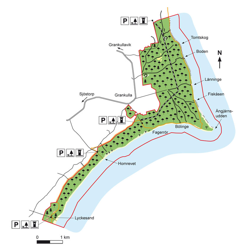
Map: Naturcentrum AB, Stenungsund.
Download: the County administrative boards brochure over (in Swedish only) (354 kB): Bödakusten Östra
Download: the entire brochure (in Swedish only) (19 MB): Utflyktsguide Öland
© Lantmäteriverket, Ur Geografiska Sverigedata, översiktskartan Dnr. 106-2004/188”
Source: County Administrative Board, Kalmar
Translation: Visitoland.com
Ekerum Resort Öland
Ekerum Resort Öland
![]()
![]()
![]()
![]()
![]()
![]()


Phone: 0485-800 00
E-mail: info@ekerum.com
Hemsida: Ekerum Resort Öland
Location: Central Öland
[wpfp-link]
Visa på Google karta
Golf and the facility
Ekerum Resort Öland has long been one of the premier golf facilities in Sweden. With the entire 54 holes, divided into two 18-hole courses, a 9 hole course and a 9 hole short course, Ekerum can offer excellent golf for everyone – from beginners to the world’s elite. The quality of the courses is very high, partly because of Öland nature, but also because that the membership fees go directly to the maintenance of the courses, nothing else. And that the courses also are congestion-free almost all year around is another reason to play here.
Ekerum Resort Öland is probably one of Sweden’s most complete golf facilities, with all facilities and activities within walking distance.
It features a large excellent restaurant with panoramic views over the eighteenth hole and the Kalmar Strait. For conferences and larger events, it is well arranged on Ekerum Resort Öland. Here is a wide selection of conference rooms in different sizes – all with complete conference equipment – and the big Ekerum hall (theater seating about 280 persons, dinner seating about 200 people) is also widely used for weddings and celebrations.
Offers are available for individual golfers as well as for companies and groups up to 250 people. Here you will find three and two-day golf package, weekends as well as mid-week, here are golf training courses and above all here is a very relaxing and scenic surrounding.
Miscellaneous:
Short-hole course, practice area beyond the driving range. Changing rooms with shower & sauna. Restaurant, pavilion and pub. Golf Shop. Dogs on leash permitted.
Green fee: Please contact reception for current price, 0485-80000 or info@ekerum.com
Booking: contact reception 0485-80000
All prices are indicative and can change during the season. Name and hcp must be provided for all players in the ball. Official handicap is required. Max 110 hcp in the ball (weekends and July).
Buggy: 18 Holes: SEK 395, 36 holes SEK 890 . Medical certificate: SEK 100 discount.
Reservation: 0485-80 000.
Driving range: Tokens purchase at the front desk or directly at the driving range with a Visa or MasterCard.
See also, EAT: Ekerum Resort, Restaurant & Bar and STAY: Ekerum Golf & Resort
Welcome!
Böda Sand Golf Club
Böda Sand Golf Club
![]()
![]()
![]()
![]()
![]()
![]()


Phone: 0485-222 00
E-mail: info@bodasand.se
Hemsida: Böda Sand Golf Club
Location: Northern Öland
[wpfp-link]
Visa på Google karta
Golf
Böda Sand Golf Club is a combined ‘Pay and Play’ and official Club. Here, both the “try-on” golfer and the more experienced golfers can enjoy a good 9-hole Forest course in an Öland pine forest.
The golf course is located at Böda Sand, one of the largest, most modern and well-maintained camping facility with 120 cottages and 1,300 campsites, each at least 100 square meters. Here you will stay between the golf course and the 12 km long famous sandy beach. From the 9th hole is it only 100 m to the center with restaurants, bakery, snack bar and ICA grocery store
Are you a beginner? Then you will given all necessary instructions before going out to the first tee. Of course you can rent clubs and equipment at the club. And if you get hooked on golf, you can join one of the courses under the guidance of the golf pro Håkan Fransson.
Miscellaneous:
Large driving range, putting green, chipping green and bunker shots, golf shop, lessons and more. Green fee from SEK 100, Drop-in! (No time booking)
Open
April – October.
The course:
Type/nature: woodland course
Number of holes: 9
Par: 68
Tee: Grass and carpets
Length: 4200 m (yellow) 3790 m (red) at 18 holes.
Slope & bogey Men (yellow) 65.5 / 102 Ladies (red) 67.1 / 104
Driving range: Yes
Putting Green: Yes
Carts/clubs: Yes, Rent in shop
18-hole Golf course “Bödakroken”
Play from coast to coast.
Golf on northern Öland. “Bödakroken” is an interesting combination of two courses with entirely different characters
Western course:
Byxelkrok Golf Club’s 9-hole course “Storängen” In typical Öland meadows and landscapes with blooming orchids in spring and early summer.
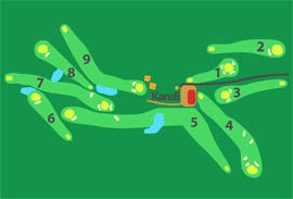
Eastern course:
Böda Sand Golf Club’s 9-hole course. A beautiful and challenging woodland course in Öland pine forest.
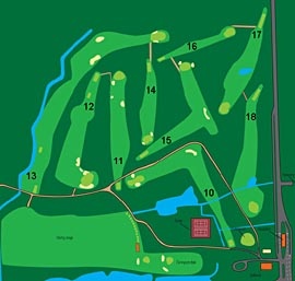
Welcome!
Byxelkroks Golf & Stugor (Cottages)
Byxelkroks Golf & Stugor (Cottages)
![]()
![]()
![]()
![]()
![]()
![]()


Phone: 0485-280 48, 070-661 0143
E-mail: info@byxelkroksgk.se
Hemsida: Byxelkroks Golf & Stugor (Cottages)
Location: Northern Öland
[wpfp-link]
Visa på Google karta
Golf
Adjacent to Byxelkrok, with the most sunshine hours in Sweden, you find Öland’s most northerly golf course. The course is best presented as a parkland course in a scenic meadow landscape.
The golf course may at first seem simple, but the track record on par (64) speaks another language. The longest hole, 465 meter (509 yards), requires a good drive over the historic building foundations from the 4th century, and a tough second shot over water prepares for the approach to a green guarded by a tricky bunker and stone walls.
The Course
Type/nature: Parkland
Number of holes: 18 + 9
Par: 72/36
Tee: Grass
Length: Yellow 6055/2895, Red 4997/2471
Driving range: Yes
Putting green: 3
Pitching green: 3
Carts: Yes, Rent
The courses: See bottom
Accommodations
Byxelkroks Golf & Stugor (Cottages)
Offers comfortable accommodation in six fully modern and fresh apartments and cottages in a relaxing and idyllic golf environment. All apartments have kitchen, shower, toilet, television and a private patio, and access to laundry.
Exclusive value for accommodation in Byxelkroks Golf & Stugor. As a guest, you have free golf on the golf course Storängen all weeks except the weeks 29-32 when you pay only SEK 100 a week and player. Children under age 17 play for free.
Enemansgården
Bed & Breakfast right next to Byxelkroks golf course.
See Enemansgården under STAY/B&B
Cafe
Ulla’s Golf Café 2014.
Ulla’s Golf café are planned to open, at the latest, during Easter 2014, weather permitting. Then open Friday – Sunday until midsummer and then daily. Sandwiches, pies, homemade buns, cakes and more.
Questions and requests, call 0761-39 49 09
Opening Hours:
Accommodations: All year
Golf Course: All year (except in case of frost or snow)
Café: Season.
The Golf courses
18-hole Golf course “Bödakroken”, play from coast to coast.
“Bödakroken” is an interesting combination of two courses with entirely different characters:
Western course:
Byxelkrok Golf Club’s 9-hole course “Storängen”. In typical Öland meadows and landscapes with blooming orchids in spring and early summer.
Eastern course:
Böda Sand Golf Club’s 9-hole course. A beautiful and challenging woodland course in Öland pine forest.
Welcome!
The west coast of Böda
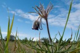
The west coast of Böda
![]()
![]()
![]()
![]()
![]()
![]()


Location: Northern Öland
[wpfp-link]
Visa på Google karta
Windswept old pines
The nature reserve Bödakusten Västra (West Coast of Böda) stretches from Byxelkrok in the north to Byrum in the south. Here you can walk in the windswept old “kingdom” of pines, experience the mighty dunes and caress soft pebbles. The area includes a stone circle and the remains of lime kilns.
Sand dunes and old pines
The old, sparse and windswept pine forests, with many dead trees, towering sand dunes and rubble fields are the area’s most typical environments. It features dune fields and sandy field where the wind for thousands of years has transported the sand and built up the dunes which can be ten meter high and miles long. In the 17th century, attempts were made to prevent the drifting sand by planting pine and balsam poplar. At “Kinshögar”, “Masthuggsudden” and “Rörstensudden” occurs rubble stone fields, with stones rounded by the see and flushed onto the shore by the waves. In the southern part of the reserve there are “Alvar” land and dry meadows. On “Mensalvaret” growes the Hoary Rock-rose, Fly orchid and Fairy flax. In the spring at “Bränsle äng” (meadow) the soil is stained of the Small Pasque Flowers violet flowers. The western coast of Böda offers rich opportunities for swimming, berry picking and hiking, and through the aera is a hiking path, Bödaleden (the Böda Trail).
Valuable water areas
Along the coast of Böda there is limestone outcrops, sandbars and shallow shores. The shallow shores are important spawning and nursery facilities for herring and flounder.
Rare species
Many rare species of insects thrive in the varied natural environments along the Böda coast. Here is one of the few places in the country where all three species of the antlion occur. Also the fungal flora is interesting here, with species like Boletopsis grisea, Alexander’s Funnel and Scented Knight.
FACTS:
Size: 742 ha (1834 acres), including 250 ha (618 acres) of water
Year of decision: 1999
Objective: Maintain an area of coniferous forests, deciduous forests, limestone pavement, sand dunes, pebble beaches and valuable coastal waters. The area is part of the EU ecological network of protected areas, Natura 2000.
How to Get here:
Northwest Öland. The reserve extends from Sandviken, south Byxelkrok down to Mens Alvaret and south Byrum.
GPS coordinates to the parking lot WGS 84 decimal (lat, lon): 57.29877, 16.97140
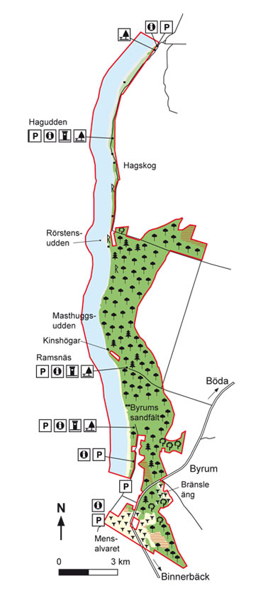
Map: Naturcentrum AB, Stenungsund.
Download: the County administrative boards brochure over (in Swedish only) (317 kB): Bödakusten Västra
Download: the entire brochure (in Swedish only) (19 MB): Utflyktsguide Öland
© Lantmäteriverket, Ur Geografiska Sverigedata, översiktskartan Dnr. 106-2004/188”
Source: County Administrative Board, Kalmar
Translation: Visitoland.com
Byrums Raukar (Limestone tower rauk)
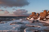
Byrums Raukar (Limestone tower rauk)
![]()
![]()
![]()
![]()
![]()
![]()


Location: Northern Öland
[wpfp-link]
Visa på Google karta
Peculiar stone statues
At Byrum you find Öland’s most famous and best shaped rauk area. The peculiar stone statues have been chiseled out over millions of years by the ocean’s constant movement against the limestone.
The bedrock of Öland
For 490 million years ago was the land mass that Öland belongs to at the height of the southern tropic, in a tropical climate. Lime Sludge began deposited in large coral reefs in warm, shallow seas. For a long time the coral reefs was pressed together under high pressure and the limestone of Öland was formed. Researchers believe that it took 1000 years of lime precipitation to form a millimeter of todays limestone. The thickness of the limestone layers on Öland generally amounts to 40 meters, which means that it took 40 million years to form the limestone bedrock on Öland.
Limestone tower rauk and fossils
Due to the different contents of the clay minerals the hardness of the limestone varies. Rauks at Byrum were formed when softer limestone eroded away by wave impact and left behind
stone statues (Rauks) of harder limestone. The area at Byrum is rich in fossils. Fossils are dead prehistoric animals that has sunk to the ocean floors and been embedded in sediment. The sediments have been compressed during a long time into a rock, in which the animal forms is preserved. At Byrum occurs fossils of the Trilobite genus Asaphus occurs so plentiful that it lent its name to one of the layers of the limestone.
Remember, it is forbidden to gather fossils! You may only enjoy them on the location!
Facts:
Size: 3 ha (7,41 acres)
Year of decision: 1935
Purpose: to preserve a geologically interesting landscape section and Öland and its best shaped rauk area
How to get here:
The Rauk area is located approximately 8 Kilometers NE of Löttorp. Take the road in direction of Byrum, either from Löttorp or Böda. Drive about 8 km or 6 km and then take off at the sign with text “Raukar”. After a few hundred meters, turn left and continue approximately 500 m to the parking lot.
GPS coordinates to the parking lot WGS 84 decimal (lat, lon): 57.22247, 16.95231
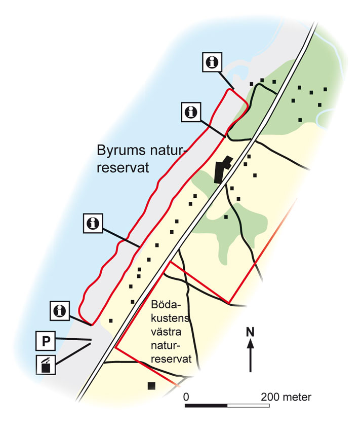
Map: Naturcentrum AB, Stenungsund.
Download: the County administrative boards brochure over (in Swedish only) (440 kB): Byrums Raukar
Download: the entire brochure (in Swedish only) (19 MB): Utflyktsguide Öland
© Lantmäteriverket, Ur Geografiska Sverigedata, översiktskartan Dnr. 106-2004/188”
Source: County Administrative Board, Kalmar
Translation: Visitoland.com
Bjärby & Lilla Dalby Alvar (moor)
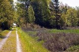
Bjärby & Lilla Dalby Alvar (moor)
![]()
![]()
![]()
![]()
![]()
![]()


Location: Southern Öland
[wpfp-link]
Visa på Google karta
Grasshoopers and a deserted village
“Lilla Dalby” and “Bjärby” alvar is varied with wetlands, wooded ridges and open rocky Alvar. The landscape is scattered with rocks and boulders since the inland ice retreated.
Alvar flora
The thin soil has been grazed for thousands of years. Here grows spiked speedwell, Dropwort, Small Pasque Flower, Bulbous Buttercup and rarer species such as Alpine Catchfly and Lesser Butterfly-orchid. In the early summer blossoms Elder-flowered Orchid, Burnt Orchid and other orchids in large quantity. The terrain offers a stone circle from the Iron Age, a number of mounds and fine examples of Öland stone walls.
Birdlife
Within the area there are several smaller wetlands, for example, “Rosamossen” and wet meadows along “Penåsabäcken” (bäck = rivulet). Here nests for example Common Snipe and Common Redshank. Out on the “Alvar” you can hear nature birds as European Golden Plover, Northern Wheatear and Whinchat. Perhaps you also will see the elegant Montagu’s Harrier come sailing over the “alvar”, hunting for vole, mice or small birds.
Rare grasshoppers
On the Alvar lives Band-winged Grasshopper which has fared left since last heat period. The hiker on the Alvar may be very surprised when they fly up with a loud snarl and show their pink iridescent wings.
Penåsa deserted village
On Bjärby alvar is Penåsa, a deserted village. Penåsa was cultivated in 1779. The village consisted of two farms that were very small. 1844 Penåsa ceased to excist a village, one of the farms was sold to Kastlösa and the other to Bjärby. Today there are foundations after residential buildings, ruins of a stone cellars and fruit trees and bushes out here.
Walking and cycling path
On the old railway embankment between Kastlösa and Skärlöv you can take a nice walk or bike ride over the Alvar. The railway was in use 1910-1961 and was built to transport sugar beets. The Station houses in Kastlösa and Skärlöv is preserved.
FACTS:
Size: Lilla Dalby 481 ha (1 188 acres), Bjärby 326 ha, (806 acres)
Year of decision: 1980
Objective: To maintain the unique bait depending cultural landscape, vegetation types that are representative of the “Alvar”, benefit both typical and rare plant and animal species, preserve and make visible the cultural relics, facilitate the public experience of natural and cultural relics. The area is part of the EU ecological network of protected areas, Natura 2000.
How to get here:
Follow Route 136 south to Kastlösa alternatively Bjärby. Here are information sites. at Penåsa Ödeby along the old railroad embankment is the parking.
GPS coordinates to the parking lot WGS 84 decimal (lat, lon): 56.44327, 16.46523
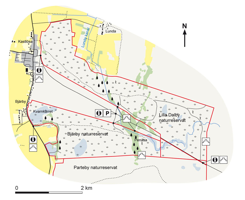
Map: Naturcentrum AB, Stenungsund.
Download: the County administrative boards brochure over (in Swedish only)(343kB): Bjarby & Lilla Dalby Alvar
Download: the entire brochure (in Swedish only) (19MB): Utflyktsguide Öland
© Lantmäteriverket, Ur Geografiska Sverigedata, översiktskartan Dnr. 106-2004/188”
Source: County Administrative Board, Kalmar
Translation: Visitoland.com
Albrunna lund (grove)
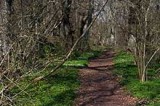
Albrunna lund (grove)
![]()
![]()
![]()
![]()
![]()
![]()


Location: Southern Öland
[wpfp-link]
Visa på Google karta
A deciduous forest oasis on the edge of the Great Alvar
As a green oasis between the “Alvar” and arable land lies Albrunna lund (grove). Here you can hide away for a moment from the midday heat outside on the “alvar” and enjoy the rich birdlife and flora.
Broadleaf forest and meadow
Albrunna lund was used formerly as hay land but has also served as pasture for cattle and horses. A portion of the grove is still referred to as “Oxhagen” (ox pasture). The northern grove consists of uneven aged oak and ash forest with elements of field elm, maple and Small-leaved lime. The average age of the forest is about 100 years, but some large oaks are much older. In the north of the grove are two herb-rich hay meadows that are harvested every year. The southern grove consists of a mixed forest with mainly oak and birch. The forest is relatively young, but even here there are elements of large oaks. Forests with tree species composition of oak, ash and elm, as in Albrunna lund, is unusual in Sweden.
Vascular plants
The springtime flora in Albrunna grove is lavishly rich with wood anemone and yellow anemone. In the meadowland in the reserve grows large quantities of spring pheasant’s eye which occurs only here on southern Öland and on Gotland and is a surviving species from the last warm period during the Bronze Age. In the meadows you will find Dropwort and Bloody Crane’s-bill growing
Lichens and fungi
Albrunna lund have a rich life of rare lichens and fungi. It has Bactrospora dryina and Megalaria laureri. Of rare fungi occurs Ramariopsis pulchella, iodine bolete, Green Dapperling and Lactarius mairei.
Birds and Insects
The bird choir is impressive, and from the rich nesting bird fauna, we can mention Garden warbler, Thrush Nightingale and Common Rosefinch. Of the less common species nesting here is Eurasian Wryneck and Red-breasted Flycatcher. In Albrunna lund there is a very rare small butterfly, Scarce Lance-wing, that is linked to hogweed and only known from four sites in Northern Europe, all on the island of Öland.
Bomb shelters
When you walk in Albrunna grove, you’ll will notice a number of bunker-like buildings. It is bomb shelters that were built during World War II. In the grove there is also traces of an old festivity place.
Facts
Size: 36 ha (88,96 acres)
Year of decision: 1996
purpose: To preserve a naturally developing deciduous forest of oak, ash and elm with its fauna and flora, ensure that the meadows with the botanical values persist. The area is part of the EU’s ecological network of protected areas, Natura 2000.
How to get there
The area can be easily reached from County Road 136 in southern Öland and is located about three kilometers south of “Södra Möckleby” church and “Degerhamn”. A parking is available next to the road, immediately south of Albrunna. Additional parking facilities are 250 m further on, to the left towards the grove, follow the local road to the location information.
GPS coordinates to the parking lot, WGS 84 decimal (lat, lon): 56.31786, 16.41065

Map: Naturcentrum AB, Stenungsund.
Download: the County administrative boards brochure over (in Swedish only) (518kB): Albrunna Lund
Download: the entire brochure (in Swedish only) (19MB): Utflyktsguide Öland
© Lantmäteriverket, Ur Geografiska Sverigedata, översiktskartan Dnr. 106-2004/188”
Source: County Administrative Board, Kalmar
Translation: Visitoland.com
Beijershamn
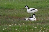
Beijershamn
![]()
![]()
![]()
![]()
![]()
![]()


Location: Southern Öland
[wpfp-link]
Visa på Google karta
the former harbour area that has become a paradise for birds
Beijershamn is, together with Ottenby, one of Ölands best and most well known bird habitats. A failed harbour project in the 1850s led to the area becoming silted up, which subsequently resulted in the development of reedbeds and coastal meadows that provide a perfect place for bird life.
The dream of a large port
In the 1850s, Otto Wilhelm Beijer, the crown equerry on the State demesne Ottenby, initiated a major seaport that could outcompete Färjestaden. A two kilometer long pier with a port at the far end was built at the place we now call Beijershamn. Because of a design flaw the dock area began to silt up so that it eventually became impossible for the larger ships to enter the port and the operation was closed.
Valuable bird habitats
Perhaps Otto Wilhelm Beijer had rejoiced after all, if he had known what the future would give. On the silted up sand, rushes and reeds began to establish, and eventually the area developed into a mosaic of coastal meadows, reedsbeds and open spaces which are appreciated by wading birds, ducks, geese, and birds of prey. Thanks to cattle grazing, clearing and reed harvesting in recent years, Beijershamn is today one of Öland’s finest bird habitats. A total of 250 bird species has been observed there.
The area is primarily an important resting and breeding habitat for waders, but ducks, terns and gull birds is also breeding here. Examples of unusual species that visits Beijershamn is Bar-tailed godwits, Garganeys, Caspian terns, and Peregrine falcons. The area has much to offer to the visiting nature lovers. There are observation towers, bird platforms, hides, information boards, trails, and a much appreciated trail for the disabled.
Butterflies and Bats
Beijershamn is one of Öland’s finest butterfly premises. On a narrow strip of dry, open grassland, between the meadows and the woods, the Handmaid (Dysauxes ancilla), have its single occurrence in the Nordic countries. In total, more than 650 of Sweden’s 950 butterfly species have been found here. Thanks to the good insect availability, Beijershamn is also a paradise for bats, twelve of Sweden’s eighteen species have been found in the area. Of rare bats that are present here includes Whiskered bat and Nathusius pipistrelle bat..
Facts:
Size: 1 618,54 acres (The Natura 2000 area)
Year of decision: 2000
Mission: Protect and preserve the typical character of the open land and pasture and nurturing the unique aquatic environment, so that all the plant and animal communities, characteristic of these habitats can survive in viable populations. The area is part of the EU’s ecological network of protected areas, Natura 2000
How to get here:
The area is located approximately 7 kilometers south of Färjestaden. It has parking space, information boards, observation towers, bird platform, hides, trails for Disabled etc..
GPS coordinates to the parking lot WGS 84 decimal (lat, lon): 56.58650, 16.41456

Map: Naturcentrum AB, Stenungsund.
Download: the County administrative boards brochure over (in Swedish only) (330kB): Beijershamn
Download: the entire brochure (in Swedish only) (19MB): Utflyktsguide Öland
© Lantmäteriverket, Ur Geografiska Sverigedata, översiktskartan Dnr. 106-2004/188”
Source: County Administrative Board, Kalmar
Translation: Visitoland.com
VIDA Museum & Art Gallery
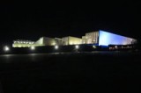
VIDA Museum & Art Gallery
![]()
![]()
![]()
![]()
![]()
![]()


Phone: 0485-774 40
E-mail: info@vidamuseum.com
Hemsida: VIDA Museum & Art Gallery
Location: Central Öland
[wpfp-link]
Visa på Google karta
VIDA MUSEUM 2000 m2 of ART!
Two Exhibition halls – Three Museum halls – Great Museum Shop – Cafe/Bistro
VIDA Museum & Art Gallery, built in a fantastically beautiful place, on top of the slope down to the Kalmar Strait just north of Halltorp Gästgiveri (Inn)
The present 2000 m2 building, floats out over the slope down to the Kalmar strait, standing on its pillars and with the mighty glass facade and the large wooden deck out towards the Strait. On the 10, 000 m2 lot with a drop of ten feet rises VIDA Museum in concrete, glass, iron and wood. It’s simple and fastidious, austere, without decor, and with just simple walls and ceilings. The ceilings height is between 5 and 7 meters and do the halls large and spacious, with the fantastic light from the glass facades in the west along with the light from the window up at the ceiling.
June 24 2001 the newly-built museum and art gallery VIDA opened, featuring an art gallery
and two wings for each Ulrica Hydman-Vallien and Bertil Vallien, here are the most important works from the early 1960s up to the latest in glass, ceramics, sculpture and painting shown.
2003 VIDA was extended with a gallery, the NORTH HALL for the Rasjö collection, a large private art collection focusing on contemporary Swedish art, and ever changing exhibitions of paintings from Rasjö collection is on display here at VIDA.
On June 11, 2005, when Ulf Trotzig turned eighty, an additional gallery “TROTZIGH-ALLEN” opened. In the hall changing exhibitions are presented, with Trotzigs paintings from his fifty years-long oeuvre.
In addition to the permanent halls, so are new artists constantly presented in the exhibition halls, new artists, new themes and techniques, there is always something exciting going on at VIDA.
Museum Shop and Café
At VIDA you will find a Museum Shop with an extensive selection of particular Ulrica Hydman-Vallien and Bertil Vallien production, plus a great variety of glass objects that exist only at the VIDA Museum & Art Gallery.
In the museum shop there is also a selection of Gunilla Ponténs clothing collection with emphasis on the black.
Each year VIDA invites twenty of the country’s foremost silversmiths to exhibit under varying themes.
VIDA cafe/bistro is located between the North Hall and the Trotzig hall, with a roof terrace with a wonderful view of the Kalmar Strait. Here, you can finish the tour at VIDA with a simple meal or a good cup of coffee, indoors or on the terrace.
The Global Art Glass Triennial
From VIDA is the Global Art Glass Triennials at Borgholm Castle administered. The Triennials and VIDA Art Museum placed the regions, Öland and the famous area of Swedish glassworks in Småland called “Glasriket” (the Kingdom of Crystal), on the international glass map. The three Triennials appeared in 1999, 2002 and 2005 and the Global Art Glass will hopefully recur.
Welcome!
Böda skogsjärnväg (forest railway)
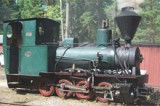
Böda skogsjärnväg (forest railway)
![]()
![]()
![]()
![]()
![]()
![]()


Phone: 0485-241 40, 070-363 8349
Hemsida: Böda skogsjärnväg (forest railway)
Location: Northern Öland
[wpfp-link]
Visa på Google karta
The railway
The new technique of rail transport made its foray into Boda Kronopark when Domänverket built the forest railway in the years 1908-1909. The total track length was 27 km and the gauge only 600 mm. Initially horses were used as thrust. In 1910, Domänverket acquired the steam locomotive “MORMOR” (Grandma on mother’s side) and 1928 the steam locomotive “FARMOR” (Grandma on father’s side).
After World War II, the motoring got its breakthrough and the railroad was definitely closed in 1959.
Association Böda Skogsjärnväg (Forest Railway) was formed July 21, 1974 with the intention to rebuild and operate appropriate subsections of the disused railway and to preserve objects and run locomotives and wagons from the old forest railway era 1908-1959. In 1978 they were able to operate a small fraction of that distance.
In 1991 the work to extend the tracks from “Tomtskog” and north began, and with the help of enthusiastic members and the forest companies Domän, ASSI-Domän, to day Svea Skog, the track reached Trollskogen, where it was inaugurated the 21 July 1994 by the Mayor of Borgholm.
Traffic on the railway
For time table se homepage, only in Swedish.
Naturum in Trollskogen
Take the train to Naturum in Trollskogen.
At Naturum in Trollskogen is it always something going on. Naturum have a long open season and activities for both young and old. This year, children can accompany Morris Mård (Marten) on an expedition around the exhibitions.
Welcome!
Öland Kitesurfers
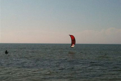
Öland Kitesurfers
![]()
![]()
![]()
![]()
![]()
![]()


Phone: 070-574 0342
E-mail: anders@olandkitesurfers.se
Hemsida: Öland Kitesurfers
Location: Southern Öland
[wpfp-link]
Visa på Google karta
Kitesurfers
Oland Kite Surfers are Öland’s largest and oldest kite school. We have organized kite courses since the summer of 2007 and are certified by KSA. This means, among other things that after completed course you receive an international certificate. A certificate can be good to have to show if you are going to rent equipment, both in Sweden and abroad.
Oland Kite Surfers is operated by Anders and Bertil who both have extensive experience in kite surfing. They have surfed around the entire island of Öland and therefore they have a good knowledge about which site is most suitable for the day.
Öland kite surfers offers rental of kite equipment after completion of the course, or if you can show KSA or IKO certificate. It is the school’s equipment from 2012 that are rented out temporary if not used for the day of the course activities.
Courses
Öland Kite Surfers offers a number of courses in which even private lessons are included so that the course can be tailored to your own needs and skills.
Our courses:
– Basic course
– Continuation
– Private Course
– Course Package with accommodation
– Kite Camp
– Companies and Groups
Wind warranty, in the unlikely situation that it’s no wind one day then you don’t pay for that day or get a refund.
Welcome!
Aledals Ridcenter

Aledals Ridcenter
![]()
![]()
![]()
![]()
![]()
![]()


Phone: 0485-351 77, 070-820 1203, 070-820 0200
Fax: 0485-351 77
E-mail: info@aledals-ridcenter.net
Hemsida: Aledals Ridcenter
Location: Central Öland
[wpfp-link]
Visa på Google karta
Aledals Gård, Riding School and Equestrian Centre
Beautifully located on Öland, 4 km north of the bridge. The farm extends from the Öland land ridge down to the Kalmar strait
At Aledal there are horse stables (built 2001) with space for 68 horses. The distribution is approximately 40 places to school horses and 28 for private horses. The stable is built at an angle, and four partitions with boxes and stalls that culminate in a public square in the middle.
On the square stands a gently babbling fountain in natural stone. This is an obvious focal point, which functions as cleaning position. On the square are three small red houses, one of which is office and two are heated saddle rooms, one for the boarded horses and one for the riding school horses.
Riding school
Aledals Equestrian Centre has no club or association attached to it, and operates entirely privately without municipal contribution. They can not organize bigger events, but smaller events for the facility riders are held 2-3 times per semester.
Other associations have shown their interest to have different events at Aledal, including the Breed Society that has held 3-year old tests here and the East Coast Dressage Riders have organized National Grand Prix and regional dressage competitions and clinics of various kinds.
In the stables are about 40 riding school horses owned by the riding center. The races include Swedish halfbred and pony races of different types, such connemara, New Forest and Welsh.
day camps
NOTE! None Starter camp
Week 27,28,29 and 30 during the summer of 2014 camps are held at the school
Camps are from Monday – Friday and runs from 9 am to 3 pm (full day) or 8:30 am to 12 noon or 12:30 pm to 4 pm (half day).
What do we do at the camp?
– Rider dressage
– Jumps
– Has outdoor rides in the beautiful riding terrain
– Voltige
– Bath with horses in the Kalmar strait (approximately 800 meters from the compound)
You will be assigned a horse the first day that you then have all week. Please bring a packed lunch and swimwear.
Bring your horse on holiday
In cooperation with KronoCamping Saxnäs (See STAY/Camping) we offer holiday accommodation for you and your horse.
Welcome!
Ölands GokartCenter

Ölands GokartCenter
![]()
![]()
![]()
![]()
![]()
![]()


Phone: 070-3968198
E-mail: olandsgokart@gmail.com
Hemsida: Ölands GokartCenter
Location: Northern Öland
[wpfp-link]
Visa på Google karta
Ölands Gokart Center
Öland’s largest kart circuit with rent karts for all ages and tastes!
On Öland Go-kart center in Föra about 20 kilometers north of Borgholm offers large powerful Caroli karts newly purchased 2016, with timekeeping, junior karts from 2015, double-karts and mini-karts for from about 3 year old. There is also a separate Junior kart circuit available. In connection with the circuit are a kiosk with ice cream, candy, and hot and cold drinks.
At Öland Go-Kart Center is it drop-in, just come and pay your fee during opening hours and you will get next available run on the track. It is also possible to book the track for companies or groups, off the regular hours, this with special arrangements like price ceremony after the race.
From the season 2016 we are focusing again on the new Swedish-made quality kart. Caroli Stinger is the new generation rental kart where driving pleasure and safety is given top priority. Take the opportunity to try the most modern karts on Öland.
Driving kart is both simple and fun! There is no need for previous experience. The karts just require throttle and brake and the shift is automatic. Our Caroli karts have been designed for maximum safety and all karts are equipped with rollbar and seatbelt and the karts can be regulated by remote control by the staff if needed. Helmets and neck protection in various sizes are available.
Opening Hours DROP IN 2021
Pay your ticket at site during opening hours and you will get next available run on the track.
Spring
15 May 11 am – 5 pm
22 May 11 am – 3 pm
29 May 11 am – 3 pm
Summer
5 June 11 am – 3 pm
12 – 16 June 11 am – 3 pm
17 June – 4 July 11 am – 5 pm
5 July – 13 August 11 am – 7 pm
14 – 22 August 11 am – 5 pm
28 August 11 am – 5 pm
Autumn
11 September 11 am – 5 pm
18 September 11 am – 5 pm
25 September 11 am – 5 pm
2 October 11 am – 5 pm
Outside regular hours and dates is it also possible to book the kart circuit for groups.
Welcome!
Glabo Gokart & Paintball
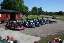
Glabo Gokart & Paintball
![]()
![]()
![]()
![]()
![]()
![]()


Phone: 070-2512711
E-mail: glabogokart@gmail.com
Hemsida: Glabo Gokart & Paintball
Location: Northern Öland
[wpfp-link]
Visa på Google karta
Welcome to Glabo gokart.
Glabo gokart has the biggest kart course on Öland. You find them between Löttorp and Böda on northern Öland.
The karts are Rimo go-karts with an engine of 270 cc, same as Ralf Shumacher uses on his course in Germany, both good acceleration and top speed, and the track is newly paved in 2012 so it is smooth and fine, all for the experience to be as perfect as possible.
We have go-karts for all ages.
Big go-karts, children’s go-karts, 2-person go-karts where both control the steering wheel, but only one manages throttle and brake, great option for the disabled and for small children who can not or dare drive themselves and then electric cars for the youngest.
Lap times on a display mounted on the steering wheel, makes driving much more fun, you get the current time displayed and your fastest lap saved.
Here the whole family will have a fun and exciting day.
Opening hours 2025
Spring
Date Hours
18 May 11-15
19 May 11-15
30 April 11-15
1 Maj 11-15
10 Maj 11-15
30-31 Maj 11-15
Summer
Date Hours
10-17 June 11-15
18-19 June 10-17
20 June 10-17
21 June – 3 July 10-18
4 July – 2 Aug. 10-19
3-9 August 10-18
10-17 August 11-15
Price:
7 min 14 min
JuniorGokart 145 SEK 260 SEK
Big Gokart 185 SEK 340 SEK
DubbleGokart 200 SEK 360 SEK
Welcome!
Segerstads Fyr
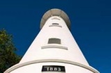
Segerstads Fyr
![]()
![]()
![]()
![]()
![]()
![]()


Phone: 070 – 966 6450
E-mail: Christian@segerstadsfyr.se
Hemsida: Segerstads Fyr
Location: Southern Öland
[wpfp-link]
Visa på Google karta
The lighthouse
At the fabled Segerstads lighthouse you can rent rooms or the entire lighthouse keepers flat, for a relaxing holiday by the sea, right in the bird paradise.
If you wish, you can also get bird and nature tours, private or in groups.
The man at the Lighthouse, Christian, have a solid education from the University of Stockholm in Biology and Geology and is a devoted ornithologist, and also a licensed guide, examined by Kalmar University and the county administration. Christian’s tours focus primarily on birds and nature.
During the lighthouse’s Day, in August, when Swedish Lighthouses is shown to the public, there is also a lighthouse café for those who just want to sit down and relax in these wonderful surroundings, the coffee cup can also pop up every now and then during the rest of the season, but that will come as an extra surprise at these times.
Guided tours
Fixed scheduled tours
A decisive program of guided tours are available on the website, examples of these are:
Spring watching in nice tempo, 3 days
Nature Tours to “Öland bird mountain”, about 1.5 hours
Birds, fossils and lighthouse, about 1.5 hours
Autumn watching, in a relaxed pace, 3 days
Other shorter half-and full-day tours are also on the program
Private Guided tours
For you – you and your friends – Business – Schools – Associations
The guided tours tailored to your interests and knowledge, not only includes birds, their flight and sounds, but also fossils, landscape, history and much more, here we mix knowledge from many fields and put it all in to context, for a deeper understanding.
Examples of tours organized:
Birds and Lighthouse, Nightingale evening, Ottenby morning. The sounds at night, the list is long, but always interesting, so many comes back to continue from where they left off last time.
Contact Segerstad Fyr with your own special requests.
Hint: Give a privately guided tour as a present! Birthdays, colleagues, wedding … A different experience appreciated more than another vase or toaster by those who already “have everything”.
Welcome!
Ottenby Fågelstation (Bird Observatory)
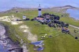
Ottenby Fågelstation (Bird Observatory)
![]()
![]()
![]()
![]()
![]()
![]()


Phone: 0485-661093
E-mail: ottenby@ottenby.se
Hemsida: Ottenby Fågelstation (Bird Observatory)
Location: Southern Öland
[wpfp-link]
Visa på Google karta
Ottenby Bird Observatory
Ottenby on the southern tip of Öland is one of Sweden’s most famous bird habitats. The bird Observatory was founded in 1946 in conjunction with the advent of our principal the Swedish Ornithological Society. Ringing of migratory birds has been conducted continuously since then and we are proud to maintain the worlds longest unbroken catch series.
At Ottenby Bird Observatory is the bird research extensive and wide. The field includes such areas as: the mysteries of bird migration, monitoring of population dynamics and the significance of birds as a reservoir of influence viruses. In addition to this, the observatory also conducts major contract research and collection of materials for external institutions.
This important activity is based on voluntary work and the income is mainly obtained from tourism through guided tours and sales. For the environmental monitoring function the observatory obtain grants from the National Environmental Protection Agency.
Guided tour & visit
Ottenby is one of the country’s most visited nature areas and a fantastic day out for all the family. Here on the southern tip of Öland you find hiking paths across vast meadows and through rich deciduous forests, all to the tune of the rich bird life and the sound from the surrounding ocean.
The lighthouse “Långe Jan” (Tall Jan) is open much of the year and in Ottenby Naturum Visitor Centre is a large, beautiful and child-friendly exhibition on nature and culture on southern Öland. The same building also houses the capes own restaurant “Fågel Blå” (Blue Bird).
The bird Observatory is located just north of the lighthouse “Långe Jan” For those who are curious about the activities at the bird observatory and would like to experience ringing of wild birds a little more hands on, there is guided tours that will let you do that.
The operations on the southern tip of Öland raise many questions and these are best answered on the spot in the middle of the beautiful and fascinating nature of Öland! Both Swedish and English speaking guide groups are available of all sizes and interest orientations.
Several different types of tours are offered by both the bird observatory and the nature center “NATURUM” (See under DO/Sports & Interests), examples of guided tours are Ringing Guidance, Research Guidance and Jubilee Guidance. See the website for info about the respective tours.
Ringing & Observations
Observations and ringing of migratory birds has since the start formed the pillars of the bird stations work. These data are recorded and the data is added daily, and various forms of analyzes are carried out regularly or as needed.
Fågel Blå Restaurant & Café
Take the opportunity to take a break from all the sights and relax with something to drink or eat.
The Fågel Blå (Blue Bird) restaurant and café is a wonderful place in the sun, sit inside or out and enjoy the day’s experiences. Fågel Blå cook everything on site, and uses only raw materials of best quality and it is given that the raw materials are organic, KRAV labeled (certified organic) and locally produced as much as possible
ParaFly Sydsvenska Skärmflygskolan

ParaFly Sydsvenska Skärmflygskolan
![]()
![]()
![]()
![]()
![]()
![]()


Phone: 070-554 15 71
E-mail: anders@parafly.se
Hemsida: ParaFly Sydsvenska Skärmflygskolan
Location: Northern Öland
[wpfp-link]
Visa på Google karta
LEARN TO FLY PARAGLIDER
We at Parafly teach you to be a free flight or paramotor pilot. Our school is in Växjö in spring and autumn, in the summer months we are at Lundegårds Camping on Öland, see under BO/ Camping. There are many of us who dream of flying free as birds, and closer to this is hard to come.
With us you will learn how to handle your paraglider and equipment safely.
We start with a student license which means that you get to practice balancing the glider on the ground and do glides in slopes on your own. During training we alternate theory with practice, depending on the weather.
Are you 4-6 and there are conditions where you live, we can come to you and do the training. When student course have finished you select the certificate you want Engine, Towing, Ridge Soaring or Mountain.
Paramotor the easiest way to get a lot of time in the air.
The car is fully packed, motor, paraglider, and the other equipment is in the trunk and you have finished the job, the weather is perfect for a flight. You can be ready about 15 minutes after you arrive at your launch pad, which can be a field near where you live, one-hour flight and pack the equipment in the trunk again and you still have time to mow the lawn and eat supper with your family.
Tandem, try on
We fly tandem paramotor and towing the year around. Go into our shop and buy a gift certificate and surprise a friend with a fantastic flight over Småland, natural beauty with lakes and forests, or why not treat yourself to this. You need no prior knowledge to try paragliding.
A happy mood will get you far.
Welcome!
Long Island Divers

Long Island Divers
![]()
![]()
![]()
![]()
![]()
![]()


Phone: 0485-281 60, 0705-33 78 66
E-mail: info@longislanddivers.com
Hemsida: Long Island Divers
Location: Northern Öland
[wpfp-link]
Visa på Google karta
Öland as diving area
Around Northern Öland are the best waters for diving to be found in the Swedish part of the Baltic Sea. Light sandy bottom and good water circulation provides very good visibility for Swedish conditions. Northern Öland has one for Scandinavia stable and fine weather in the summer, contributing to many fine days of diving, with light winds and small swell. The season often extends right up to October’s clear autumn days. This is also when the water are the clearest.
Diving school on Öland
At our diving school, we train many students every summer in the art of safe diving. Our instructors will lead students in stages from basic training to the most qualified education. We work with both NAUI and CMAS and educate our students according to these organizations standards.
Many of our students combine their vacation with acquiring basic diving skill, or to upgrade their qualifications to a higher level of expertise. The training ends with an exciting dive at one of the many wrecks around Öland or beautiful nature dive at “Blå Jungfrun” (the famous Rock Island in the Kalmar strait) where we dive at the “sunken cathedral”
We try to adapt our courses to make it easy to participate, this means that we organize courses at short notice when interested is at hand.
Education at our courses leads to NAUI diving certificate, approved worldwide.
Dive sites and Diving trips
With modern marine technology aboard the diving ship Midland, have we in recent years found a series of sunken treasures. Most are located at depths we can reach with conventional diving equipment, but some require advanced equipment and qualified diver training. Our wreck catalog is a story of 400 years of naval war and shipwrecks. We’d love to show these treasures for other divers, but we are very careful that marine archaeological sites not are looted or torn down.
In our list of dive sites are some 20 permanent locations, including sunken ships, submarines, barges, aircraft, and various sites of marine biological interest.
We also arrange underwater adventures for diving clubs and other groups. Exciting treasure hunts and other adventures, at our beautiful dive sites, which do not contain fiery moments that could jeopardize the safety of diving.
Bad weather?
Safety is most important for us. This means that we do not go out when the weather conditions are not completely safe. Generally at, wind speed over 7 m/s, large swells, poor visibility or at high risk for sudden weather changes, we can come to cancel or postpone the planned dive excursion.
Decisions about go/no go is based on SMHI’s weather forecast and the Marine weather forecast area map – SMHI at 1 pm, the day before the planned excursion. If the weather situation is doubtful, we can make a later decision, if it is possible for our participants.
Paid money can then be either refunded or remain with us for a jaunt later.
Service
Filling of bottles with air and nitrox and hiring of extra bottles in our dive shop
Ölands Boulehall

Ölands Boulehall
![]()
![]()
![]()
![]()
![]()
![]()


Phone: 0485/564195, 0485-564090, 070-5574195
E-mail: info@olandsboulehall.se
Hemsida: Ölands Boulehall
Location: Northern Öland
[wpfp-link]
Visa på Google karta
Welcome to Öland Boulehall in Tjusby!
Here you can play petanque, practice golf and eat good food. The Petanque hall contains twelve courses and there is room for six people to simultaneously practice golf.
The restaurant has seating for about 45 guests in a cozy and pleasant environment and we are fully licensed. The petanque courses is located directly adjacent to the cafeteria.
Book your office party, kick-offs, corporate, union activity or annual meeting with us. Celebrate your birthday in the Petanque hall and we will arrange food and activities.
The entire building is handicapped accessible and heated.
Welcome!
Vickleby ädellövskog (Vickleby broadleaf forest)
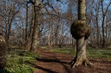
Vickleby ädellövskog (Vickleby broadleaf forest)
![]()
![]()
![]()
![]()
![]()
![]()


Location: Southern Öland
[wpfp-link]
Visa på Google karta
“The most beautiful grove you’ve ever seen.”
When Linnaeus in the 18th century rode through Vickleby he regarded it as “The most beautiful grove you’ve ever seen.” The ground in Vickleby hardwood forest in May is a sea of kidneywort, wood anemones and yellow anemones with hints of purple corydalis and spring pea.
Öland’s coastal broadleaf forests
Just a few hundred years ago there were lush deciduous forests along Öland west coast between Borgholm and Smedby. Most of this area is today arable land or has been planted with coniferous forests. At Stora Vickleby the deciduous forest is remaining. The shrub layer consists of, as in most of Öland’s groves and forests, big grown hazel bushes. Vickleby forest is a mixture of different forest types. Hazel rich oak forests are most common but there are also in wetter soils ash forest and alder swamp forests.
A rich spring flora
In the hazel-rich oak forests are a rich spring flora, including kidneywort, spring pea and cowslip. The oaks have often wide crowns which show that the forest was previously a leafy meadow. In the summer the canopy dense and then plants like Dog’s Mercury, ground elder and Wood Meadow-grass takes over. In elm dominated parts species like Wonder Violet and Coralroot thrives. Here is also swamp areas with dense alder swamp forests where alders standing on high pedestals and give the forest a little magical nature. Tall species such as Greater Pond-sedge and meadowsweet are typical.
Voices in the bird choir
The deciduous forest at Vickleby has a rich birdlife. In a survey it was found that 41 bird species was nesting in the protected part of the forest. The most common breeding birds are common chaffinch, European robin, willow warbler and wood warbler. Examples of some rarer species are hawfinches, long-tailed tit, lesser spotted woodpecker and Stock Dove.
Fungi and lichens
In the forest there are rare fungus including Cortinarius fulmineus, Hygrophorus nemoreus and ox tongue. Of rare lichens include Scribble lichens and Blemished lichen
Facts:
Size: 47,5 ha (117.38 acres)
Year of decision: 1999
Purpose: To preserve a representative section of the coast of Öland hardwood forest with its biodiversity. The area is part of the EU’s network of protected areas, Natura 2000.
How to get there:
The nature reserve is located 5 km south of Färjestaden. From the port of Färjestaden, take the coast road to Mörbylånga. On the right side, adjacent to the road, is the reserve after approximately 7 km. Look for a sign for the reserve, the entrance to the forest is easy to miss.
GPS coordinates to the parking lot WGS 84 decimal (lat, lon): 56.59527, 16.43953
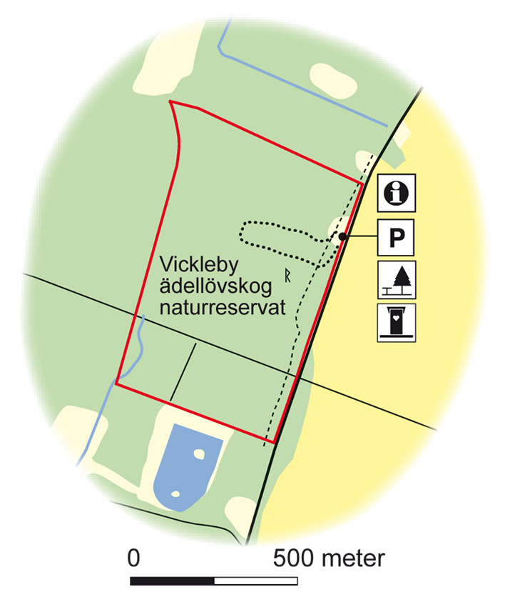
Map: Naturcentrum AB, Stenungsund.
Download: the County administrative boards brochure over (in Swedish only) (415 kB):Vickleby Ädellövskog
Download: the entire brochure (in Swedish only) (19 MB): Utflyktsguide Öland
© Lantmäteriverket, Ur Geografiska Sverigedata, översiktskartan Dnr. 106-2004/188”
Source: County Administrative Board, Kalmar
Translation: Visitoland.com
J.A.G.S. Museum
J.A.G.S. Museum
![]()
![]()
![]()
![]()
![]()
![]()


Phone: 0485-66 40 22, 66 40 89
E-mail: jags@telia.com
Hemsida: J.A.G.S. Museum
Location: Southern Öland
[wpfp-link]
Visa på Google karta
J.A.G.S
Welcome to Gustav-Jons world of fantasy, created by characters from fairy tales, myths, history and the Bible.
Gustaf Jon has created folklore and folk art just like two other well known Swedish artists Döderhultarn from Småland and Lim Johan from Hälsingland, but with a special character from the Alvar of Öland and the barren coast. The dream was his reality, and it is no wonder that his contemporaries regarded the colorful wooden sculptures and paintings with great awe.
Background
Johan August Gustafsson “1852-1932” lived all his life in Segerstads parish in the southeastern Öland. He was a farmer and sailor, but above all he was an artist, sculptor and furniture maker. All his life besides farming, he used to sculpt the material he found in the sea and on the beach.
The sea and boats were an important part of his life. He made many ship paintings and ship models. The farm which he cultivated lay next to the Baltic Sea that inspired him and gave material to the artworks. When ship sank, he got wood to his characters. Otherwise, it was the small Bible, illustrated by Gustave Doré which provided material for “King Pharaoh and his crew”, his most famous sculpture.
As his last wish, he wrote in his will that the collection would be displayed and cared for in his home parish.
The Museum
Permanent exhibition.
The museum consists of a permanent exhibition, the Gustaf Jons collection, here you can see his work collected in one place and follow through his artistry.
Temporary exhibitions
In addition to the permanent exhibition, temporary exhibitions with various artists are presented during the season, exciting known and unknown artists, always worth a visit, see website for current exhibition.
Naturum, Ottenby
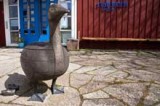
Naturum, Ottenby
![]()
![]()
![]()
![]()
![]()
![]()


Phone: 0485-66 12 00, 0730-58 23 77
E-mail: naturum@ottenby.se
Hemsida: Naturum, Ottenby
Location: Southern Öland
[wpfp-link]
Visa på Google karta
Naturum – visitor centres in nature
A naturum is a visitor centre with activities and exhibitions, located in connection with several of Sweden’s national parks and nature reserves. Here, you will be welcomed by friendly, knowledgeable staff that will answer your questions and guide you through the area’s interesting sights.
The nature experience starts at naturum
At naturum, you can learn almost everything there is to know about the region’s plants, birds, insects and animals. You can also learn about the cultural history and geology of the area as well as people’s relationship to the nature and their impact on it. Information about the area’s national parks and nature reserves and why we need to protect and take care of our nature can also be found here. Join us on an activity out in the nature!
Naturum Ottenby
In 1997, the visitor center building was completed in the old lighthouse village. The spacious house blends beautifully into the environment and includes a nature center with Film Theater and a restaurant with a breathtaking view.
In cooperation with the Swedish Ornithological Society (Ottenby Bird Observatory) a unique exhibition in the Visitor Centre has been created. Here you can get a fascinating insight into the life of the birds, not least when it comes to their impressive movements across the globe. How is it possible, for example, for a twelve grams heavy flycatcher to find its way from the Winter Quarter of South Africa to the nest in “Blomstermåla” where it nested last year?
Also shown is the historical treatment through the history of the land by the farmers of Öland and its importance for biodiversity today (as well as modern agriculture, of course) and thus for resting and breeding birds.
The Centre and its staff will help you to find the best hideaways on Öland, in terms of flora and fauna and other natural experiences. From the Visitor Centre also most of the guided tours assume.
In addition to the visitor center is also a restaurant “Fågel Blå” (Blue Bird), and a small lighthouse museum, a hide, a number of shelters and of course – “the highlight” on the Cape – the lighthouse “Långe Jan” (Tall Jan), who will take you almost 42 meters up in the air. At the car park are the old bird museum and the bird observatory owned and operated by the Swedish Ornithological Society.
The Lighthouse
The lighthouse “Långe Jan” (Tall Jan) was first lit November 1st 1785, after a construction period of almost two years. The lighthouse was then about 36 meters high with a diameter of about 12 meters and 197 steps to the top. “Långe Jan” is currently 41.6 meters and Sweden’s tallest lighthouse.
The lighthouse is open during the day in spring, summer and autumn (see Visitor Centre opening hours) and the view of the Baltic Sea and the southern Öland is magnificent! The visit costs 30 SEK for adults and 20 SEK for children.
Guided tours EVERY DAY, June 25th to August 7th:
(Sign up and payment at the Visitor Centre)
Naturum performs scheduled guide tours on a daily basis during the summer month, but the tours are performed in the Swedish language, this with the exception of one daily tour.
2.45 PM Birds & banding (guiding in English), come and see how it is performed.
Except from this scheduled tour in English, Guided tours in English can be performed upon request. Please contact Naturum by mail or phone to see what can be arranged. And as a comment, they usually solve most of the requests.
Störlinge Agricultural & Motor Museum
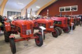
Störlinge Agricultural & Motor Museum
![]()
![]()
![]()
![]()
![]()
![]()


Phone: 0485-56 02 61, 070-586 72 04, 070-759 21 95
E-mail: info@motormuseet.se
Hemsida: Störlinge Agricultural & Motor Museum
Location: Central Öland
[wpfp-link]
Visa på Google karta
The Museum
Störlinge Agricultural & Motor Museum is privately owned and quietly situated in one of the eastern Öland unique and well preserved village Störlinge.
The museum opened in 2008 and has become a popular destination for tourists. The varied collection (approx. 2500 items) caters not only to the genuine motoring enthusiasts, but also to other family members, both children and adults.
In other words, a destination for the whole family!
In the 1200 m2 hall shows besides a large number of tractors from the 1930s and onwards, also old farm equipment, stationary engines, motorcycles, mopeds and Lokomobil. Appliances used in the home are also on displayed here. Some items are refurbished, others are in old working order.
Objects related to local usage on Öland, tells a fascinating story about the time when they had a central role in the society. At the museum there is also a photo exhibition, old radios and televisions, cameras, china, toys, etc.
The exhibition is continuously extended and varied by new items, this makes every visit to the museum a new and unique experience.
The machines are used not only as a museum piece, but also widely used at various events such as plowing, tractor rally and at the popular annual motor day in July and at the Öland Harvest Festival.
Cafe and Shop
In our cafe you can buy coffee, cakes, sandwiches and ice cream.
Sales of models, films, books, etc.
On the upper floor there is a hall that is approved for 50 people.
Admission and Hours
Adults: 120 SEK per person
Adolescent and children 7-15 years: SEK 50 accompanied by an adult
Children 0-7 years: Free admission accompanied by an adult
Groups more than 15 persons 120 SEK / person, driver and guide free entrance.
Open 2025
On May 3rd we open the gates to the museum and cafe for the season, and then we are open 11 am – 4 pm every Saturday and Sunday until midsummer.
Motor history day June 6th 11 am – 4 pm
Midsummereve closed.
Daily:
June 21 st to August 17th at 11 am to 4 pm.
The Museum and our cafe is of course disability friendly.
Welcome to visit us!
Skedemosse Museum
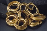
Skedemosse Museum
![]()
![]()
![]()
![]()
![]()
![]()


Phone: 070-6264984
E-mail: info@skedemosse.se
Hemsida: Skedemosse Museum
Location: Northern Öland
[wpfp-link]
Visa på Google karta
The Museum
Around the time of the birth of Christ, Skedemosse was one of southern Sweden’s most important places for ritual sacrifice. Here were ritually sacrificed large amounts of animals, weapons, gold and even people – all to appease or thank the gods.
By far the most famous discovery of Skedemosse is the gold rings. The so-called “Skedemosseguldet” (the Gold of Skedemosse), has seven neck rings of pure gold with a total weight of 1.3 kg – an unimaginable wealth at that time.
At Skedemosse Museum, you will experience the exciting history of the sacrifice bog, and how life was like on the Iron Age Öland. Along with the museum there is a walking trail of 5 km that leads to the old excavation site.
Guided tours
Guided tours to the excavation site can be arranged on request. Please contact us and we will help you to arrange an exciting and interesting day at Skedemosse Farm.
The museum showes the newly produced documentary film “The Iron Age – the grand time of Öland” The film tells the story of the place of ritual sacrifice at Skedemosse, and also about other exciting places like Skäftekärr Iron Age village and the island’s many ancient fortresses.
Opening hours
Skedemosse Museum is open May-September, daily from 11 am to 5pm.
Accommodation
At Skedemosse Farm you will also find a B&B and a Spa, see under each heading STAY/B&B and DO/Spa & Wellness
Eketorps Fortress
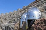
Eketorps Fortress
![]()
![]()
![]()
![]()
![]()
![]()


Phone: 010-354 79 90
E-mail: info@eketorp.se
Hemsida: Eketorps Fortress
Location: Southern Öland
[wpfp-link]
Visa på Google karta
The Fortress
Eketorp fortress is a completely excavated ancient fortress where the wall and the houses have been rebuilt directly on the ancient ruins.
The archaeological excavations, carried out between 1964-1973, showed that Eketorp held three settlement phases, two in the Iron Age, and one during the Middle Ages.
Eketorp I, 300-400 A.C.
Eketorp II, 400-650 A.C.
Eketorp III, 1170-1240 A.C.
The well in the center of the courtyard, highlighted by Linné June 8, 1741, has been there since the oldest period, and is still giving water. At the Museum you can see a selection of the huge amount (about 26 000) of objects that were found in the excavations.
Welcome into the houses and workshops, look and try on different objects used for crafts and households. Domestic animals roam around and people in clothes from the time do various jobs to help make history come alive.
Activities
Eketorp fortress is an open and living museum, here you can try different activities from ancient times. See and experience how people lived in the past.
Both children and adults can during the summer season try a variety of activities that are both fun and educational, such as archery, king riding, various crafts, medieval games, bread baking, and more. If you are interested in nature and culture, then you will get your fill of it in the fortress interesting history, archeology and the fauna on the “Alvar” (the unique and typical moor on Öland)
Shop and cafe
We have a wide selection of crafts, glass and ceramics and giftware. We also offer jewelry by Swedish designers, gift, patterns and stuff for kids as well as literature on archeology, history and Öland.
The shop serves coffee, tea and different kinds of cakes. We also sell ice cream and candy
Admission and Hours 2024
Spring
2 -6 April, Tuesday – Saturday, 11.00 – 16.00
11 -27 April, Thursday – Saturday, 11.00 – 16.00
30 April Tuesday, 17-20
1- 18 May, Thursday – Saturday, 11.00 – 16.00
21 May-20 June, Tuesday – Saturday, 11.00 – 16.00
21 June closed
Entrance fees
Adult: 75 sek
Child (7-15 years): 50 sek
Child (0-6 years): Free entrance
Summer Spring
22 June – 17 August, Monday – Sunday, 10.00 – 17.00
Harvest festival
27-September Friday 11.00 – 21.00.
26 and 28 September 11-16
Entrance fees Summer
Adult: 125 sek
Child (7-15 years): 75 sek
Child (0-6 years): Free entrance
Autumn
22 August – 2 November, Thursday- Saturday, 11.00 – 16.00
Entrance fees
Adult: 75 sek
Child (7-15 years): 50 sek
Child (0-6 years): Free entrance
Borgholms Castle
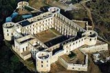
Borgholms Castle
![]()
![]()
![]()
![]()
![]()
![]()


Phone: 0485-88500
E-mail: borgholms.slott@borgholm.se
Hemsida: Borgholms Castle
Location: Central Öland
[wpfp-link]
Visa på Google karta
900 years of Swedish history
Borgholm Castle “Nordic finest ruin” is a structure that hardly leaves any visitor indifferent. Its size is overwhelming and situated in a fascinating surrounding. Seldom have nature and architecture merged into an entity such as this and this unit was only further highlighted when the castle in 1806 was ravaged by a huge fire and the only thing left was the naked limestone walls of all the former glory.
Borgholm Castle today is the ruins of the magnificent Baroque palace that King Karl X Gustav built here in the middle of the 17th century. He is the only one of Sweden’s kings who lived coherent long periods of time at the castle.
Today Borgholm Castle is one of the region’s largest tourist destination, and gives us in a unique way a tour of the Swedish, Nordic and European history, spanning over 900 years! Borgholm Castle is part of our common cultural heritage and managed by the National Property Board.
Borgholm Castle is a living museum, combining history with the present. The castle mixes permanent exhibits about the castle’s history with art exhibitions, children’s activities, guided tours and concerts. At the Castle new exhibitions and concerts is constantly presented, creating an interesting and exiting environment.
The history of Borgholm Castle.
The castle’s fascinating history is exhibited at the museum wing at Borgholm Castle, here you can see findings from excavations of the castle, and models of how the castle looked like during different time periods.
Castle shop
The entrance building at Borgholm Castle is a castle shop. Here you pay the entrance to the castle and can buy books, postcards, toys, gifts and other pleasant memories of your visit. The castle shop also sells tickets for some concerts, ice cream, candy and soda.
Opening Hours:
Borgholm Castle is handicap certified.
Dogs are welcome to Borgholm Castle.
For opening hours see: Open